Area Overview for RG25 2QG
Photos of RG25 2QG
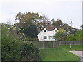
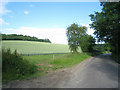
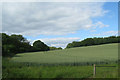
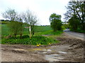
14 photos from this area
Area Information
Key information about the RG25 2QG including its size, population, and administrative classification.
- Area Type
- Postcode
- Area Size
- 28.9 hectares
- Population
- 1482
- Population Density
- 20 people/km²
House Prices in RG25 2QG
14
Properties
£557,421
Average Sold Price
£335,000
Lowest Price
£990,000
Highest Price
Showing 14 properties
| Address | Type | Beds | Baths | Last Sale Price | Last Sale Date | |
|---|---|---|---|---|---|---|
| Whitewing, Axford Road, Ellisfield, RG25 2QG | Retail | 2 | 1 | £544,950 | May 2022 | |
| Woodpeckers, Axford Road, Ellisfield, RG25 2QG | Detached | 4 | 2 | £452,000 | Sep 2019 | |
| The Acorns, Axford Road, Ellisfield, RG25 2QG | Bungalow | 3 | - | £550,000 | Jun 2019 | |
| Copper Beeches, Axford Road, Ellisfield, RG25 2QG | house | 6 | - | £990,000 | Jun 2019 | |
| The Glen, Axford Road, Ellisfield, RG25 2QG | house | 4 | - | £585,000 | Jul 2010 | |
| Woodside, Axford Road, Ellisfield, RG25 2QG | Bungalow | - | - | £445,000 | May 2007 | |
| Tweedale, Axford Road, Ellisfield, RG25 2QG | Detached | - | - | £335,000 | Aug 2002 | |
| Kvanndal, Axford Road, Ellisfield, RG25 2QG | Bungalow | 3 | 1 | - | - | |
| Belamy, Axford Road, Ellisfield, RG25 2QG | Detached | 5 | 3 | - | - | |
| Mobile Home, Wyckens, Axford Road, Ellisfield, RG25 2QG | Mobile Home | - | - | - | - |
Page 1 of 2
Energy Efficiency in RG25 2QG
Amenities
Schools
| Rank | School | Type | Entry gender | Ages |
|---|
Explore more schools in this area
Go to Schools tabDemographics
Household Size
Two person
most common
Accommodation Type
Houses
most common
Tenure
55
majority
Ethnic Group
White
most common
Religion
N/A
most common
Household Composition
N/A
most common
Age
47
median
Adults (30-64 years)
most common
Household Deprivation
N/A
with no deprivation
NS-SEC
43
in Lower managerial occupations
Explore more demographic insights in this area
Go to Demographics tabPlanning
Planning Constraints
- Flood RiskPremium
- Ramsar Wetland SitesPremium
- Area of Outstanding Natural BeautyPremium
- Protected Nature ReservePremium
- Protected WoodlandPremium