Area Overview for RG25 2JQ
Photos of RG25 2JQ
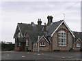
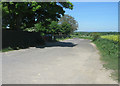
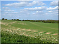
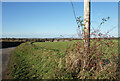

80 photos from this area
Area Information
Key information about the RG25 2JQ including its size, population, and administrative classification.
- Area Type
- Postcode
- Area Size
- 13.1 hectares
- Population
- 1432
- Population Density
- 44 people/km²
House Prices in RG25 2JQ
14
Properties
£433,929
Average Sold Price
£77,500
Lowest Price
£800,000
Highest Price
Showing 14 properties
| Address | Type | Beds | Baths | Last Sale Price | Last Sale Date | |
|---|---|---|---|---|---|---|
| 1 Church Lane, Cliddesden, RG25 2JQ | Detached | 3 | 3 | £725,000 | Dec 2019 | |
| Church Hill House, Church Lane, Cliddesden, RG25 2JQ | Detached | - | - | £800,000 | Jul 2018 | |
| The Old Stable, Church Lane, Cliddesden, RG25 2JQ | house | - | - | £77,500 | Apr 2018 | |
| 2 Church Lane, Cliddesden, RG25 2JQ | Bungalow | 4 | 3 | £575,000 | Feb 2016 | |
| Cart Cottage, Church Lane, Cliddesden, RG25 2JQ | Semi-detached | - | - | £90,000 | Jan 2002 | |
| Church Farm House, Church Lane, Cliddesden, RG25 2JQ | Detached | - | - | £470,000 | Aug 1997 | |
| Lower Church Cottage, 7 Church Lane, Cliddesden, RG25 2JQ | house | - | - | £300,000 | Apr 1996 | |
| 5 Church Lane, Cliddesden, RG25 2JQ | Bungalow | 4 | - | - | - | |
| Upper Church Cottage, 9 Church Lane, Cliddesden, RG25 2JQ | Semi-detached | - | - | - | - | |
| 6 Church Lane, Cliddesden, RG25 2JQ | Semi-detached | - | - | - | - |
Page 1 of 2
Energy Efficiency in RG25 2JQ
Amenities
Schools
| Rank | School | Type | Entry gender | Ages |
|---|
Explore more schools in this area
Go to Schools tabDemographics
Household Size
Two person
most common
Accommodation Type
Houses
most common
Tenure
75
majority
Ethnic Group
White
most common
Religion
N/A
most common
Household Composition
N/A
most common
Age
47
median
Adults (30-64 years)
most common
Household Deprivation
N/A
with no deprivation
NS-SEC
50
in Lower managerial occupations
Explore more demographic insights in this area
Go to Demographics tabPlanning
Planning Constraints
- Flood RiskPremium
- Ramsar Wetland SitesPremium
- Area of Outstanding Natural BeautyPremium
- Protected Nature ReservePremium
- Protected WoodlandPremium