Area Overview for RG25 2DJ
Photos of RG25 2DJ
Area Information
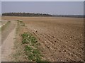
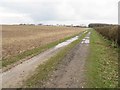
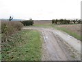
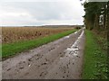
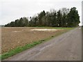
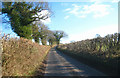
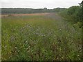
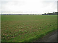
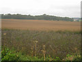
Living in RG25 2DJ offers a distinctly quiet and settled existence within a specific residential cluster. This postcode covers a small area of 89.9 hectares in England, carefully shaping a community of 2,296 residents. The population density here stands at 97 people per square kilometre, which translates to a spread-out living environment where neighbours are often further apart than in denser urban locations. You will find that daily life here is characterised by space and a slower pace, absent the congestion typical of larger towns. The neighbourhood is defined by its compact size yet offers a complete fabric of local living without the need to travel far for essentials. This small cluster provides a stable backdrop for families and individuals seeking a residential focus rather than a urban centre experience. The limited footprint of the area ensures that local interactions remain personal while maintaining a clear separation from busier through-traffic routes. Residents enjoy the benefits of a contained community where the boundaries of the postcode directly influence the scale of your immediate surroundings.
- Area Type
- Postcode
- Area Size
- 89.9 hectares
- Population
- 2296
- Population Density
- 97 people/km²
The property market in RG25 2DJ revolves almost entirely around detached and semi-detached houses rather than flats or converted buildings. With 77% of people owning their homes, this is firmly an owner-occupied area where investment is typically made for long-term living rather than as a portfolio of rentals. The stock consists of houses that match the area density of 97 people per square kilometre, offering space that appeals to families needing gardens or driveways. Buying into this postcode means entering a neighbourhood where the housing stock is established and rarely changes rapidly. You will find a scarcity of new-build apartments or shared ownership flats, as the provided data points to a traditional housing market. This homogeneity simplifies your search; you know exactly what type of dwelling you will find before you view a single property. The absence of rental data suggests a stable market where price movements are driven by local demand from cross-border commuters or those working in nearby hubs like Basingstoke. Security of tenure is generally higher here, as most owners are anchored to their properties for the long haul.
House Prices in RG25 2DJ
Showing 7 properties
Energy Efficiency in RG25 2DJ
Daily life in RG25 2DJ benefits from a cluster of amenities located within practical reach of your home. For shopping needs, you are close to five notable retailers, including Budgens Old, Tesco Hounsome, and The Southern Co-operative Co. These supermarkets provide everything from fresh groceries to household essentials, reducing the necessity to travel long distances for daily supplies. Three railway stations lie nearby, offering further flexibility for those who wish to mix train travel with local driving. Overton Railway Station, Micheldever Railway Station, and Basingstoke Railway Station provide links to wider networks, which is crucial for commuters aiming to reach major employment centres. The presence of Basingstoke Railway Station specifically connects you to the wider region, allowing access to jobs in Hampshire and beyond. Residents can walk or drive quickly to these transport hubs, ensuring that your lifestyle remains flexible despite the quiet nature of the area. The combination of local retail and rail access creates a balanced environment where convenience meets connectivity.
Amenities
Schools
Families moving to RG25 2DJ will have access to North Waltham Primary School, which is situated within practical reach of the postcode. This school offers education for younger children and holds a good OFsted rating, ensuring a standard of teaching that meets national expectations. The proximity of this single primary institution makes it the immediate education choice for local families with children starting their academic journey. There is no data on secondary schools in the provided records, so you must look beyond the immediate suburb to find junior and high schools for older students. The presence of a primary school with a good rating provides a strong foundational option for early education within the age range of 30 to 64 year old adults who frequently populate the homes here. The limited school options suggest that this area is not a major educational hub but rather relies on the central cluster of schools located slightly further away. You should verify travel times from your specific address to the local primary site before committing to a move.
| Rank | School | Type | Entry gender | Ages |
|---|
Explore more schools in this area
Go to Schools tabDemographics
The community in RG25 2DJ reflects a mature and established population. The median age for residents is 47 years old, confirming that the most common age group consists of adults between 30 and 64 years. This demographic profile suggests a neighbourhood dominated by those in the middle and later stages of their working lives, likely including empty nesters and established professionals. Home ownership is a defining feature of this area, with 77% of households owning their properties outright or with a mortgage. This high rate indicates long-term residency rather than a transient rental market, creating stability in the local streets. Almost all accommodation within RG25 2DJ comprises houses, meaning there are no blocks of flats or high-rise apartments competing for space. The predominant ethnic group recorded is White, which aligns with the generally conservative character often found in such rural districts. You will not find significant demographic fluctuations here; instead, the area maintains a consistent make-up where long-term residents have settled for decades. Deprivation metrics are not provided in the available records, so you should rely on the clear indicators of ownership and age to gauge the area's prosperity.
Household Size
Accommodation Type
Tenure
Ethnic Group
Religion
Household Composition
Age
Household Deprivation
NS-SEC
Explore more demographic insights in this area
Go to Demographics tabPlanning
Planning Constraints
- Flood RiskPremium
- Ramsar Wetland SitesPremium
- Area of Outstanding Natural BeautyPremium
- Protected Nature ReservePremium
- Protected WoodlandPremium