Area Overview for RG25 2BP
Photos of RG25 2BP
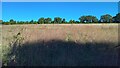
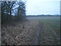
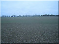
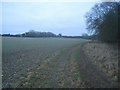
8 photos from this area
Area Information
Key information about the RG25 2BP including its size, population, and administrative classification.
- Area Type
- Postcode
- Area Size
- 29.4 hectares
- Population
- 2296
- Population Density
- 97 people/km²
House Prices in RG25 2BP
32
Properties
£483,399
Average Sold Price
£176,000
Lowest Price
£763,000
Highest Price
Showing 32 properties
| Address | Type | Beds | Baths | Last Sale Price | Last Sale Date | |
|---|---|---|---|---|---|---|
| 7 St Michaels Close, North Waltham, RG25 2BP | house | 3 | 2 | £590,000 | Sep 2024 | |
| 18 St Michaels Close, North Waltham, RG25 2BP | Detached | 4 | 3 | £763,000 | Sep 2024 | |
| 8 St Michaels Close, North Waltham, RG25 2BP | Detached | 4 | 1 | £520,000 | Nov 2021 | |
| 14 St Michaels Close, North Waltham, RG25 2BP | Detached | 4 | 2 | £582,500 | Sep 2020 | |
| 21 St Michaels Close, North Waltham, RG25 2BP | Detached | 5 | 3 | £690,000 | Jul 2019 | |
| 6 St Michaels Close, North Waltham, RG25 2BP | Detached | 3 | 2 | £490,000 | Jun 2019 | |
| 19 St Michaels Close, North Waltham, RG25 2BP | Detached | 6 | - | £640,000 | Mar 2016 | |
| 13 St Michaels Close, North Waltham, RG25 2BP | Detached | 4 | - | £445,000 | Dec 2015 | |
| 3 St Michaels Close, North Waltham, RG25 2BP | house | - | - | £438,190 | Nov 2015 | |
| 25 St Michaels Close, North Waltham, RG25 2BP | Detached | 4 | 2 | £535,000 | May 2015 |
Page 1 of 4
Energy Efficiency in RG25 2BP
Amenities
Schools
| Rank | School | Type | Entry gender | Ages |
|---|
Explore more schools in this area
Go to Schools tabDemographics
Household Size
Family (3-5 people)
most common
Accommodation Type
Houses
most common
Tenure
77
majority
Ethnic Group
White
most common
Religion
N/A
most common
Household Composition
N/A
most common
Age
47
median
Adults (30-64 years)
most common
Household Deprivation
N/A
with no deprivation
NS-SEC
52
in Lower managerial occupations
Explore more demographic insights in this area
Go to Demographics tabPlanning
Planning Constraints
- Flood RiskPremium
- Ramsar Wetland SitesPremium
- Area of Outstanding Natural BeautyPremium
- Protected Nature ReservePremium
- Protected WoodlandPremium