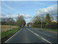
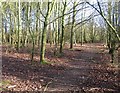
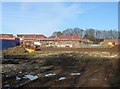
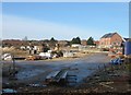
Area Overview for RG24 9XT
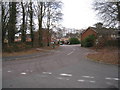
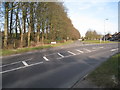
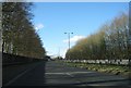
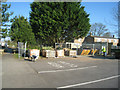
Photos of RG24 9XT
Area Information
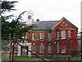
RG24 9XT represents a specific residential cluster within the broader Sherborne St. John and Rooksdown district in Hampshire. This postcode covers an area size of 4869 square metres, housing a population of 2196 residents. You are looking at a location where history and modern development intersect. The area sits near the former Park Prewett Mental Hospital site, which was redeveloped to include new housing estates like The Beeches, Rooksdown, Park Village, and Limes Park. The wider locality shares deep historical roots tracing back to Roman times and the Domesday Book, where the land was once part of the Vyne estate owned by families such as the Brocas and Chute. Today, the landscape reflects this layered past, featuring listed buildings from the original hospital alongside established village features in Sherborne St. John. You will find a mix of the old and new, from the St Andrews parish church and village green in the east to the structured housing developments in the west. Living in RG24 9XT means access to these distinct neighbourhoods while being situated in the Basingstoke and Deane district. The area defines a transition zone where a historic civil parish meets contemporary suburban growth, offering a setting anchored by significant local landmarks.
- Area Type
- Postcode
- Area Size
- 4869 m²
- Population
- 2196
- Population Density
- 5777 people/km²
You are looking at a housing market defined by established ownership and traditional housing forms. The data indicates that 54% of households own their homes, establishing this as a territory dominated by owner-occupiers rather than a dynamic rental sector. Accommodation types in RG24 9XT consist primarily of houses, consistent with the village geography of Sherborne St. John and the new housing estates developed around the former hospital site in Rooksdown. The property stock includes listed buildings retained from the Park Prewett Hospital era, such as a clock tower and entertainment hall, mixed with modern developments like The Beeches, Park Village, and Limes Park. This difference suggests you can find both historic character and contemporary layouts. As a specific postcode cluster covering a small residential area, RG24 9XT does not offer a wide variety of property types in isolation but serves as a focal point within the wider village. Buyers targeting this area should expect a market where stability prevails, with many residents having long-term ties to the location. The high home ownership figure implies that the area has seen sustained demand over time, making it a solid choice for those seeking permanence in the Basingstoke district.
House Prices in RG24 9XT
Showing 12 properties
| Address | Type | Beds | Baths | Last Sale Price | Last Sale Date | |
|---|---|---|---|---|---|---|
| 6 East Siding, Basingstoke, RG24 9XT | house | - | - | £462,500 | Jun 2021 | |
| 9 East Siding, Basingstoke, RG24 9XT | house | - | - | £402,000 | Mar 2021 | |
| 8 East Siding, Basingstoke, RG24 9XT | Terraced | - | - | £393,500 | Feb 2021 | |
| 12 East Siding, Basingstoke, RG24 9XT | Semi-detached | 4 | 2 | - | - | |
| 2 East Siding, Basingstoke, RG24 9XT | Detached | 4 | 3 | - | - | |
| 11 East Siding, Basingstoke, RG24 9XT | house | - | - | - | - | |
| 5 East Siding, Basingstoke, RG24 9XT | house | - | - | - | - | |
| 7 East Siding, Basingstoke, RG24 9XT | house | - | - | - | - | |
| 10 East Siding, Basingstoke, RG24 9XT | house | - | - | - | - | |
| 4 East Siding, Basingstoke, RG24 9XT | house | - | - | - | - |
Energy Efficiency in RG24 9XT
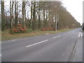
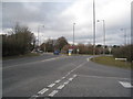
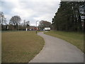
Living in RG24 9XT provides access to essential amenities within a short practical distance. You can find five notable retail outlets nearby, including Aldi Winklebury, Farmfoods Basingstoke, and The Southern Co-operative Co. These supermarkets and convenience stores meet daily requirements for groceries and household provisions without the need for extensive travel. For travelling or long-distance movement, two railway stations serve the immediate vicinity. Basingstoke Railway Station and Bramley Railway Station provide the primary public transport links for commuters and visitors. Beyond shopping and transport, the lifestyle is shaped by the unique blend of village and estate living. Sherborne St. John offers a village green and a duck pond, providing green space for leisure. The area also benefits from proximity to The Vyne, a historic house managed by the National Trust, which hosts events and gardens for visitors. The retention of listed buildings from the former Park Prewett Hospital adds architectural interest to the local streetscape. You have a quiet environment punctuated by access to major retail chains and rail services, balancing suburban convenience with the charm of historic Hampshire villages.
Amenities
Schools
| Rank | School | Type | Entry gender | Ages |
|---|
Explore more schools in this area
Go to Schools tabDemographics
The community profile for RG24 9XT shows a mature population skewed towards middle age. The median age recorded is 47 years, with adults between 30 and 64 years old forming the most common age range. This demographic suggests a stable resident base rather than a transient market. Home ownership stands at 54%, indicating that more than half of the residents own their properties outright or with a mortgage. The remaining households are likely renters or those seeking to enter the property ladder. Accommodation types are predominantly houses, aligning with the suburban nature of Sherborne St. John and the new estate developments in Rooksdown. The predominant ethnic group is White, reflecting the area's composition within the Basingstoke region. You will encounter a community characterised by this age stability and high home ownership rate. The population density reaches 451,014 people per square kilometre within the defined postcode cluster, though this figure reflects the high precision of the small residential cluster definition rather than the broader sweeping countryside often associated with the wider villages. This concentration indicates a compact living environment where neighbours are potentially close by despite the nearby open spaces.
Household Size
Accommodation Type
Tenure
Ethnic Group
Religion
Household Composition
Age
Household Deprivation
NS-SEC
Explore more demographic insights in this area
Go to Demographics tabPlanning
Planning Constraints
- Flood RiskPremium
- Ramsar Wetland SitesPremium
- Area of Outstanding Natural BeautyPremium
- Protected Nature ReservePremium
- Protected WoodlandPremium