Area Overview for RG24 9UJ
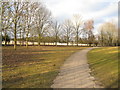
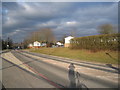
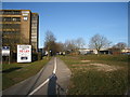
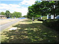
Photos of RG24 9UJ

Area Information
Living in RG24 9UJ means residing in a small residential cluster defined by its distinct postcode. This specific area covers 895 square metres of land and currently accommodates a population of 1063 residents. The community operates at a population density of 1,187,242 people per square kilometre, reflecting a tightly packed local environment. While the area size is modest, the number of homes suggests a concentrated settlement pattern typical of this cluster. Daily life here is characterised by proximity, with residents navigating a neighbourhood designed for immediate access to local services. The area functions as a cohesive unit where the high density creates a sense of closeness among households. You will find a setting that prioritises residential stability within a compact geographical footprint.
- Area Type
- Postcode
- Area Size
- 895 m²
- Population
- 1063
- Population Density
- 3565 people/km²
The property market in RG24 9UJ is defined by a substantial owner-occupied sector, with 44% of residents owning their properties. Houses constitute the dominant accommodation type, suggesting a housing stock built for permanent family living rather than student rentals or transient use. This concentration of single-family homes indicates an area where residents have deep roots and seek long-term stability. Prospective buyers looking at this small postcode area will primarily encounter detached or semi-detached properties suited for established households. The high home ownership rate signals a mature market where properties often change hands slowly through inheritance or planned succession. You will find fewer chance encounters with short-term tenants compared to areas with younger demographics.
House Prices in RG24 9UJ
Showing 32 properties
Energy Efficiency in RG24 9UJ
Residents of RG24 9UJ enjoy practical access to essential retail and rail links within a reasonable distance. The nearest retail options include Aldi Winklebury, The Southern Co-operative Co, and a second location for The Southern Co-operative Co, offering convenient grocery shopping. For rail connectivity, Basingstoke Railway Station and Bramley Railway Station provide access to wider regional networks. These two stations serve as primary hubs for commuters needing to travel beyond the local cluster. The presence of these specific retailers ensures that daily essentials are within practical reach without requiring long journeys. Shopping and work commutes rely heavily on these established amenities surrounding the postcode area.
Amenities
Schools
| Rank | School | Type | Entry gender | Ages |
|---|
Explore more schools in this area
Go to Schools tabDemographics
The community in RG24 9UJ is predominantly composed of adults between the ages of 30 and 64 years. This demographic range aligns with a median age of 47, indicating a mature and established household base. Forty-four per cent of residents own their homes, meaning nearly half the population has a secure tenure in this postcode area. Houses form the primary accommodation type, shaping the character of streets and gardens across the cluster. The area's ethnic profile is predominantly White, reflecting a homogeneous community composition. This age structure suggests a population settled long enough to prioritise home stability and local integration. Families likely dominate the social fabric, given the high proportion of middle-aged adults residing here.
Household Size
Accommodation Type
Tenure
Ethnic Group
Religion
Household Composition
Age
Household Deprivation
NS-SEC
Explore more demographic insights in this area
Go to Demographics tabPlanning
Planning Constraints
- Flood RiskPremium
- Ramsar Wetland SitesPremium
- Area of Outstanding Natural BeautyPremium
- Protected Nature ReservePremium
- Protected WoodlandPremium