Area Overview for RG24 9QY
Photos of RG24 9QY
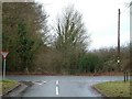
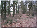
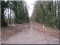
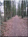
100 photos from this area
Area Information
Key information about the RG24 9QY including its size, population, and administrative classification.
- Area Type
- Postcode
- Area Size
- 1.0 hectares
- Population
- 2655
- Population Density
- 2002 people/km²
House Prices in RG24 9QY
37
Properties
£384,104
Average Sold Price
£277,995
Lowest Price
£816,104
Highest Price
Showing 37 properties
| Address | Type | Beds | Baths | Last Sale Price | Last Sale Date | |
|---|---|---|---|---|---|---|
| 12 Blackmoor Drive, Basingstoke, RG24 9QY | Terraced | 2 | 2 | £325,000 | Mar 2025 | |
| 26 Blackmoor Drive, Basingstoke, RG24 9QY | Detached | 3 | 2 | £420,000 | Feb 2024 | |
| 3 Blackmoor Drive, Basingstoke, RG24 9QY | Retail | 3 | 2 | £400,000 | Jul 2022 | |
| 7 Blackmoor Drive, Basingstoke, RG24 9QY | house | - | - | £434,995 | Jun 2022 | |
| 27 Blackmoor Drive, Basingstoke, RG24 9QY | house | 2 | 2 | £334,995 | Dec 2021 | |
| 20 Blackmoor Drive, Basingstoke, RG24 9QY | house | - | - | £302,500 | Sep 2021 | |
| 39 Blackmoor Drive, Basingstoke, RG24 9QY | house | - | - | £364,995 | Oct 2020 | |
| 35 Blackmoor Drive, Basingstoke, RG24 9QY | house | - | - | £364,995 | Oct 2020 | |
| 43 Blackmoor Drive, Basingstoke, RG24 9QY | house | - | - | £299,995 | Sep 2020 | |
| 13 Blackmoor Drive, Basingstoke, RG24 9QY | house | - | - | £362,995 | Sep 2019 |
Page 1 of 4
Energy Efficiency in RG24 9QY
Amenities
Schools
| Rank | School | Type | Entry gender | Ages |
|---|
Explore more schools in this area
Go to Schools tabDemographics
Household Size
Family (3-5 people)
most common
Accommodation Type
Houses
most common
Tenure
63
majority
Ethnic Group
White
most common
Religion
N/A
most common
Household Composition
N/A
most common
Age
47
median
Adults (30-64 years)
most common
Household Deprivation
N/A
with no deprivation
NS-SEC
48
in Lower managerial occupations
Explore more demographic insights in this area
Go to Demographics tabPlanning
Planning Constraints
- Flood RiskPremium
- Ramsar Wetland SitesPremium
- Area of Outstanding Natural BeautyPremium
- Protected Nature ReservePremium
- Protected WoodlandPremium