Area Overview for RG24 9NF
Photos of RG24 9NF
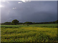
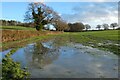
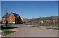
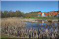
47 photos from this area
Area Information
Key information about the RG24 9NF including its size, population, and administrative classification.
- Area Type
- Postcode
- Area Size
- 17.6 hectares
- Population
- 1375
- Population Density
- 197 people/km²
House Prices in RG24 9NF
65
Properties
£452,097
Average Sold Price
£279,000
Lowest Price
£547,000
Highest Price
Showing 65 properties
| Address | Type | Beds | Baths | Last Sale Price | Last Sale Date | |
|---|---|---|---|---|---|---|
| 60 Hasker Road, Basingstoke, RG24 9NF | Detached | 4 | 2 | £530,000 | Oct 2024 | |
| 36 Hasker Road, Basingstoke, RG24 9NF | Detached | 3 | 3 | £420,000 | Apr 2024 | |
| 39 Hasker Road, Basingstoke, RG24 9NF | house | - | - | £280,000 | Sep 2021 | |
| 30 Hasker Road, Basingstoke, RG24 9NF | Semi-detached | 3 | 2 | £310,000 | Nov 2020 | |
| 4 Hasker Road, Basingstoke, RG24 9NF | Bungalow | - | - | £505,140 | Mar 2020 | |
| 28 Hasker Road, Basingstoke, RG24 9NF | house | - | - | £496,000 | Mar 2020 | |
| 18 Hasker Road, Basingstoke, RG24 9NF | house | 4 | 2 | £474,000 | Mar 2020 | |
| 26 Hasker Road, Basingstoke, RG24 9NF | house | - | - | £547,000 | Mar 2020 | |
| 16 Hasker Road, Basingstoke, RG24 9NF | house | - | - | £495,000 | Mar 2020 | |
| 52 Hasker Road, Basingstoke, RG24 9NF | house | - | - | £539,000 | Nov 2019 |
Page 1 of 7
Energy Efficiency in RG24 9NF
Amenities
Schools
| Rank | School | Type | Entry gender | Ages |
|---|
Explore more schools in this area
Go to Schools tabDemographics
Household Size
Family (3-5 people)
most common
Accommodation Type
Houses
most common
Tenure
75
majority
Ethnic Group
White
most common
Religion
N/A
most common
Household Composition
N/A
most common
Age
47
median
Adults (30-64 years)
most common
Household Deprivation
N/A
with no deprivation
NS-SEC
52
in Lower managerial occupations
Explore more demographic insights in this area
Go to Demographics tabPlanning
Planning Constraints
- Flood RiskPremium
- Ramsar Wetland SitesPremium
- Area of Outstanding Natural BeautyPremium
- Protected Nature ReservePremium
- Protected WoodlandPremium