Area Overview for RG23 7LT
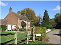
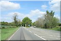
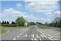
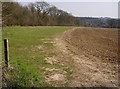
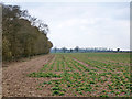
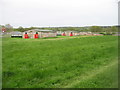
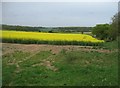
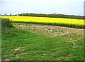
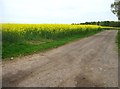
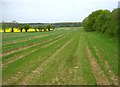
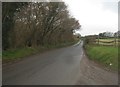
Photos of RG23 7LT
Area Information
RG23 7LT represents a specific residential cluster within the RG23 postcode region of England. This area spans 17 hectares and houses a population of 1,568 residents. You will find a quiet, low-density environment with a population density of just 92 people per square kilometer. The terrain consists of houses rather than apartment blocks or high-rise developments. Living in RG23 7LT offers a distinct sense of space often found in smaller outskirts villages rather than dense suburbs. The character of the neighbourhood is defined by its scale and the specific mix of households that call this postcode home. It is a place where daily life revolves around local amenities and a community that knows its neighbours personally. The area maintains a balanced presence without the overwhelming crowds found in larger urban centres. For those seeking a home in a defined, manageable zone, this postcode provides a clear geographic boundary for your new location. The setting prioritises privacy and access to green spaces alongside practical connectivity to larger transport hubs nearby. You gain a home in a setting that values stability and established community patterns over rapid development cycles.
- Area Type
- Postcode
- Area Size
- 17.0 hectares
- Population
- 1568
- Population Density
- 92 people/km²
You are looking at a market dominated by private home ownership. Sixty-four percent of residents own their properties, which creates a stable environment for those seeking to purchase. The accommodation type is almost exclusively houses, meaning you will not find apartment blocks or high-density flats within this specific postcode. This structure caters to buyers who require garden space, private entrances, and the freedom to modify their living environment without building control restrictions common in flats. The low population density of 92 people per square kilometer reinforces the house-dominant market, ensuring that every home stands out within the 17-hectare layout. Investors seeking rental yields may find this area less dynamic than student hubs or major city edges, as the high ownership rate indicates a resident-focused rather than landlord-dominant estate. However, this stability often correlates with better value retention over time. If you value a quiet street with permanent residents rather than short-term tenants, RG23 7LT offers exactly that. The market here reflects a desire for space and independence, making it suitable for couples, growing families, and retirees.
House Prices in RG23 7LT
Showing 12 properties
| Address | Type | Beds | Baths | Last Sale Price | Last Sale Date | |
|---|---|---|---|---|---|---|
| 31 Northanger Road, Basingstoke, RG23 7LT | house | - | - | - | - | |
| 25 Northanger Road, Basingstoke, RG23 7LT | house | - | - | - | - | |
| 33 Northanger Road, Basingstoke, RG23 7LT | house | - | - | - | - | |
| 27 Northanger Road, Basingstoke, RG23 7LT | house | - | - | - | - | |
| 19 Northanger Road, Basingstoke, RG23 7LT | house | - | - | - | - | |
| 35 Northanger Road, Basingstoke, RG23 7LT | house | - | - | - | - | |
| 78 Lulworth Way, Basingstoke, RG23 7LT | house | - | - | - | - | |
| 29 Northanger Road, Basingstoke, RG23 7LT | house | - | - | - | - | |
| 21 Northanger Road, Basingstoke, RG23 7LT | house | - | - | - | - | |
| 13 Northanger Road, Basingstoke, RG23 7LT | house | - | - | - | - |
Energy Efficiency in RG23 7LT
Daily life in RG23 7LT blends residential calm with practical access to retail and rail links. You have five key retail venues within practical reach, including Tesco Hounsome, The Southern Co-operative Co, and Lidl Basingstoke. These locations provide essential groceries and daily necessities without requiring a journey into a major city centre. Shopping trips remain local and convenient. Transport links are equally accessible, with three railway stations serving the area: Basingstoke Railway Station, Overton Railway Station, and Micheldever Railway Station. These stations offer direct routes to wider networks, connecting you to professional hubs and leisure destinations. The combination of nearby supermarkets and rail access means you rarely feel cut off from the wider region. On weekends, you can drive to Tesco or Lidl for supplies or step Out to catch a train at Overton. This setup supports an active lifestyle where work, shopping, and travel blend seamlessly. The area remains a base for exploring the wider Hampshire or Berkshire regions with minimal travel time.
Amenities
Schools
For families considering homes in RG23 7LT, education options are centred around private institutions. The nearest listed school is Hilsea College, which operates as an independent school. This selection means you rely on the private sector for secondary education within immediate range. Independent schools often command higher fees and offer specific curricular advantages over state-run options, but they also require budgeting beyond standard mortgage expenses. You will not find state-maintained comprehensive or primary schools listed for this specific postcode in the provided data. This absence suggests that families either live outside the catchment area of nearby state schools or choose private schooling for their children. The presence of an institution like Hilsea College indicates a neighbourhood where educational investment is a priority. Parents here have access to a specific type of education characterized by smaller class sizes, specialized facilities, and autonomy from local authority school boards. When planning your move, factor in the distance to Hilsea College and the associated financial commitment of independent education.
| Rank | School | Type | Entry gender | Ages |
|---|
Explore more schools in this area
Go to Schools tabDemographics
The community profile for RG23 7LT shows a mature and established population. The median age stands at 47 years, confirming that adults between the ages of 30 and 64 make up the most common age range. This demographic skew suggests a neighbourhood where families are settled and homeowners have accumulated assets over time. Home ownership is strong here, with 64% of residents owning their properties outright or with a mortgage. This high rate of ownership aligns with the accommodation type, which consists predominantly of houses rather than rental flats or serviced apartments. The predominant ethnic group is White, reflecting the traditional composition of many historic housing estates in the region. You will encounter a community likely focused on long-term stability rather than transient living arrangements. The low population density supports this demographic trend, providing ample space for households with varying needs. Residents here typically value privacy and established local networks over the density found in city centres. The age distribution creates an environment where childcare requirements and older adult services coexist smoothly within the same immediate postcode.
Household Size
Accommodation Type
Tenure
Ethnic Group
Religion
Household Composition
Age
Household Deprivation
NS-SEC
Explore more demographic insights in this area
Go to Demographics tabPlanning
Planning Constraints
- Flood RiskPremium
- Ramsar Wetland SitesPremium
- Area of Outstanding Natural BeautyPremium
- Protected Nature ReservePremium
- Protected WoodlandPremium