Area Overview for RG22 6QU
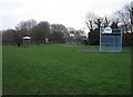
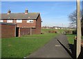
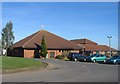
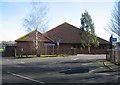
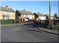
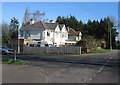
Photos of RG22 6QU
Area Information
RG22 6QU is a small residential cluster defined by its compact footprint of just 5,484 square metres. This specific postcode accommodates a population of 1,641 people, resulting in a population density of 299,230 people per square kilometre. Such a high density within a limited space suggests a tightly knit community where properties are close together and residents live in close proximity. As a specific location rather than a broad district, life here is intimate and immediate. You are living in an area where the boundaries of your immediate neighbourhood overlap rapidly with those of your neighbours. The area functions as a concentrated pocket of residential living within England, offering the advantages of a small community while retaining the practicalities of a standard property cluster. When considering homes in RG22 6QU, you must understand that you are purchasing a stake in a very specific, small-scale environment where every street corner is likely well known to local residents. This density creates a distinct daily rhythm compared to sprawling suburbs.
- Area Type
- Postcode
- Area Size
- 5484 m²
- Population
- 1641
- Population Density
- 5503 people/km²
The property market in RG22 6QU is defined by a housing stock consisting primarily of houses. With a total population of 1,641 residents spread across this specific residential cluster, the available inventory is inherently limited. Only 40% of the accommodation is owner-occupied, indicating that the majority of homes lie within the private rental sector. This split suggests a dynamic market where investors may hold a significant portion of the local supply, catering to the 60% of residents who rent. If you are looking at homes in this postcode, you should expect a mix of owner-occupier properties and rental units rather than a homogenous block of freehold homes. The compact nature of the 5,484 square metre area means that price per square metre will be high, driven by scarcity. You are competing for space in a very dense cluster. The high population density of 299,230 people per square kilometre intensifies the value of available land. Buyers seeking properties in RG22 6QU must consider that the local market is small and potentially competitive. The dominance of houses over apartments or bungalows offers a specific lifestyle associated with the main housing stock.
House Prices in RG22 6QU
Showing 18 properties
| Address | Type | Beds | Baths | Last Sale Price | Last Sale Date | |
|---|---|---|---|---|---|---|
| 23 Dartmouth Walk, Basingstoke, RG22 6QU | Terraced | 3 | 1 | £300,000 | Dec 2025 | |
| 12 Dartmouth Walk, Basingstoke, RG22 6QU | Terraced | 3 | 1 | £295,000 | Apr 2024 | |
| 2 Dartmouth Walk, Basingstoke, RG22 6QU | Terraced | 3 | - | £315,000 | Oct 2021 | |
| 15 Dartmouth Walk, Basingstoke, RG22 6QU | Terraced | 3 | 2 | £250,000 | Jun 2020 | |
| 4 Dartmouth Walk, Basingstoke, RG22 6QU | Terraced | 3 | 1 | £230,500 | Dec 2018 | |
| 13 Dartmouth Walk, Basingstoke, RG22 6QU | Terraced | 3 | 1 | £210,000 | Feb 2016 | |
| 8 Dartmouth Walk, Basingstoke, RG22 6QU | Terraced | 3 | 1 | £172,000 | Jul 2014 | |
| 6 Dartmouth Walk, Basingstoke, RG22 6QU | Terraced | 3 | 1 | £155,000 | Jun 2013 | |
| 7 Dartmouth Walk, Basingstoke, RG22 6QU | house | - | - | £167,500 | Feb 2013 | |
| 9 Dartmouth Walk, Basingstoke, RG22 6QU | house | - | - | - | - |
Energy Efficiency in RG22 6QU
Residents of RG22 6QU enjoy convenient access to a range of practical amenities. Retail options include Lidl South, The Southern Co-operative Co, and Morrisons Daily Basingstoke Buckland PDE, offering five distinct supermarket and convenience stores within practical reach. These venues provide groceries and daily essentials without the need for long travel. Transport links are equally accessible, with three railway stations nearby: Basingstoke Railway Station, Bramley Railway Station, and Overton Railway Station. This rail connectivity facilitates easier commutes to wider regions. For those requiring air travel, Lasham Airport serves as a local aerodrome, although it functions differently from a major commercial hub. The presence of these specific venues means your daily shopping and commuting requirements can be met locally. You can stock your household at Southern Co-operative or Morrisons while taking trains from Basingstoke or Bramley for further journeys. Living in RG22 6QU places you at the centre of a functional network of shops and transport hubs designed for resident convenience.
Amenities
Schools
Families living in RG22 6QU have access to Bishop Challoner Catholic Secondary School, which offers secondary education. This institution holds an Ofsted rating of good, providing a standard of education that meets national expectations. As the only school listed for this immediate area, it serves as a primary educational resource for the local community. The presence of a secondary school with a good rating suggests that the area supports older children and teenagers with formal schooling options nearby. For parents relocating to this postcode, the school acts as a key anchor for family decision-making. You do not have a choice of multiple secondary options listed in the immediate data, so this single institution represents the main educational route. The school's status as a Catholic institution adds a specific cultural and religious dimension to the community fabric. When evaluating schools near RG22 6QU, this is the definitive named option available. The good rating provides reassurance regarding the quality of instruction, which is a critical factor for families with school-aged children residing in this densely populated cluster.
| Rank | School | Type | Entry gender | Ages |
|---|
Explore more schools in this area
Go to Schools tabDemographics
The community within RG22 6QU reflects a mature demographic profile with a median age of 47 years. Most residents fall into the adult age range between 30 and 64 years, indicating that the area attracts or retains established households rather than young singles or empty-nesters. Home ownership stands at 40%, meaning the remaining 60% of residents likely rent their properties. Housing stock consists predominantly of houses, aligning with the preference of the central age group for family-sized or detached accommodation. The predominant ethnic group is White, which characterises the cultural makeup of the locality. While specific deprivation indices are not listed in the core demographic summary, the concentration of households in the 30-64 age bracket often suggests stability and a family-oriented environment. A median age of 47 means you are looking at an area where many residents have already established their lives locally. This age profile often correlates with a demand for reliable services and amenities that cater to adults who balance work and family life. The high home ownership rate of 40% is notable for a small postcode, suggesting that while there is a significant rental component, nearly half of the residents have purchased their homes.
Household Size
Accommodation Type
Tenure
Ethnic Group
Religion
Household Composition
Age
Household Deprivation
NS-SEC
Explore more demographic insights in this area
Go to Demographics tabPlanning
Planning Constraints
- Flood RiskPremium
- Ramsar Wetland SitesPremium
- Area of Outstanding Natural BeautyPremium
- Protected Nature ReservePremium
- Protected WoodlandPremium