Area Overview for RG22 6PD
Photos of RG22 6PD
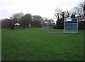
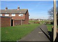
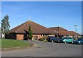
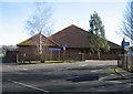
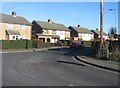
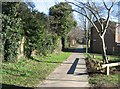
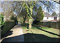
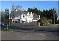
100 photos from this area
Area Information
Key information about the RG22 6PD including its size, population, and administrative classification.
- Area Type
- Postcode
- Area Size
- 1.8 hectares
- Population
- 1495
- Population Density
- 2673 people/km²
House Prices in RG22 6PD
28
Properties
£360,580
Average Sold Price
£95,750
Lowest Price
£557,000
Highest Price
Showing 28 properties
| Address | Type | Beds | Baths | Last Sale Price | Last Sale Date | |
|---|---|---|---|---|---|---|
| 288 Old Worting Road, Basingstoke, RG22 6PD | Bungalow | 3 | 1 | £450,000 | Nov 2024 | |
| 256 Old Worting Road, Basingstoke, RG22 6PD | Terraced | 3 | 2 | £380,000 | Sep 2024 | |
| 266 Old Worting Road, Basingstoke, RG22 6PD | Bungalow | 2 | 1 | £330,000 | May 2023 | |
| 254 Old Worting Road, Basingstoke, RG22 6PD | Retail | 5 | 2 | £557,000 | Sep 2022 | |
| 258 Old Worting Road, Basingstoke, RG22 6PD | house | - | - | £370,000 | Sep 2022 | |
| 282 Old Worting Road, Basingstoke, RG22 6PD | Retail | 4 | 3 | £550,000 | May 2022 | |
| 280 Old Worting Road, Basingstoke, RG22 6PD | Semi-detached | 3 | - | £431,000 | Sep 2021 | |
| 284 Old Worting Road, Basingstoke, RG22 6PD | Bungalow | 4 | - | £405,000 | Apr 2021 | |
| 246 Old Worting Road, Basingstoke, RG22 6PD | hospital_care_home | - | - | £425,000 | Feb 2021 | |
| 270 Old Worting Road, Basingstoke, RG22 6PD | Bungalow | 3 | - | £380,000 | Mar 2016 |
Page 1 of 3
Energy Efficiency in RG22 6PD
Amenities
Schools
| Rank | School | Type | Entry gender | Ages |
|---|
Explore more schools in this area
Go to Schools tabDemographics
Household Size
Two person
most common
Accommodation Type
Houses
most common
Tenure
59
majority
Ethnic Group
White
most common
Religion
N/A
most common
Household Composition
N/A
most common
Age
47
median
Adults (30-64 years)
most common
Household Deprivation
N/A
with no deprivation
NS-SEC
29
in Lower managerial occupations
Explore more demographic insights in this area
Go to Demographics tabPlanning
Planning Constraints
- Flood RiskPremium
- Ramsar Wetland SitesPremium
- Area of Outstanding Natural BeautyPremium
- Protected Nature ReservePremium
- Protected WoodlandPremium