Area Overview for RG22 6DW
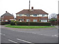
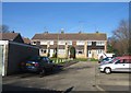
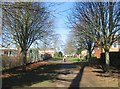
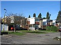
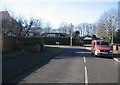
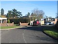
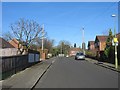
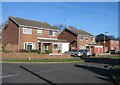
Photos of RG22 6DW
Area Information
Living in RG22 6DW means residing within a very specific residential cluster of just 4,443 square metres. This small postcode area contains a population of 1,733 people, creating a tight-knit environment where neighbours know each other by name. You will find accommodation largely takes the form of houses rather than flats, catering to families and established households. The community is predominantly White, reflecting the broader demographic trends of the region. With a population density reaching 390,046 people per square kilometre for this specific postcode, the housing stock is concentrated. Daily life here revolves around accessing nearby railway stations and local shops without travelling far. The area sits close to Lasham Airport and Basingstoke Railway Station, offering practical links for commuting. While the physical footprint is small, the connectivity to the wider Basingstoke area ensures you remain integrated with regional opportunities. This compact setting provides a quiet backdrop for life, though you must consider the implications of such a dense concentration of homes in a limited space. The character of RG22 6DW is defined by its residential focus and immediate proximity to essential transport hubs.
- Area Type
- Postcode
- Area Size
- 4443 m²
- Population
- 1733
- Population Density
- 2696 people/km²
The property market in RG22 6DW is characterised by a specific accommodation type: Houses. This indicates that the housing stock is dominated by standalone or semi-detected properties rather than flats or maisonettes. With home ownership standing at 43%, nearly half of the residents own their properties outright or via a mortgage, while the remainder are likely tenants. This subtlety suggests a mixed market where buying remains popular but renting coexists significantly. The small size of the area, covering only 4,443 square metres, means the total number of homes available is limited compared to larger postcodes. You will find this area suitable for those seeking traditional house living rather than high-rise accommodation. The presence of families is evident from the school choices nearby, which often drives demand for larger houses to accommodate growing households. Buying a home here offers the space associated with house ownership in a concentrated location. The 43% ownership rate reflects a market where residential stability is common, making it an environment where properties change hands based on standard market dynamics rather than speculative development trends.
House Prices in RG22 6DW
Showing 13 properties
| Address | Type | Beds | Baths | Last Sale Price | Last Sale Date | |
|---|---|---|---|---|---|---|
| 36 St Patricks Road, Basingstoke, RG22 6DW | house | - | - | £300,000 | Apr 2019 | |
| 23 St Patricks Road, Basingstoke, RG22 6DW | Terraced | 2 | 1 | £189,950 | Sep 2014 | |
| 21 St Patricks Road, Basingstoke, RG22 6DW | Terraced | 2 | 1 | £171,000 | Dec 2012 | |
| 17 St Patricks Road, Basingstoke, RG22 6DW | Bungalow | - | - | £130,000 | Jul 2012 | |
| 46 St Patricks Road, Basingstoke, RG22 6DW | house | - | - | £30,750 | May 2000 | |
| 48 St Patricks Road, Basingstoke, RG22 6DW | Semi-detached | - | - | £19,250 | Feb 2000 | |
| 34 St Patricks Road, Basingstoke, RG22 6DW | house | - | - | - | - | |
| 25 St Patricks Road, Basingstoke, RG22 6DW | Terraced | 2 | 1 | - | - | |
| 19 St Patricks Road, Basingstoke, RG22 6DW | Semi-detached | - | - | - | - | |
| 38 St Patricks Road, Basingstoke, RG22 6DW | house | - | - | - | - |
Energy Efficiency in RG22 6DW
Your lifestyle in RG22 6DW is supported by a Practical array of amenities within easy reach. Retail options include The Southern Co-operative Co, Iceland Basingstoke, and Aldi St Michaels, ensuring you have access to groceries and essential goods without needing to travel far. The Southern Co-operative Co provides a local retail experience, while Iceland Basingstoke and Aldi St Michaels offer broader supermarket choices for household shopping. For travel, two railway stations are nearby: Basingstoke Railway Station and Bramley Railway Station. These hubs facilitate commutes to major cities or regional travel. Additionally, Lasham Airport is accessible, offering private travel or charter flight possibilities if required. This combination of retail, rail, and air transport means your daily needs are met conveniently. You can visit Iceland Basingstoke for a full weekly shop or drop at Bramley Railway Station for a quick trip. The presence of these specific venues defines the convenience of life in this postcode, ensuring that neither food shopping nor transport planning involves significant logistical hurdles for residents.
Amenities
Schools
Families in RG22 6DW have access to a specific selection of educational institutions, including St Anne's Catholic Primary School, Aldworth School, and Limington House School. St Anne's Catholic Primary School holds a Ofsted rating of good, providing reassurance regarding educational standards for younger children. Aldworth School also serves as a primary option, offering alternative catchment or intake possibilities. For special education needs, Limington House School is located nearby, catering to a broader range of student requirements. Further education options include The Blue Coat School Basingstoke, which operates as an academy and likely serves older students from the zone. This mix of primary, special, and academy provision means you can find education tailored to various learning styles within reach. If you are prioritising school quality, the good rating at St Anne's Catholic Primary School is a concrete indicator of performance. The availability of these schools supports the area's 43% home ownership rate, as families often choose locations based on proximity to decent education. You do not need to travel far to secure schooling for your children in this postcode.
| Rank | School | Type | Entry gender | Ages |
|---|
Explore more schools in this area
Go to Schools tabDemographics
The people living in RG22 6DW represent a mature community with a median age of 47 years. Most residents fall within the adult age range of 30 to 64 years, suggesting the area appeals to those established in their careers rather than young professionals or retirees. Home ownership stands at 43%, indicating a balance between owner-occupiers and others, such as renters or shared equity buyers. Houses constitute the primary form of accommodation, meaning you are unlikely to find apartment blocks in this specific postcode. The prevailing ethnic group is White, which aligns with the area's suburban nature. This profile suggests a stable neighbourhood where long-term residents often stay put. The higher median age correlates with families that have grown up or individuals planning for later life stages. You will find a community where amenities like St Anne's Catholic Primary School serve children from younger families moving into the area, while the accommodation mix supports those who have bought their own homes. The 43% ownership rate signals that significant portions of the population invest in property, creating a settled demographic environment in RG22 6DW.
Household Size
Accommodation Type
Tenure
Ethnic Group
Religion
Household Composition
Age
Household Deprivation
NS-SEC
Explore more demographic insights in this area
Go to Demographics tabPlanning
Planning Constraints
- Flood RiskPremium
- Ramsar Wetland SitesPremium
- Area of Outstanding Natural BeautyPremium
- Protected Nature ReservePremium
- Protected WoodlandPremium