Area Overview for RG22 5AB
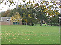
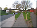
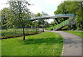
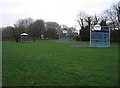
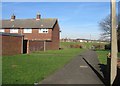
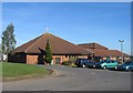
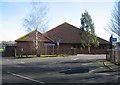
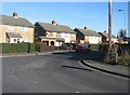
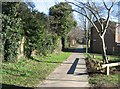
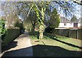
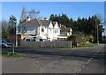
Photos of RG22 5AB

Area Information
Area Overview RG22 5AB is a compact residential postcode covering an area of 9,727 square metres within England. This small cluster hosts a population of 1,337 residents, creating a close-knit environment where neighbours know one another. The location sits at a population density of 137,450 people per square kilometre, indicating a tightly built community. Daily life here revolves around proximity; residents live in a defined cluster rather than a sprawling suburban sprawl. The sheer size of the postcode suggests a specific, possibly village-like or semi-rural, setting within the wider RG22 region. You will find that homes in RG22 5AB offer a direct connection to the immediate surroundings, free from the isolation often found in larger rural expanses. This density fosters a sense of immediacy, whether you are walking to a local shop or commuting via the nearby rail network.
- Area Type
- Postcode
- Area Size
- 9727 m²
- Population
- 1337
- Population Density
- 6808 people/km²
Property Market Dynamics RG22 5AB is characterised as a residential cluster where houses form the primary accommodation type. With home ownership standing at exactly 50 per cent, the market presents a balanced mix of owners and tenants, though the predominance of houses suggests a stock geared towards families rather than high-density flats. This area does not feature apartment blocks; instead, you will find traditional dwellings. Buying a home in this postcode often means purchasing a standing property within a small, defined neighbourhood. The 50 per cent ownership rate indicates that a significant portion of the community has the means to purchase rather than rent. This stability can make local homes in RG22 5AB attractive to buyers seeking a brick-and-mortar investment rather than a transient rental agreement. The housing stock is extensive enough to support a housing market but small enough that local conditions heavily influence property values.
House Prices in RG22 5AB
Showing 22 properties
| Address | Type | Beds | Baths | Last Sale Price | Last Sale Date | |
|---|---|---|---|---|---|---|
| 11 Edgehill Close, Basingstoke, RG22 5AB | Terraced | 3 | 1 | £340,000 | Aug 2024 | |
| 19 Edgehill Close, Basingstoke, RG22 5AB | house | - | - | £292,000 | Jun 2021 | |
| 22 Edgehill Close, Basingstoke, RG22 5AB | house | - | - | £285,000 | Apr 2021 | |
| 21 Edgehill Close, Basingstoke, RG22 5AB | Terraced | 4 | 1 | £265,000 | Jul 2018 | |
| 17 Edgehill Close, Basingstoke, RG22 5AB | Terraced | 4 | - | £235,000 | Nov 2015 | |
| 9 Edgehill Close, Basingstoke, RG22 5AB | house | - | - | £179,950 | Sep 2013 | |
| 3 Edgehill Close, Basingstoke, RG22 5AB | house | - | - | £165,000 | Aug 2004 | |
| 4 Edgehill Close, Basingstoke, RG22 5AB | Terraced | 1 | 1 | £153,000 | Mar 2004 | |
| 13 Edgehill Close, Basingstoke, RG22 5AB | Terraced | - | - | £165,000 | Jan 2004 | |
| 6 Edgehill Close, Basingstoke, RG22 5AB | house | 1 | 1 | £147,500 | May 2003 |
Energy Efficiency in RG22 5AB
Amenities and Lifestyle Residents of RG22 5AB benefit from practical access to retail and transport hubs without needing to travel far. Within practical reach, you can visit Budgens South, The Southern Co-operative Co, or Lidl South for your weekly grocery shopping. These three supermarkets form the core of the local retail landscape, ensuring essentials are locally available. For commuters, three railway stations serve the area directly: Basingstoke Railway Station, Bramley Railway Station, and Overton Railway Station. These rail links provide the primary method for regional travel and commute connections. The proximity of these stations means you can easily access wider employment centres while living in this quiet postcode. Daily life is defined by the balance of local independence and regional connectivity offered by these specific venues and transport nodes.
Amenities
Schools
| Rank | School | Type | Entry gender | Ages |
|---|
Explore more schools in this area
Go to Schools tabDemographics
Community Profile The people living in RG22 5AB skew towards maturity. The median age is 47 years, and the most common age range comprises adults between 30 and 64 years old. This demographic profile suggests a community dominated by established families or professionals nearing mid-career stages. Over 50 per cent of households own their homes, indicating high stability and long-term settlement. The predominant ethnic group is White, reflecting the broader demographic trends of the surrounding region. The majority of the population resides in houses, which aligns with the age profile of older or established families. There is no significant data on deprivation levels provided for this specific postcode, so any general assessment of quality of life relies on the standard amenities and transport links available. Residents enjoy a stable environment where homeownership is the norm rather than the rental exception.
Household Size
Accommodation Type
Tenure
Ethnic Group
Religion
Household Composition
Age
Household Deprivation
NS-SEC
Explore more demographic insights in this area
Go to Demographics tabPlanning
Planning Constraints
- Flood RiskPremium
- Ramsar Wetland SitesPremium
- Area of Outstanding Natural BeautyPremium
- Protected Nature ReservePremium
- Protected WoodlandPremium