Area Overview for RG22 4RH
Photos of RG22 4RH
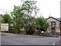
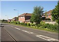
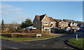
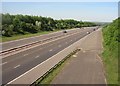
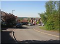
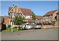
47 photos from this area
Area Information
Key information about the RG22 4RH including its size, population, and administrative classification.
- Area Type
- Postcode
- Area Size
- 3.2 hectares
- Population
- 1593
- Population Density
- 4001 people/km²
House Prices in RG22 4RH
66
Properties
£251,078
Average Sold Price
£63,950
Lowest Price
£480,000
Highest Price
Showing 66 properties
| Address | Type | Beds | Baths | Last Sale Price | Last Sale Date | |
|---|---|---|---|---|---|---|
| 9 Highdowns, Basingstoke, RG22 4RH | Detached | 4 | 2 | £480,000 | Sep 2025 | |
| 26 Highdowns, Basingstoke, RG22 4RH | Terraced | 2 | 1 | £220,000 | Mar 2025 | |
| 24 Highdowns, Basingstoke, RG22 4RH | Terraced | 2 | 1 | £300,000 | Nov 2024 | |
| 59 Highdowns, Basingstoke, RG22 4RH | Semi-detached | 3 | 2 | £437,500 | Jun 2023 | |
| 23 Highdowns, Basingstoke, RG22 4RH | Retail | 2 | 1 | £304,000 | Oct 2022 | |
| 14 Highdowns, Basingstoke, RG22 4RH | house | 3 | 3 | £368,000 | May 2022 | |
| 40 Highdowns, Basingstoke, RG22 4RH | Detached | 4 | - | £465,000 | Nov 2021 | |
| 38 Highdowns, Basingstoke, RG22 4RH | house | - | - | £450,000 | Jun 2021 | |
| 54 Highdowns, Basingstoke, RG22 4RH | house | 4 | - | £420,000 | May 2021 | |
| 42 Highdowns, Basingstoke, RG22 4RH | Detached | 4 | 3 | £465,000 | Jul 2020 |
Page 1 of 7
Energy Efficiency in RG22 4RH
Amenities
Schools
| Rank | School | Type | Entry gender | Ages |
|---|
Explore more schools in this area
Go to Schools tabDemographics
Household Size
Family (3-5 people)
most common
Accommodation Type
Houses
most common
Tenure
84
majority
Ethnic Group
White
most common
Religion
N/A
most common
Household Composition
N/A
most common
Age
47
median
Adults (30-64 years)
most common
Household Deprivation
N/A
with no deprivation
NS-SEC
52
in Lower managerial occupations
Explore more demographic insights in this area
Go to Demographics tabPlanning
Planning Constraints
- Flood RiskPremium
- Ramsar Wetland SitesPremium
- Area of Outstanding Natural BeautyPremium
- Protected Nature ReservePremium
- Protected WoodlandPremium