Area Overview for RG22 4NH
Photos of RG22 4NH
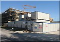
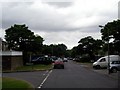
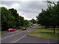
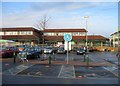
100 photos from this area
Area Information
Key information about the RG22 4NH including its size, population, and administrative classification.
- Area Type
- Postcode
- Area Size
- 1.9 hectares
- Population
- 1376
- Population Density
- 3189 people/km²
House Prices in RG22 4NH
34
Properties
£191,591
Average Sold Price
£56,000
Lowest Price
£366,000
Highest Price
Showing 34 properties
| Address | Type | Beds | Baths | Last Sale Price | Last Sale Date | |
|---|---|---|---|---|---|---|
| 48 Barry Way, Basingstoke, RG22 4NH | Terraced | 3 | 1 | £328,000 | Oct 2023 | |
| 57 Barry Way, Basingstoke, RG22 4NH | Terraced | 4 | 1 | £366,000 | Sep 2023 | |
| 58 Barry Way, Basingstoke, RG22 4NH | house | - | - | £275,000 | Sep 2021 | |
| 50 Barry Way, Basingstoke, RG22 4NH | house | - | - | £320,000 | Apr 2021 | |
| 49 Barry Way, Basingstoke, RG22 4NH | Terraced | 3 | 1 | £290,000 | Sep 2020 | |
| 60 Barry Way, Basingstoke, RG22 4NH | Terraced | 3 | 2 | £285,000 | Jul 2019 | |
| 53 Barry Way, Basingstoke, RG22 4NH | Terraced | 3 | 2 | £245,000 | Mar 2017 | |
| 63 Barry Way, Basingstoke, RG22 4NH | house | - | - | £132,000 | Jan 2009 | |
| 41A Barry Way, Basingstoke, RG22 4NH | Flat | 2 | 1 | £124,000 | Oct 2007 | |
| 39 Barry Way, Basingstoke, RG22 4NH | Flat | - | - | £155,500 | Oct 2006 |
Page 1 of 4
Energy Efficiency in RG22 4NH
Amenities
Schools
| Rank | School | Type | Entry gender | Ages |
|---|
Explore more schools in this area
Go to Schools tabDemographics
Household Size
One person
most common
Accommodation Type
Houses
most common
Tenure
63
majority
Ethnic Group
White
most common
Religion
N/A
most common
Household Composition
N/A
most common
Age
47
median
Adults (30-64 years)
most common
Household Deprivation
N/A
with no deprivation
NS-SEC
35
in Lower managerial occupations
Explore more demographic insights in this area
Go to Demographics tabPlanning
Planning Constraints
- Flood RiskPremium
- Ramsar Wetland SitesPremium
- Area of Outstanding Natural BeautyPremium
- Protected Nature ReservePremium
- Protected WoodlandPremium