Area Overview for RG21 8ZY
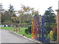
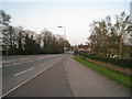
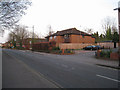
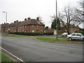
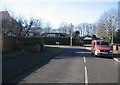
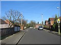
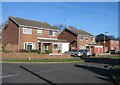
Photos of RG21 8ZY

Area Information
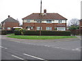
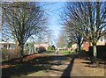
Living in RG21 8ZY offers a defined residential experience within a small postcode cluster measuring 4,232 square metres. This specific area forms part of the RG21 postcode, covering a total population of 1,649 residents. The high population density of 389,671 people per square kilometre reflects a tightly packed residential environment typical of concentrated housing zones. You will find yourself in a setting designed for close-knit living rather than sprawling suburban development. The locality is situated in England, providing a specific context for those researching homes in RG21 8ZY. Daily life here is characterised by proximity to neighbours and efficient use of space. This postcode represents a distinct residential enclave where land is utilised intensively to accommodate the local community. The physical footprint of the area reinforces its status as a compact living space. Prospective buyers looking for homes in RG21 8ZY should expect a neighbourhood defined by its precise boundaries and focused residential purpose.
- Area Type
- Postcode
- Area Size
- 4232 m²
- Population
- 1649
- Population Density
- 4685 people/km²
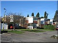
The property market in RG21 8ZY is defined by a significant presence of owner-occupiers. With 52 per cent of residents owning their homes, the area demonstrates a strong tradition of home ownership alongside a substantial rental sector. Houses constitute the primary form of accommodation, meaning you will encounter traditional residential stock rather than high-rise flats or purpose-built apartment complexes. This concentration of house ownership typically indicates a market where long-term residents have invested in brick and mortar rather than transient or short-term rentals. For buyers researching homes in RG21 8ZY, this suggests a neighbourhood with established family homes. The small physical size of the postcode area limits the sheer volume of available properties compared to larger districts. However, the balance between ownership and renting often provides stability for the local estate. If you are looking to purchase a house, you are engaging with a market where nearly half the population has already secured their property. This environment often supports steady property values driven by owner commitment.
House Prices in RG21 8ZY
Showing 20 properties
Energy Efficiency in RG21 8ZY
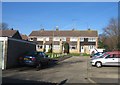
Lifestyle in RG21 8ZY is convenient, with key amenities located within practical reach of residents. Retail options are well serviced by five local stores, including Morrisons Basingstoke, The Southern Co-operative Co, and Tesco Basingstoke. These supermarkets address daily shopping needs without requiring long journeys to larger towns. Transport links are equally accessible, with two railway stations nearby: Basingstoke Railway Station and Bramley Railway Station. These stations offer direct rail connections for commuters accessing wider regions. Furthermore, Lasham Airport is situated close to the area, providing air travel options for residents. The presence of diverse retail and transport hubs defines the area's character. You will find everything required for daily life without extensive travel. The mix of major supermarkets and rail interchanges makes RG21 8ZY a practical base for working professionals and families. These facilities are integrated into the postcodes immediate vicinity, enhancing the overall convenience of living here.
Amenities
Schools
| Rank | School | Type | Entry gender | Ages |
|---|
Explore more schools in this area
Go to Schools tabDemographics
The community within RG21 8ZY is shaped by a distinct age profile and housing tenure. The median age of residents is 47 years, with adults aged between 30 and 64 years making up the most common age range. This demographic skew suggests a population comprised largely of established families or individuals in their mid-career stages. Home ownership stands at 52 per cent, indicating a balanced mix of owners and renters within the area. Houses represent the predominant accommodation type, confirming a residential focus on detached or semi-detached properties rather than flats. The predominant ethnic group in the area is White. There are no specific deprivation statistics provided in the available information for this postcode, so you cannot assess income gaps or poverty rates locally. The housing stock is primarily owned by those living there, which often correlates with greater investment in the property. This balance of ownership and rental suggests a stable yet diverse community composition typical of established residential clusters.
Household Size
Accommodation Type
Tenure
Ethnic Group
Religion
Household Composition
Age
Household Deprivation
NS-SEC
Explore more demographic insights in this area
Go to Demographics tabPlanning
Planning Constraints
- Flood RiskPremium
- Ramsar Wetland SitesPremium
- Area of Outstanding Natural BeautyPremium
- Protected Nature ReservePremium
- Protected WoodlandPremium