Area Overview for RG21 8SA
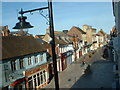
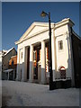
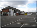
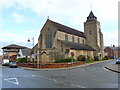
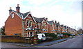
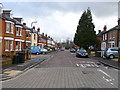
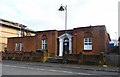
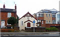
Photos of RG21 8SA

Area Information
Living in RG21 8SA means residing in a very specific residential cluster with a population of 1,738 people spread across only 1,362 square metres. The extreme population density of 1,276,231 people per square kilometre suggests a highly concentrated housing environment, indicating that this postcode represents a densely packed residential block rather than a sprawling neighbourhood. Despite the tight spatial footprint, the area offers a definitive sense of place for those seeking homes in this specific location. Daily life here is characterised by proximity to immediate neighbours and a contained community atmosphere. The area functions as a distinct node within the wider Basingstoke local economy. Residents benefit from being situated close to major transport arteries, which facilitates easy movement to Basingstoke town centre and surrounding communities. While the low physical area size might initially suggest limited green space, the location avoids significant planning constraints such as flood zones or protected nature reserves. This makes RG21 8SA a straightforward choice for homebuyers prioritising a secure land status over extensive natural landscapes. The community is defined by its compact nature, offering a quiet yet connected existence for families and professionals alike.
- Area Type
- Postcode
- Area Size
- 1362 m²
- Population
- 1738
- Population Density
- 3681 people/km²
The property market in RG21 8SA is heavily skewed towards owner-occupiers, with home ownership recorded at 58%. This figure confirms that the local market is driven by couples and families who have bought into the area rather than a high volume of private rentals. The accommodation type is strictly houses, which aligns with the median age of the residents and the high percentage of ownership. You will find exclusively detached or semi-detached properties here, with no apartments or maisonettes available within this postcode. This restriction creates a homogenous market where listings are primarily single-family homes. For buyers looking at homes in RG21 8SA, the inventory will reflect this composition of standalone houses designed for traditional family living. The small area size of 1,362 square metres implies a high concentration of these houses in a short distance from one another. Potential buyers should recognise that this is not a letting market but a community established by those who have settled permanently. The density of housing within such a small landmass means properties are closely situated, which can influence noise levels and visual privacy for the occupants of these houses.
House Prices in RG21 8SA
Showing 11 properties
| Address | Type | Beds | Baths | Last Sale Price | Last Sale Date | |
|---|---|---|---|---|---|---|
| 3, Spring House, Sarum Hill, Basingstoke, RG21 8SA | Flat | - | - | £162,000 | Aug 2024 | |
| 11, Spring House, Sarum Hill, Basingstoke, RG21 8SA | Flat | - | - | £160,000 | Aug 2021 | |
| 9, Spring House, Sarum Hill, Basingstoke, RG21 8SA | Flat | - | - | £172,500 | Nov 2004 | |
| 10, Spring House, Sarum Hill, Basingstoke, RG21 8SA | Flat | 1 | 1 | - | - | |
| 6, Spring House, Sarum Hill, Basingstoke, RG21 8SA | Flat | 1 | 1 | - | - | |
| 8, Spring House, Sarum Hill, Basingstoke, RG21 8SA | Flat | 2 | 1 | - | - | |
| 1, Spring House, Sarum Hill, Basingstoke, RG21 8SA | Flat | 2 | 1 | - | - | |
| 5, Spring House, Sarum Hill, Basingstoke, RG21 8SA | Flat | 2 | 1 | - | - | |
| 2, Spring House, Sarum Hill, Basingstoke, RG21 8SA | Flat | - | - | - | - | |
| 4, Spring House, Sarum Hill, Basingstoke, RG21 8SA | Flat | - | - | - | - |
Energy Efficiency in RG21 8SA
Daily life in RG21 8SA benefits from practical access to a range of essential amenities within a short distance. Retail shoppers can visit Tesco Basingstoke, M&S Basingstoke, and Iceland Chelsea, ensuring all grocery and daily shop needs are met without a lengthy journey. For those prioritising rail travel, three stations are in reach: Basingstoke Railway Station, Bramley Railway Station, and Hook Railway Station. This network connects the residential cluster directly to the national rail grid, facilitating commutes to London and other major business hubs. Lasham Airport is also nearby, offering an alternative air travel option for those requiring flexibility. The proximity of these major transport nodes reduces the time spent commuting significantly. Residents can attend school events at Fairfields Primary School or catch connections at The King's School from a convenient distance. The concentration of supermarkets on the boundary of the area supports a self-sufficient lifestyle where you can run most errands locally. This blend of retail, air, and rail transport creates a convenient living environment that minimises travel time for daily tasks.
Amenities
Schools
Families living in RG21 8SA have access to a mix of state and private education options nearby. Fairfields Primary School serves the primary education needs of younger children and holds a 'good' Ofsted rating, confirming its standard of education meets maintained benchmarks. For secondary or specialist independent education, The King's School is available as a nearby independent option for those seeking a fee-paying alternative. This combination provides a clear choice between a well-rated state sector primary education and a private school setting for older children or specific educational philosophies. The presence of an independent school suggests that families with the financial means can access schools outside the state system without travelling far. You do not need to look outside the immediate vicinity to find these educational institutions. The coexistence of a 'good' rated primary school and an independent secondary institution indicates a supportive ecosystem for learners. Parents should note that The King's School does not have a current Ofsted rating listed in available information, so further independent research is required to verify its specific status. Fairfields Primary School remains the only state-funded institution referenced for this area, making it a key pillar for the local educational infrastructure.
| Rank | School | Type | Entry gender | Ages |
|---|
Explore more schools in this area
Go to Schools tabDemographics
The community in RG21 8SA is defined by a mature population with a median age of 47 years. The most common age range comprises adults between 30 and 64 years old, indicating a neighbourhood where stable households dominate. This demographic profile suggests a stable environment driven by long-term residents rather than transient populations. Home ownership stands at 58%, meaning more than half of the households occupy properties they own outright or have a significant equity stake. This level of ownership typically contributes to a slower-paced community life compared to high-rent districts. The area accommodates exclusively houses, removing the presence of flats or high-rise blocks from the housing stock. This housing type aligns perfectly with the older demographic, providing family-oriented living spaces typical of this age group. The predominant ethnic group is White, reflecting the broader regional trends of Hampshire. There are no indications of significant recent demographic shifts or changes in ethnic composition. The demographic stability reinforces the area's appeal to buyers seeking a traditional suburban setting. The lack of student accommodation or shared housing further isolates this area as a family-centric zone rather than a student quarter.
Household Size
Accommodation Type
Tenure
Ethnic Group
Religion
Household Composition
Age
Household Deprivation
NS-SEC
Explore more demographic insights in this area
Go to Demographics tabPlanning
Planning Constraints
- Flood RiskPremium
- Ramsar Wetland SitesPremium
- Area of Outstanding Natural BeautyPremium
- Protected Nature ReservePremium
- Protected WoodlandPremium