Area Overview for RG21 7SB
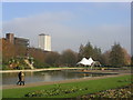
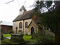
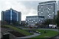
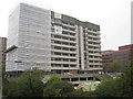
Photos of RG21 7SB

Area Information
Living in RG21 7SB means residing within a tightly defined residential cluster that covers just two hectares. This specific postcode area contains 2,059 residents, creating a population density of 1,667 people per square kilometre. You are looking at a concentrated community where daily distances are short and neighbours are close by. The setting functions as a distinct residential zone rather than a sprawling suburb, offering a sense of immediate locality. The area serves as a practical base for those seeking access to wider Basingstoke facilities without the isolation of more distant villages. Your daily routine centres on this compact footprint, which connects you quickly to the main town centre and rail network. The environment is best understood as a small, functional pocket of housing that prioritises efficiency and proximity to services. You gain a living situation that is simple to navigate, with clear boundaries defining your immediate neighbours and local landscape.
- Area Type
- Postcode
- Area Size
- 2.0 hectares
- Population
- 2059
- Population Density
- 1667 people/km²
The property market in RG21 7SB is characterised by a high proportion of rented accommodation and specific housing typology. Only 30% of residents own their homes, which indicates that the majority of the 2,059 population are tenants. The predominant accommodation type is flats, meaning that freehold houses or large detached properties are not the primary offering in this 2-hectare zone. You should expect to find a market dominated by apartment blocks or converted residential clusters rather than traditional suburban row houses. This mix suggests the area appeals to young professionals, investors, or those who do not wish to tie their finances to a mortgage. Buyers looking for detached homes in RG21 7SB will need to search beyond this specific postcode and look to the wider RG21 catchment. The high rental segregation implies that if you own, your property might be in a larger complex where leasehold terms are standard. The housing stock is utilitarian and dense, designed to cluster residents efficiently within the small geographical boundary. Understanding this split is crucial for anyone considering a purchase here.
House Prices in RG21 7SB
Showing 1 properties
| Address | Type | Beds | Baths | Last Sale Price | Last Sale Date | |
|---|---|---|---|---|---|---|
| Living Accomodation The Castle Inn, Old Reading Road, Basing View, Basingstoke, RG21 7SB | Flat | - | - | - | - |
Energy Efficiency in RG21 7SB
Your daily convenience in RG21 7SB relies on a ring of major supermarkets and key transport hubs that are all within practical reach. Five significant retail outlets serve the local community, including Waitrose Basingstoke, Sainsburys Basingstoke, and Tesco Basingstoke. These grocery stores ensure you can access fresh food, household essentials, and clothing close to your home. Beyond shopping, three railway stations act as the primary gateways for your journey to the wider region: Basingstoke Railway Station, Bramley Railway Station, and Hook Railway Station. For those requiring air travel, Lasham Airport is situated within reach, offering access to private and general aviation. The concentration of these amenities means you do not need to travel far to complete errands or head to work. Your lifestyle centres on the ability to walk or take a short drive to these named venues. The utility of this location is defined by the density of these services relative to the small size of the postcode itself. You gain independence from distant city centres while maintaining easy access to national networks.
Amenities
Schools
| Rank | School | Type | Entry gender | Ages |
|---|
Explore more schools in this area
Go to Schools tabDemographics
The community in RG21 7SB is defined by a mature resident base with a median age of 47 years. The majority of households consist of adults aged between 30 and 64 years, indicating a population that has moved past early career stages. About 30% of residents own their homes, leaving the remaining 70% within the private or social rented sectors. Housing stock consists primarily of flats, making this area suitable for those comfortable with this specific accommodation type. The demographic profile is predominantly White, forming the largest ethnic group in the postcode. This age structure suggests a stable environment where long-term residents are common, rather than a transient population. You can expect a neighbourhood where families with older children and empty nesters form the core of the housing demand. The high concentration of adults in prime working age groups supports local footfall for amenities and trains during standard business hours. This demographic reality shapes the character of the estate and the pace of daily life within these flats.
Household Size
Accommodation Type
Tenure
Ethnic Group
Religion
Household Composition
Age
Household Deprivation
NS-SEC
Explore more demographic insights in this area
Go to Demographics tabPlanning
Planning Constraints
- Flood RiskPremium
- Ramsar Wetland SitesPremium
- Area of Outstanding Natural BeautyPremium
- Protected Nature ReservePremium
- Protected WoodlandPremium