Area Overview for RG21 7PG
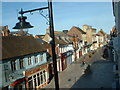
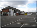
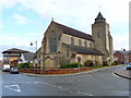
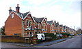
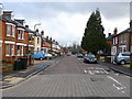
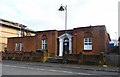
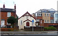
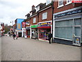
Photos of RG21 7PG


Area Information
RG21 7PG represents a specific residential cluster within the Basingstoke and Deane postcode area. This small district covers 4,819 square metres and is home to 1,738 residents. The population density here is extremely high, recorded at 360,673 people per square kilometre, which indicates very tightly packed housing within this particular postcode sector. Living in RG21 7PG means residing in a concentrated residential zone where space is at a premium. The area sits in a location that supports a significant number of households within a very small geographical footprint. You can expect a lived-in environment where daily routines are supported by proximity to local services. The context of this postcode is entirely residential, focusing on housing solutions for nearby families and professionals. While the data describes a narrow slice of the broader RG21 area, it confirms a defined community with clear boundaries. Prospective buyers should understand that this specific postcode serves as a distinct pocket of residential activity rather than a sprawling suburb. The sheer number of residents relative to the area size defines the character of this location.
- Area Type
- Postcode
- Area Size
- 4819 m²
- Population
- 1738
- Population Density
- 3681 people/km²
The property market in RG21 7PG is characterised by a strong presence of owner-occupied homes. A total of 58% of properties in this postcode are owned by their occupants, meaning the majority of the housing stock is not part of the private rental market. The predominant accommodation type is houses, distinguishing this area from those dominated by apartments or phased retirement communities. You are unlikely to find a mix of diverse building styles within this specific cluster; instead, the housing stock focuses on traditional residential solutions. Living in RG21 7PG typically involves purchasing a home to live in rather than renting for a short period. This high ownership rate suggests that house prices in this specific postcode sector are likely influenced by long-term buyers who wish to settle. The concentration of houses means you can expect detached, semi-detached, or terraced housing forms to be the standard. There is no indication of student accommodation or Labour hire housing in this specific sector. Buyers looking for established neighbourhoods with a stable tenure structure will find this postcode aligns with their requirements. The market dynamics here reflect a desire for permanence and roots within the community.
House Prices in RG21 7PG
Showing 12 properties
| Address | Type | Beds | Baths | Last Sale Price | Last Sale Date | |
|---|---|---|---|---|---|---|
| 29 London Street, Basingstoke, RG21 7PG | Terraced | - | - | - | - | |
| Carter Jonas, Ground Floor, 26 London Street, Basingstoke, RG21 7PG | office_workshop | - | - | - | - | |
| Vita Europe Ltd, First Floor, Vita House, London Street, Basingstoke, RG21 7PG | Office | - | - | - | - | |
| Vita Ltd, Second Floor, Vita House, London Street, Basingstoke, RG21 7PG | Office | - | - | - | - | |
| The Treatment Hub, First Floor Rear, 27 London Street, Basingstoke, RG21 7PG | Office | - | - | - | - | |
| 37 London Street, Basingstoke, RG21 7PG | Terraced | - | - | - | - | |
| 31 London Street, Basingstoke, RG21 7PG | Terraced | - | - | - | - | |
| 33 London Street, Basingstoke, RG21 7PG | house | - | - | - | - | |
| 39 London Street, Basingstoke, RG21 7PG | Terraced | - | - | - | - | |
| 35 London Street, Basingstoke, RG21 7PG | Terraced | - | - | - | - |
Energy Efficiency in RG21 7PG
Residents of RG21 7PG enjoy practical access to a selection of retail and transport amenities within practical reach. For daily shopping needs, Iceland Chelsea, M&S Basingstoke, and Tesco Basingstoke are all available nearby. These five notable retailers ensure you do not need to travel far for groceries or household necessities. Transport links are similarly well-supported by three railway stations in the vicinity: Basingstoke Railway Station, Bramley Railway Station, and Hook Railway Station. These rail hubs provide regular train services for commuting to London or other major cities. Lasham Airport is the nearest airport option, offering flight connectivity for those who require air travel. You benefit from a lifestyle that balances local convenience with wider regional access. The presence of major high street chains and multiple rail nodes means daily errands and business trips are manageable from this postcode. This connectivity supports a flexible working lifestyle without isolation. Living in RG21 7PG grants you the convenience of urban amenities while maintaining a residential focus.
Amenities
Schools
Parents living in RG21 7PG have access to specific educational institutions within practical reach. The nearest primary option is Fairfields Primary School, which holds a good Ofsted rating. This state school offers a regulated and monitored education for children in the early years. For those seeking independent education, The King's School is a nearby option for older children or those already in secondary education. Both schools are located close enough to be considered part of the immediate catchment or travelling distance for residents. The presence of these two specific schools provides a choice between state and independent provision without the need to travel far outside the immediate area. You do not need to rely on distant institutions for core schooling needs in this postcode. The availability of a good-rated primary school supports families with young children who prioritise performance metrics. The independent option nearby appeals to parents wishing for an alternative curriculum or fee-paying environment. This mix allows you to choose the educational path that best fits your child's needs while staying within the local radii of RG21 7PG.
| Rank | School | Type | Entry gender | Ages |
|---|
Explore more schools in this area
Go to Schools tabDemographics
The community in RG21 7PG is defined by a mature demographic profile. The median age for residents is 47 years, and most common age groups fall within the 30 to 64 year range. This age distribution suggests a population that has established careers and likely settled into long-term homes. Home ownership is the dominant tenure type, with 58% of residential properties in this postcode owned outright or with a mortgage. The remaining 42% of the housing stock is predominantly occupied by other tenure types. Almost all residents live in houses, aligning with the preference for family-oriented or established single-home living arrangements in this sector. The predominant ethnic group is White, reflecting the composition of the wider local population. You will find a stable community where the majority of households have been resident for some time. The high proportion of owner-occupied homes contributes to a sector where long-term stability is common. There is a clear focus on established households rather than transient populations. This demographic makeup supports local businesses targeted at families and mature professionals seeking residential stability.
Household Size
Accommodation Type
Tenure
Ethnic Group
Religion
Household Composition
Age
Household Deprivation
NS-SEC
Explore more demographic insights in this area
Go to Demographics tabPlanning
Planning Constraints
- Flood RiskPremium
- Ramsar Wetland SitesPremium
- Area of Outstanding Natural BeautyPremium
- Protected Nature ReservePremium
- Protected WoodlandPremium