Area Overview for RG21 4PT
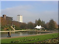
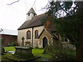
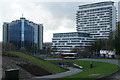
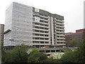
Photos of RG21 4PT

Area Information
RG21 4PT represents a small, concentrated residential cluster within the RG21 postcode district in England. The entire area covers just 2,012 square metres and supports a population of 2,059 people. This high density is consistent with the 1,667 people per square kilometre figure, indicating a built-up rather than rural environment. Life here is practical and immediate, defined by close proximity to essential services rather than expansive green space or large private plots. The compact nature of the settlement means that daily tasks require little travel, placing residents in close reach of retail outlets and railway connections within a practical walking distance. You are living in RG21 4PT, an environment where community interaction is likely high due to space constraints. The area functions as a distinct micro-community within the wider Basingstoke region. While the physical footprint is small, the population size ensures that local facilities remain in constant use. Your daily routine will be shaped by this density, offering convenience but potentially limiting privacy compared to larger neighbourhoods. This specific postcode area prioritises access over sprawl.
- Area Type
- Postcode
- Area Size
- 2012 m²
- Population
- 2059
- Population Density
- 1667 people/km²
The property market in RG21 4PT is defined by a scarcity of owner-occupied homes and a significant rental component. Only 30% of properties are owned by their residents, making this a comparatively high-rent area. The overwhelming majority of the housing stock consists of flats, which is the predominant accommodation type in the postcode. This configuration explains the high population density of 1,667 people per square kilometre within the small 2,012 square metre area. If you are buying homes in RG21 4PT, expect to compete with institutional investors and letting agents rather than individual owner-occupiers. The lack of traditional detached or semi-detached houses changes the buying landscape significantly. You may find more ease in purchasing a flat in this high-density cluster than in a typical suburban estate where ownership drives demand. The market is less about family expansion and more about location convenience. Buyers should prioritise service charges and building management when viewing flats, as individual ownership of freehold units is rare in this configuration. The area functions primarily as a rental asset class with a small owner entry.
House Prices in RG21 4PT
Showing 7 properties
| Address | Type | Beds | Baths | Last Sale Price | Last Sale Date | |
|---|---|---|---|---|---|---|
| 2 The Butty, Basingstoke, RG21 4PT | house | - | - | - | - | |
| 7 The Butty, Basingstoke, RG21 4PT | Terraced | - | - | - | - | |
| 6 The Butty, Basingstoke, RG21 4PT | house | - | - | - | - | |
| 1 The Butty, Basingstoke, RG21 4PT | Terraced | - | - | - | - | |
| 5 The Butty, Basingstoke, RG21 4PT | Bungalow | - | - | - | - | |
| 3 The Butty, Basingstoke, RG21 4PT | Terraced | - | - | - | - | |
| 4 The Butty, Basingstoke, RG21 4PT | Terraced | - | - | - | - |
Energy Efficiency in RG21 4PT
Living in RG21 4PT offers immediate access to key retail and leisure facilities. Within practical reach, you have five major retail outlets including Waitrose Basingstoke, Iceland Chelsea, and M&S Basingstoke. These venues provide a comprehensive range of groceries and fashion without requiring a long drive. The area is equally well connected to major airports, with two within easy reach: Lasham Airport and RAF Odiham. This proximity appeals to residents who travel frequently or require private aviation access. Beyond shopping and air travel, your lifestyle includes access to three railway stations: Basingstoke, Bramley, and Hook. This network ensures you are not dependent on cars for regional trips or daily commuting. The presence of M&S Basingstoke indicates a standard high-street retail environment is just a short trip away. Daily life involves utilising these nearby amenities to maintain a balanced routine. Convenience is the defining feature of the lifestyle offered by this small postcode cluster.
Amenities
Schools
| Rank | School | Type | Entry gender | Ages |
|---|
Explore more schools in this area
Go to Schools tabDemographics
The community profile of RG21 4PT reflects an established residential base. The median age is 47, and the most common age range for residents is Adults between 30 and 64 years. This demographic structure suggests a population composed largely of families with grown-up children, mature professionals, or retirees still active in the workforce. Society within this area is predominantly White, forming the core ethnic group. Access to homes in RG21 4PT is characterised by specific tenure patterns; only 30% of households are owner-occupiers. The remaining 70% of the population likely rents, indicating a market dominated by private landlords or social housing providers rather than family ownership. Furthermore, flats are the predominant accommodation type in the RG21 4PT area. This housing style aligns with the high population density of 1,667 people per square kilometre and fits the needs of a younger adult demographic within the 30-64 bracket. You will find a community where shared living spaces are common and resident turnover may be higher than in owner-occupied estates.
Household Size
Accommodation Type
Tenure
Ethnic Group
Religion
Household Composition
Age
Household Deprivation
NS-SEC
Explore more demographic insights in this area
Go to Demographics tabPlanning
Planning Constraints
- Flood RiskPremium
- Ramsar Wetland SitesPremium
- Area of Outstanding Natural BeautyPremium
- Protected Nature ReservePremium
- Protected WoodlandPremium