Area Overview for RG21 4HY
Photos of RG21 4HY
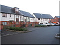
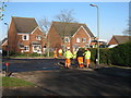
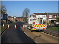
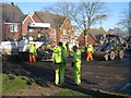
100 photos from this area
Area Information
Key information about the RG21 4HY including its size, population, and administrative classification.
- Area Type
- Postcode
- Area Size
- 1.3 hectares
- Population
- 2569
- Population Density
- 1635 people/km²
House Prices in RG21 4HY
57
Properties
£169,853
Average Sold Price
£39,500
Lowest Price
£286,000
Highest Price
Showing 57 properties
| Address | Type | Beds | Baths | Last Sale Price | Last Sale Date | |
|---|---|---|---|---|---|---|
| 29 Westray Close, Basingstoke, RG21 4HY | Terraced | 3 | 1 | £275,000 | Jan 2025 | |
| 28 Westray Close, Basingstoke, RG21 4HY | Terraced | 3 | 1 | £286,000 | Sep 2022 | |
| 37 Westray Close, Basingstoke, RG21 4HY | Terraced | 3 | 1 | £266,000 | Nov 2021 | |
| 12 Westray Close, Basingstoke, RG21 4HY | house | - | - | £250,000 | Nov 2021 | |
| 26 Westray Close, Basingstoke, RG21 4HY | Terraced | 3 | 1 | £250,000 | Nov 2017 | |
| 14 Westray Close, Basingstoke, RG21 4HY | Terraced | 3 | - | £235,000 | Oct 2017 | |
| 1 Westray Close, Basingstoke, RG21 4HY | Semi-detached | 3 | 1 | £205,000 | Dec 2015 | |
| 17 Westray Close, Basingstoke, RG21 4HY | house | - | - | £145,000 | Jan 2013 | |
| 8 Westray Close, Basingstoke, RG21 4HY | Terraced | 3 | - | £147,000 | Jun 2012 | |
| 7 Westray Close, Basingstoke, RG21 4HY | house | 3 | - | £160,000 | Jun 2007 |
Page 1 of 6
Energy Efficiency in RG21 4HY
Amenities
Schools
| Rank | School | Type | Entry gender | Ages |
|---|
Explore more schools in this area
Go to Schools tabDemographics
Household Size
Family (3-5 people)
most common
Accommodation Type
Houses
most common
Tenure
40
majority
Ethnic Group
White
most common
Religion
N/A
most common
Household Composition
N/A
most common
Age
47
median
Adults (30-64 years)
most common
Household Deprivation
N/A
with no deprivation
NS-SEC
25
in Lower managerial occupations
Explore more demographic insights in this area
Go to Demographics tabPlanning
Planning Constraints
- Flood RiskPremium
- Ramsar Wetland SitesPremium
- Area of Outstanding Natural BeautyPremium
- Protected Nature ReservePremium
- Protected WoodlandPremium