Area Overview for RG21 3LZ
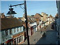
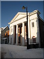
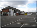
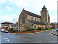
Photos of RG21 3LZ
Area Information
Living in RG21 3LZ offers a quiet residential experience within a compact postcode cluster. This specific area covers 6315 square metres and is home to 1981 residents. The population density reaches 313,676 people per square kilometre, indicating a tightly packed yet low-profile settlement rather than a sprawling suburb. You will find mostly houses rather than high-rise developments or terraced blocks. This layout supports a slower pace of life while maintaining access to the wider Basingstoke and Henley-on-Thames surrounds. The community consists largely of adults aged between 30 and 64 years, with a median age of 47 years old. This demographic skew suggests a neighbourhood drawn to by families and individuals seeking stability rather than transient student housing. The area functions as a self-contained residential node, prioritising domestic space over commercial density. You do not need to travel far for your daily essentials, as local amenities are within practical reach. However, the size of the postcode means you should verify specific roads or developments if you have exact plot requirements in mind. The overall character is defined by established ownership and a focus on traditional housing types suited to the English countryside fringe.
- Area Type
- Postcode
- Area Size
- 6315 m²
- Population
- 1981
- Population Density
- 3805 people/km²
The property market in RG21 3LZ is characterised by a clear preference for house ownership. With 63 per cent of homes owner-occupied, the area functions primarily as a market for buyers rather than landlords. This high ownership rate implies that the housing stock consists mainly of bricks and mortar intended for families or downsizers. You will find predominantly houses, which offers more space and garden area compared to flats found in urban centres. This type of accommodation suits those who value outdoor space and privacy. The high proportion of owner-occupied homes suggests restricted rental activity compared to London or Manchester. Prices in RG21 3LZ likely reflect the cost of acquiring a house versus a flat, often resulting in higher entry costs for first-time buyers but greater stability for investors looking for buy-to-let yields in a stable market. The lack of flats means the local landlord pool is smaller, potentially leading to higher rents for private tenants but also more security for homeowners. When assessing property values, the density of 313,676 people per square kilometre indicates that land is valuable, keeping prices firm despite the relatively small total area size.
House Prices in RG21 3LZ
Showing 10 properties
| Address | Type | Beds | Baths | Last Sale Price | Last Sale Date | |
|---|---|---|---|---|---|---|
| 6 Charles Richards Close, Basingstoke, RG21 3LZ | Bungalow | - | - | - | - | |
| 7 Charles Richards Close, Basingstoke, RG21 3LZ | Bungalow | - | - | - | - | |
| 9 Charles Richards Close, Basingstoke, RG21 3LZ | Semi-detached | - | - | - | - | |
| 4 Charles Richards Close, Basingstoke, RG21 3LZ | Bungalow | - | - | - | - | |
| 5 Charles Richards Close, Basingstoke, RG21 3LZ | Bungalow | - | - | - | - | |
| 10 Charles Richards Close, Basingstoke, RG21 3LZ | Bungalow | - | - | - | - | |
| 8 Charles Richards Close, Basingstoke, RG21 3LZ | Bungalow | - | - | - | - | |
| 3 Charles Richards Close, Basingstoke, RG21 3LZ | Bungalow | - | - | - | - | |
| 1 Charles Richards Close, Basingstoke, RG21 3LZ | Bungalow | - | - | - | - | |
| 2 Charles Richards Close, Basingstoke, RG21 3LZ | Bungalow | - | - | - | - |
Energy Efficiency in RG21 3LZ
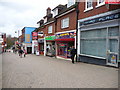
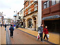
Residents of RG21 3LZ benefit from a range of retail and transport amenities within practical reach. You have five key retail outlets nearby, including Morrisons Basingstoke, M&S Grove Road BP, and M&S Basingstoke. These supermarkets allow you to shop for groceries and household essentials without needing a long drive. The presence of M&S locations on Grove Road and in Basingstoke gives you variety in pricing and product range. Transport links include three rail stations: Basingstoke Railway Station, Bramley Railway Station, and Hook Railway Station. This rail network provides rapid access to major employment hubs, including London and Alantra. You can also access Lasham Airport, offering helicopter services for business travellers and private aviation enthusiasts. The convenience of these transport nodes means commuting times are manageable and predictable. Daily life involves a balance of local shopping trips and occasional rail commutes to larger cities.
Amenities
Schools
Families living in RG21 3LZ have access to several primary schools within practical reach. Kings Furlong Infant School and Nursery operates as both a standard primary institution and an academy. The Ofsted rating for Kings Furlong Junior School is good, confirming quality education for older primary children. Similarly, Cranbourne holds a good Ofsted rating, providing another option for parents seeking accredited education. This mix of primary-only and infant/junior split schools gives residents flexibility in choosing where their children start their education. You can send your child to Kings Furlong for infant education and then progress to the junior section at the same campus, or move to Cranbourne. The presence of multiple state-funded options means you do not need to rely on expensive private schooling immediately. Proceed to secondary education by checking transport links to nearby high schools, as these four listed institutions cover the critical early education years. The good ratings ensure a baseline of academic standard without the pressure of topping the league tables.
| Rank | School | Type | Entry gender | Ages |
|---|
Explore more schools in this area
Go to Schools tabDemographics
The community in RG21 3LZ is dominated by homeowners, with a home ownership rate of exactly 63 per cent. This figure indicates a stable, invested community where residents have a financial stake in the longevity and quality of their surroundings. The remaining households are likely composed of private renters or those currently in transition, but the market clearly favours owner-occupiers. Most residents live in houses, which aligns with the preference for family-sized properties or larger two-bedroom dwellings common in this demographic. The population shows a strong concentration of adults between 30 and 64 years of age. This age range suggests the area attracts retired couples, growing families, and established professionals rather than young single starters. The median age of 47 years reflects this maturity curve, meaning you will encounter neighbours with established routines and long-term roots. When you consider the predominant ethnic group, White residents make up the majority of the population. This homogeneity often correlates with consistent community expectations and traditional neighbourhood norms. There are no indications of high transient sickness or deprivation levels in the available data, suggesting a generally affluent and well-maintained environment.
Household Size
Accommodation Type
Tenure
Ethnic Group
Religion
Household Composition
Age
Household Deprivation
NS-SEC
Explore more demographic insights in this area
Go to Demographics tabPlanning
Planning Constraints
- Flood RiskPremium
- Ramsar Wetland SitesPremium
- Area of Outstanding Natural BeautyPremium
- Protected Nature ReservePremium
- Protected WoodlandPremium