Area Overview for RG21 3BE
Photos of RG21 3BE
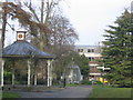
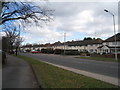
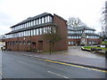
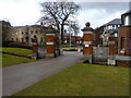
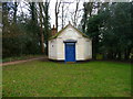
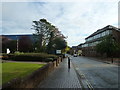

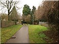
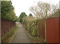

100 photos from this area
Area Information
Key information about the RG21 3BE including its size, population, and administrative classification.
- Area Type
- Postcode
- Area Size
- 8751 m²
- Population
- 1542
- Population Density
- 4382 people/km²
House Prices in RG21 3BE
16
Properties
£234,083
Average Sold Price
£84,000
Lowest Price
£335,000
Highest Price
Showing 16 properties
| Address | Type | Beds | Baths | Last Sale Price | Last Sale Date | |
|---|---|---|---|---|---|---|
| 17 Grove Road, Basingstoke, RG21 3BE | Retail | 3 | 1 | £325,000 | Jul 2022 | |
| 11 Grove Road, Basingstoke, RG21 3BE | house | - | - | £300,000 | Dec 2021 | |
| 13 Grove Road, Basingstoke, RG21 3BE | house | - | - | £335,000 | Dec 2021 | |
| 35 Grove Road, Basingstoke, RG21 3BE | house | - | - | £305,000 | Jun 2021 | |
| 31 Grove Road, Basingstoke, RG21 3BE | Semi-detached | 3 | 2 | £305,000 | Nov 2019 | |
| 39 Grove Road, Basingstoke, RG21 3BE | Semi-detached | 3 | 1 | £310,000 | Oct 2018 | |
| 25 Grove Road, Basingstoke, RG21 3BE | Terraced | 3 | 2 | £289,000 | Jan 2017 | |
| 29 Grove Road, Basingstoke, RG21 3BE | Terraced | - | - | £180,500 | Apr 2005 | |
| 27 Grove Road, Basingstoke, RG21 3BE | Terraced | - | - | £137,000 | Sep 2001 | |
| 23 Grove Road, Basingstoke, RG21 3BE | Semi-detached | - | - | £126,500 | Jul 2001 |
Page 1 of 2
Energy Efficiency in RG21 3BE
Amenities
Schools
| Rank | School | Type | Entry gender | Ages |
|---|
Explore more schools in this area
Go to Schools tabDemographics
Household Size
One person
most common
Accommodation Type
Houses
most common
Tenure
54
majority
Ethnic Group
White
most common
Religion
N/A
most common
Household Composition
N/A
most common
Age
47
median
Adults (30-64 years)
most common
Household Deprivation
N/A
with no deprivation
NS-SEC
33
in Lower managerial occupations
Explore more demographic insights in this area
Go to Demographics tabPlanning
Planning Constraints
- Flood RiskPremium
- Ramsar Wetland SitesPremium
- Area of Outstanding Natural BeautyPremium
- Protected Nature ReservePremium
- Protected WoodlandPremium