Area Overview for RG20 9SE
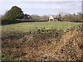
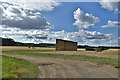
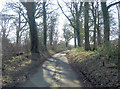
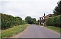
Photos of RG20 9SE

Area Information
Living in RG20 9SE means residing in a specific residential cluster that covers 57.3 hectares of land in England. This postcode defines a small, contained environment where community interaction occurs at a manageable scale. The area accommodates 1,634 residents, creating a population density of approximately 100 people per square kilometre. This figure suggests a suburban pace of life rather than the congestion found in high-density urban centres. The layout favours low-rise development suited to a quieter neighbourhood. You are looking at a setting designed for calm domestic life rather than city-centre urgency. The geography is intimate enough that local features are easily accessible, yet distinct enough to offer privacy. Residents here benefit from a stable residential base without the overwhelming pressure of larger towns. The 1,634 inhabitants are spread across a manageable footprint, allowing for a sense of familiarity within the immediate vicinity. Every decision about where you live impacts your daily routine directly because the area is compact. The 57.3 hectares of land provide a defined boundary for your property search. You are moving into a space where distances are short and the scale remains human-centric. This setting works well for those who value a controlled environment over urban sprawl.
- Area Type
- Postcode
- Area Size
- 57.3 hectares
- Population
- 1634
- Population Density
- 99 people/km²
The property market in RG20 9SE is defined by a housing stock comprising houses as the predominant accommodation type. This suggests a landscape of detached or semi-detached dwellings suited for family living rather than urban flats. Home ownership accounts for 76 per cent of residents, indicating that the majority of properties on the open market are intended for, and occupied by, owners. You are unlikely to encounter a high volume of short-term tenancies here. Instead, the local property scene revolves around long-term accumulation and maintenance. Buyers looking at homes in this postcode should expect to compete with other owners rather than landlords flipping assets. This high rate of home ownership creates a dynamic where resale markets move at a pace determined by existing owners wishing to upsize or downsize. With 1,634 people living within these 57.3 hectares, inventory levels remain relatively controlled. The 24 per cent rental sector provides a niche for those unable to enter the purchase market immediately. However, the cultural expectation is one of ownership. When you view a home in RG20 9SE, you are engaging with a tradition of keeping family homes across generations. The data confirms a lack of transient populations. This stability often leads to higher property values sustained by residents who treat their addresses as permanent bases rather than temporary stepping stones. The focus is on enduring value rather than speculative trends.
House Prices in RG20 9SE
Showing 9 properties
| Address | Type | Beds | Baths | Last Sale Price | Last Sale Date | |
|---|---|---|---|---|---|---|
| Zell Farm House, Bartletts Down Lane, Hollington Cross, Highclere, RG20 9SE | Detached | 2 | - | £1,400,100 | Jan 2021 | |
| Hill House, Bartletts Down Lane, Hollington Cross, Highclere, RG20 9SE | house | - | - | £305,000 | Oct 1996 | |
| Hollington Cross Farm, Bartletts Down Lane, Hollington Cross, Highclere, RG20 9SE | Semi-detached | - | - | - | - | |
| Forge Cottage, Andover Road, Highclere, RG20 9SE | Cottage | 5 | 3 | - | - | |
| Zell Cottage, Bartletts Down Lane, Hollington Cross, Highclere, RG20 9SE | Detached | - | - | - | - | |
| Living Accommodation, The Pheasant, Andover Road, Highclere, RG20 9SE | Flat | - | - | - | - | |
| Cirrus Inns Ltd, The Pheasant, Andover Road, Highclere, RG20 9SE | restaurant_cafe | - | - | - | - | |
| The Forge House, Andover Road, Highclere, RG20 9SE | Detached | - | - | - | - | |
| Narnia, Bartletts Down Lane, Hollington Cross, Highclere, RG20 9SE | house | - | - | - | - |
Energy Efficiency in RG20 9SE
Daily life in RG20 9SE offers convenient access to essential retail and transport hubs within practical reach. Residents can rely on five nearby amenities for their shopping and daily needs. Notable retailers include Waitrose Little, Sainsburys Newbury, and Co-op Newbury. These specific venues provide everything from groceries to household necessities without requiring long daily commests. You can plan your weekly shop confidently knowing these three well-known chains are close by. The 57.3 hectare residential cluster sits comfortably next to these major stores, meaning fuel and travel time remain low for routine errands. Transport connections further enhance this convenience with three nearby railway stations. Newbury Railway Station, Kintbury Railway Station, and Newbury Racecourse Railway Station provide multiple points of departure. This variety means you do not need to rely on a single deviation point for your commute. Newbury Racecourse Railway Station offers a unique travel option, potentially connecting you to motorsport events or different regional lines. These three stations form a solid transport backbone for the people of RG20 9SE. The combination of five major supermarkets and three railway stations creates a balanced lifestyle where work, leisure, and household duties are easily balanced. You will find it simple to integrate these amenities into your weekly schedule without feeling rushed.
Amenities
Schools
Families living in RG20 9SE have access to Thorngrove School, which operates as an independent institution. This school holds a good Ofsted rating, providing a reputable educational option for local children. As the only school listed in the immediate vicinity, it stands out as the primary educational pillar for the neighbourhood. You must plan ahead regarding catchment areas or term-time transfers if Thorngrove does not match your specific requirements for your children. The independent status means parents pay fees directly rather than relying solely on state funding distributions. This choice often appeals to families seeking specific pedagogical approaches. The presence of just one named school indicates a reliance on this single institution for formal education within direct reach. While other schools may exist further afield, Thorngrove is the immediate option for residents of this postcode. The good rating is a concrete metric of performance, satisfying most families seeking quality instruction. However, capacity limits of independent schools can be a constraint. If your family requires a larger state-sector academic environment, you may need to look beyond the local cluster of RG20 9SE. The data does not list any other educational facilities, so your choices are limited to this single option for nearby schooling. Parents should verify current admission criteria well before term begins, as independent schools offer roll capacities that can fill quickly.
| Rank | School | Type | Entry gender | Ages |
|---|
Explore more schools in this area
Go to Schools tabDemographics
The community in RG20 9SE reflects a settled population with a median age of 47 years. Most residents fall into the adult bracket between 30 and 64 years old, indicating a neighbourhood dominated by working-age families or established individuals. House ownership stands at 76 per cent of the total population, which significantly outpaces rental occupancy. This high rate of home ownership characterises the area as a place where people have made long-term investments in their local roots. The accommodation type consists primarily of houses, reinforcing the family-oriented nature of the housing stock. You will not find tower blocks or studio flats dominating the streetscape. Ethnic diversity is currently dominated by White residents as the predominant group. The demographic profile points towards stability and continuity rather than rapid demographic shifts. With 76 per cent of households owning their homes, the economic base suggests residents possess significant stakeholder interest in the area's longevity. This ratio leaves only 24 per cent of homes in the rental sector, potentially making entry to the open market more competitive than in mixed-use areas. The age structure supports local businesses catering to adults and families, as opposed to services targeting students or young singles. A median age of 47 often correlates with suburbia where mortgage obligations have been met and family lives are well established. Consequently, the social fabric relies on neighbourhood interaction rather than commuter turnover.
Household Size
Accommodation Type
Tenure
Ethnic Group
Religion
Household Composition
Age
Household Deprivation
NS-SEC
Explore more demographic insights in this area
Go to Demographics tabPlanning
Planning Constraints
- Flood RiskPremium
- Ramsar Wetland SitesPremium
- Area of Outstanding Natural BeautyPremium
- Protected Nature ReservePremium
- Protected WoodlandPremium