Area Overview for RG20 9NR
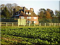
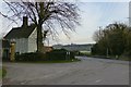
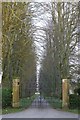
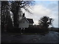
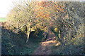
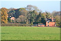
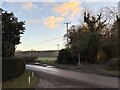
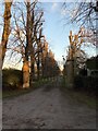
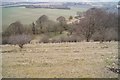
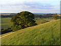
Photos of RG20 9NR

Area Information
The postcode RG20 9NR defines a specific residential cluster situated within the county of England. This location covers 69.7 hectares and supports a population of 1528 residents. With a density of 65 people per square kilometre, the area maintains a low-density character typical of rural settlements. Living in RG20 9NR means navigating a quiet environment where houses dominate the landscape. The community size suggests a close-knit neighbourhood rather than a bustling town centre. You will find a settled atmosphere where daily life revolves around local amenities that require short travel times. The area functions as a peaceful retreat, distinct from the larger towns in the surrounding region. Prospective buyers should appreciate the spacious nature of this cluster, defined by its modest footprint relative to its population. The setting offers a balance between independence and access to services without the congestion of urban living.
- Area Type
- Postcode
- Area Size
- 69.7 hectares
- Population
- 1528
- Population Density
- 65 people/km²
Buying homes in RG20 9NR involves entering a market defined by a strong preference for ownership. With 73% of homes occupied by their owners, the local property landscape is dominated by resident households. The predominant accommodation type listed in this postcode is houses, meaning you will largely encounter detached or semi-detached properties rather than flats or apartments. This composition signals a market where buying rather than renting is the standard trajectory for households. The concentration of owner-occupied properties suggests a stable environment where residents have a vested interest in their neighbourhood. When looking at homes in this small cluster of 69.7 hectares, you are likely seeking a family home rather than an investment flat. The data indicates that the housing stock caters to those who have the means to purchase and stay long-term. This high ownership percentage often correlates with better-maintained estates and a community less subject to the churn of the rental sector.
House Prices in RG20 9NR
Showing 12 properties
| Address | Type | Beds | Baths | Last Sale Price | Last Sale Date | |
|---|---|---|---|---|---|---|
| 5, Weir Vale Cottages, Sydmonton Road, Old Burghclere, RG20 9NR | Terraced | 3 | 1 | £739,000 | Apr 2024 | |
| Ladle View, Sydmonton Road, Old Burghclere, RG20 9NR | Bungalow | 3 | - | £330,999 | Nov 2021 | |
| 1, Weir Vale Cottages, Sydmonton Road, Old Burghclere, RG20 9NR | house | - | - | £910,000 | Feb 2021 | |
| 6, Weir Vale Cottages, Sydmonton Road, Old Burghclere, RG20 9NR | Semi-detached | 3 | 2 | £490,000 | Oct 2020 | |
| 4, Weir Vale Cottages, Sydmonton Road, Old Burghclere, RG20 9NR | Terraced | 3 | 1 | £476,000 | Sep 2020 | |
| Ladle Hill Cottage, Sydmonton Road, Old Burghclere, RG20 9NR | house | 5 | - | £890,000 | Feb 2011 | |
| School House, Sydmonton Road, Old Burghclere, RG20 9NR | Detached | 4 | 2 | - | - | |
| Ladle Hill House, Sydmonton Road, Old Burghclere, RG20 9NR | house | 8 | - | - | - | |
| Tennis 192M From 6 Weir Vale Cottages 37M From Unnamed Road, Sydmonton Road, Old Burghclere, RG20 9NR | Leisure | - | - | - | - | |
| Weir Vale House, Sydmonton Road, Old Burghclere, RG20 9NR | house | - | - | - | - |
Energy Efficiency in RG20 9NR
Living in RG20 9NR offers convenience through a network of amenities located within practical reach. Retail options include five notable venues, specifically Waitrose Little, Budgens Kingsclere, and Sainsburys Newbury. These supermarkets provide essential groceries and household essentials without requiring a long journey. Residents also benefit from four railway stations in their vicinity, including Overton Railway Station, Whitchurch Railway Station, and Newbury Railway Station. These transport hubs connect the residential cluster to broader regional networks. The availability of these specific retail and rail points means daily errands can be completed efficiently. You can rely on local stores for routine shopping while using the railway lines for commuting to larger cities. The presence of established chains like Waitrose and Sainsburys adds a layer of commercial familiarity to the rural setting. This combination of local retail and regional rail access defines the daily rhythm for households in the postcode.
Amenities
Schools
| Rank | School | Type | Entry gender | Ages |
|---|
Explore more schools in this area
Go to Schools tabDemographics
The community in RG20 9NR presents a clear demographic profile centred on established adulthood. The median age stands at 47 years, indicating that Adults between 30 and 64 years represent the most common age range. This data point confirms the area attracts families and individuals in their prime working years rather than young students or the elderly. Home ownership levels are notably high at 73%, suggesting a stable resident base with significant property equity. The predominant accommodation type consists of houses, reinforcing the family-oriented nature of the settlement. The demographic breakdown shows a predominantly White ethnic group, which aligns with typical patterns in this part of England. These specific figures illustrate a mature community where long-term residents have chosen to settle. The high ownership rate implies that rental options may be less common than in more student-led or transient areas.
Household Size
Accommodation Type
Tenure
Ethnic Group
Religion
Household Composition
Age
Household Deprivation
NS-SEC
Explore more demographic insights in this area
Go to Demographics tabPlanning
Planning Constraints
- Flood RiskPremium
- Ramsar Wetland SitesPremium
- Area of Outstanding Natural BeautyPremium
- Protected Nature ReservePremium
- Protected WoodlandPremium