Area Overview for RG20 9BT
Photos of RG20 9BT


Area Information
RG20 9BT is a specific postcode area covering a small residential cluster of 8.8 hectares. This compact footprint hosts a population of 1634 people, creating a neighbourhood where residents likely know their immediate surroundings. The area sits within England and functions as a quiet pocket of the wider RG20 locality. Living in RG20 9BT means experiencing a space defined by its limited size yet significant community presence. You will find a setting that prioritises residential calm over high-density development. The postcode covers a defined zone where the living density allows for a cohesive local atmosphere. Homes in RG20 9BT are situated in an environment that supports a stable, long-term community lifestyle. The area's small scale means that planning changes or new developments will be highly visible to everyone. This specificity makes the district distinct from the broader Newbury region while maintaining strong connections to local hubs.
- Area Type
- Postcode
- Area Size
- 8.8 hectares
- Population
- 1634
- Population Density
- 99 people/km²
The property market in RG20 9BT is characterised by a strong preference for owner-occupied housing. With 76% home ownership, this area is not a primary rental market. Instead, it functions as a settled neighbourhood where residents have invested in their dwellings. Houses dominate the accommodation type data for this postcode, meaning flats and converted buildings are rare or non-existent. Buyers seeking housing stock in RG20 9BT will encounter traditional residential properties. This concentration of house-owners suggests a market focused on maintenance and renovation of existing structures rather than speculative short-term lets. The small area size of 8.8 hectares further limits the volume of transactions visible at any one time. You will find a market driven by local knowledge and established values rather than rapid turnover. Prospective buyers should expect to engage with a community that values long-term residency.
House Prices in RG20 9BT
Showing 4 properties
| Address | Type | Beds | Baths | Last Sale Price | Last Sale Date | |
|---|---|---|---|---|---|---|
| 1, Milford Lake Bungalow, Foxs Lane, Penwood, Highclere, RG20 9BT | Bungalow | - | - | - | - | |
| 2, Milford Lake Bungalow, Foxs Lane, Penwood, Highclere, RG20 9BT | Bungalow | 3 | 1 | - | - | |
| Foresters Cottage, Foxs Lane, Penwood, Highclere, RG20 9BT | house | - | - | - | - | |
| Laundry Cottage, Foxs Lane, Penwood, Highclere, RG20 9BT | Semi-detached | 2 | 1 | - | - |
Energy Efficiency in RG20 9BT
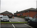
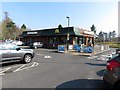
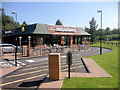
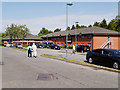
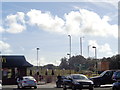
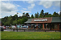
Amenities within practical reach of RG20 9BT offer solid convenience for daily life. You can access five retail locations, prominently including Waitrose Little, Sainsburys Newbury, and Co-op Newbury. These superstores are within easy travelling distance, ensuring you have opportunities for weekly shopping and household necessities. Four railway stations serve the area, including Newbury Railway Station, Newbury Racecourse Railway Station, and Kintbury Railway Station. This rail connectivity connects the residential cluster to wider employment and leisure hubs. For those who enjoy sporting events, Newbury Racecourse is nearby. The mix of major supermarkets and specific rail stations ensures that residents do not feel isolated from the broader regional economy. Daily life in RG20 9BT balances quiet residential streets with the accessibility of essential services in Newbury.
Amenities
Schools
Families living in RG20 9BT have access to Thorngrove School, which is located immediately nearby. This institution is an independent school holding a good Ofsted rating. The presence of an independent option provides a specific educational pathway for children in the cluster. While Thorngrove offers private education, state-funded primary and secondary schools are likely required through proximity to the broader RG20 zone, though specific names for state schools are not listed in the available data for this exact cluster. The school profile indicates a choice for parents prioritising a private education environment. The good rating of Thorngrove suggests a standard of education that meets regional expectations. For residents without access to independent schooling, the nearest state options would be determined by the standard catchment areas surrounding Newbury, but Thorngrove remains the named educational facility directly associated with this postcode.
| Rank | School | Type | Entry gender | Ages |
|---|
Explore more schools in this area
Go to Schools tabDemographics
The community profile of RG20 9BT reflects a mature, stability-focused population. The median age is 47 years, confirming that the most common age range comprises adults aged 30 to 64 years. High home ownership at 76% indicates that the vast majority of residents own their properties outright or with a mortgage. This metric points to long-term residents rather than transient tenants seeking temporary accommodation. The predominant ethnic group is White, which aligns with the broader demographic makeup of the surrounding region. Families and established households form the backbone of this demographic structure. The majority of accommodation consists of houses, reinforcing the trend towards family-oriented living. This housing stock supports a lifestyle where neighbours often share values regarding stability and home ownership. You are looking at an area where life milestones, such as raising children or retiring, are common events within the local community.
Household Size
Accommodation Type
Tenure
Ethnic Group
Religion
Household Composition
Age
Household Deprivation
NS-SEC
Explore more demographic insights in this area
Go to Demographics tabPlanning
Planning Constraints
- Flood RiskPremium
- Ramsar Wetland SitesPremium
- Area of Outstanding Natural BeautyPremium
- Protected Nature ReservePremium
- Protected WoodlandPremium