Area Overview for RG20 9AP
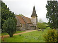
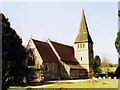
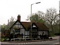
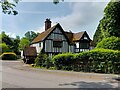
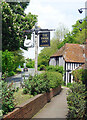
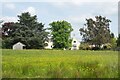
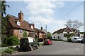
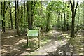
Photos of RG20 9AP
Area Information
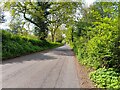
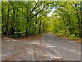
Living in RG20 9AP means residing in a specific residential cluster that spans eighteen hectares in Berkshire. This postcode serves a relatively small population of roughly fifteen hundred and twenty-eight people, resulting in a population density of sixty-five inhabitants per square kilometre. The area offers a sense of space due to its low density while remaining part of the broader Newbury region. You will find a neighbourhood defined by its quiet, residential nature rather than urban congestion. The layout supports a slower pace of life compared to denser towns, making it suitable for those who value green surroundings and lower numbers of neighbours passing by on their doorstep. This community sits within the RG20 postcode sector, known for housing families and mature residents. The physical size of the cluster ensures that properties are not cramped, allowing gardens and private space to be standard features of local homes. Daily life revolves around a sense of local familiarity, where the scale of the residential cluster keeps the street network manageable. You can expect a environment where the focus is on home life rather than large commercial districts. The area's compact size suggests a tight-knit atmosphere where residents know each other, fostering a stable and predictable living situation. It is a practical choice for buyers seeking a defined residential pocket within the Newbury travel range without the noise of a major town centre.
- Area Type
- Postcode
- Area Size
- 18.0 hectares
- Population
- 1528
- Population Density
- 65 people/km²
The property market in RG20 9AP is characterised by a strong legacy of owner occupation, where seventy-three per cent of residents hold their homes outright. This statistic significantly defines the local real estate landscape, as the vast majority of the housing stock is not available for long-term rental investment. Instead, the homes are primarily used as primary residences by families or individuals seeking stability. The accommodation type area is strictly defined by houses, meaning you will not find apartments or terraced flats within this specific residential cluster. Every property offers the space and layout associated with detached or semi-detached dwellings. For buyers considering this small area, the market indicates a focus on established ownership rather than speculative landlord activity. The housing stock comprises houses that suit various family sizes, from growing households to mature retirees. This combination of high ownership rates and single-family homes creates a consistent market where transactions typically involve moves between owner-occupiers. The absence of rental properties in the data suggests a community driven by long-term settlement. If you are looking to buy a home here, you are entering a market where previous owners have remained in the area for substantial periods. This stability often means well-maintained properties and a community focused on home improvement and local engagement. The nature of the homes ensures that land use is dedicated to residential living, offering a predictable and secure housing environment.
House Prices in RG20 9AP
Showing 22 properties
| Address | Type | Beds | Baths | Last Sale Price | Last Sale Date | |
|---|---|---|---|---|---|---|
| White Cottage, Harts Lane, Newtown, RG20 9AP | house | - | - | £950,000 | Sep 2025 | |
| Newtown Court Farm, Harts Lane, Newtown, RG20 9AP | Detached | 5 | 3 | £1,200,000 | Oct 2013 | |
| 1, Newtown House, Harts Lane, Newtown, RG20 9AP | Detached | 5 | 3 | £1,231,000 | Oct 2003 | |
| Threeways, Harts Lane, Newtown, RG20 9AP | Detached | 3 | 1 | £235,000 | Mar 2001 | |
| Jasmine Cottage, Harts Lane, Newtown, RG20 9AP | Detached | - | - | £142,000 | Dec 1996 | |
| Terrace Cottage, Harts Lane, Newtown, RG20 9AP | Detached | - | - | £152,000 | Aug 1996 | |
| 3, Newtown House, Harts Lane, Newtown, RG20 9AP | Terraced | 6 | 6 | - | - | |
| 1 Oak Tree Drive, Newtown, RG20 9AP | Land | - | - | - | - | |
| The Old Post Office, Harts Lane, Newtown, RG20 9AP | Cottage | 3 | 2 | - | - | |
| Nite's Lepe, Harts Lane, Newtown, RG20 9AP | Detached | 5 | 3 | - | - |
Energy Efficiency in RG20 9AP
Residents of RG20 9AP enjoy convenient access to retail and transport hubs within a practical reach. Five notable retail venues include Tesco Newbury, which offers a full supermarket range for weekly groceries, alongside M&S Pinchington Ln Newbury SF and Lidl Newbury. These shops provide essential shopping needs without the necessity of driving far beyond the local area. For larger purchases or weekly essentials, Lidl and the Sainsbury's located on Pinchington Lane serve as the primary high-street anchors for the postcode. Transport connectivity is well-supported by three railway stations nearby: Newbury Railway Station, Newbury Racecourse Railway Station, and Thatcham Railway Station. These five rail options facilitate easy Commuting into London or other major hubs. You can travel from the local area to Newbury town centre directly via these stations, integrating daily life with wider regional transport networks. The combination of five retail outlets and five railway stations means you do not need to travel extensively for basic errands or daily transport requirements. This accessibility enhances the quality of daily life in RG20 9AP by keeping essential services within a short drive or walk from the residential cluster.
Amenities
Schools
Families living in RG20 9AP have access to a mix of state and independent educational providers within the NE postcode sector. Two state-funded primary schools serve the immediate area: Burghclere Primary School and The Clere School. Both institutions hold a satisfactory Ofsted rating, indicating they meet the required standards for education and student welfare. These state options provide a publicly funded alternative for local children attending the nearest designated schools. In addition to the state sector, the area benefits from three private establishments that offer alternative educational pathways. Horris Hill School provides an independent education for younger students, while St Michael's School and Greenhill School serve as independent institutions for older pupils. St Michael's School holds a 'good' Ofsted rating, distinguishing it as a regulated private provider with verified quality standards. This diversity allows parents in RG20 9AP to choose between a state-educated route at Burghclere Primary or The Clere School, or a private route through the independent schools. The presence of both satisfactory state schools and an independent school rated 'good' gives families a flexible range of choices based on their educational preferences and budgets.
| Rank | School | Type | Entry gender | Ages |
|---|
Explore more schools in this area
Go to Schools tabDemographics
The demographic profile of RG20 9AP reveals a community dominated by adults between the ages of thirty and sixty-four years. The median age stands at forty-seven, indicating a population skewed towards middle and older adulthood rather than young singles or teenagers. Home ownership is the clear norm, with seventy-three per cent of residents owning their property outright. This high rate of ownership suggests a stable settlement pattern where people choose to put down roots locally. You will find that the majority of households consist of families or retired couples who have purchased homes in the area over time. Accommodation in this postcode consists almost entirely of houses, reflecting the area's suburban or semi-rural character. Free-standing or semi-detached homes replace the apartment blocks found in city centres, providing private space and outdoor areas for gardening. The predominant ethnic group in RG20 9AP is White, which aligns with the broader historical settlement patterns of many Berkshire towns. With a population density of only sixty-five people per square kilometre, the community avoids the overcrowding typical of high-rise districts. This demographic mix creates a relatively homogenous environment where established households coexist. Buyers looking for an established, owner-occupied market with a mature age profile will find RG20 9AP matches these criteria precisely.
Household Size
Accommodation Type
Tenure
Ethnic Group
Religion
Household Composition
Age
Household Deprivation
NS-SEC
Explore more demographic insights in this area
Go to Demographics tabPlanning
Planning Constraints
- Flood RiskPremium
- Ramsar Wetland SitesPremium
- Area of Outstanding Natural BeautyPremium
- Protected Nature ReservePremium
- Protected WoodlandPremium