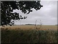
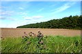
Area Overview for RG20 8SR
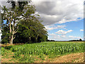
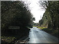
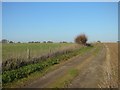
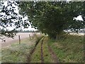
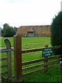
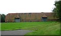
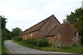
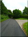
Photos of RG20 8SR


Area Information
RG20 8SR represents a quiet residential cluster in Berkshire, covering an area of 4.3 square kilometres. This specific postcode serves a compact population of 1,728 residents, creating a low-density environment defined by its houses. With a population density of 48 people per square kilometre, everyday life here moves at a slower pace compared to larger urban centres. The layout prioritises space and privacy over high-rise living or concentration. You will find a neighbourhood where proximity to nature is a defining feature, rather than a close-knit row of terraced streets. This area distinguishes itself through a domestic atmosphere where residents enjoy a substantial amount of private outdoor space around their properties. The small scale means that local interactions are inevitable but generally respectful of individual households. Living in RG20 8SR means trading urban convenience for a setting that feels open and uncrowded. The postcode acts as an anchor for a small community where the focus remains on the home and immediate surroundings. This environment suits those who prefer a secluded sense of living in the English countryside rather than a bustling town centre.
- Area Type
- Postcode
- Area Size
- 4.3 km²
- Population
- 1728
- Population Density
- 48 people/km²
RG20 8SR operates as a primarily owner-occupied market rather than a rental hub. Sixty-five percent of homes are held by the people who live in them, indicating that investment or holiday lets are not the main drivers of the local market. The accommodation type is strictly houses, meaning you will not find flats or apartments within this postcode boundary. This constraint defines the housing stock available for purchase or sale to those looking at RG20 8SR specifically. The property market here caters to buyers seeking traditional houses, likely detached or semi-detached bungalows common in households with a median age of 47. With a population of only 1,728 across 4.3 square kilometres, the total number of available homes is naturally limited. This scarcity can drive asset values higher as fewer units compete for a specific pool of wealthy buyers. The homogeneous nature of the stock means sight-unseen inspections become crucial when buying a home in this area. Sellers generally appeal to families or downsizers rather than young professionals seeking city-centre flats or student accommodation. The market behaviour reflects the demographic reality: stable ownership and a lack of transient renting activity.
House Prices in RG20 8SR
Showing 15 properties
| Address | Type | Beds | Baths | Last Sale Price | Last Sale Date | |
|---|---|---|---|---|---|---|
| 7 Stanmore, Beedon, Newbury, RG20 8SR | house | - | - | £1,850,000 | Dec 2021 | |
| 12 Stanmore, Beedon, Newbury, RG20 8SR | house | 4 | - | £575,000 | Oct 2011 | |
| Linten Cottage, 8 Stanmore, Beedon, Newbury, RG20 8SR | Semi-detached | - | - | £682,500 | Jul 2005 | |
| South Stanmore Barn, Stanmore, Beedon, Newbury, RG20 8SR | Semi-detached | 4 | 3 | £580,000 | Jul 2003 | |
| Thames & Kennet Machinery Ring, Unit 1, The Stables, Stanmore, Beedon, Newbury, RG20 8SR | Office | - | - | - | - | |
| 4 Hailey Lane, Beedon, Newbury, RG20 8SR | Semi-detached | - | - | - | - | |
| 9 Stanmore, Beedon, Newbury, RG20 8SR | Semi-detached | - | - | - | - | |
| Tennis 51M From North Stanmore Farm, Stanmore 58M From Stanmore Road, Stanmore, Beedon, Newbury, RG20 8SR | Leisure | - | - | - | - | |
| Entotem, Unit 2 And 3, The Stables, Stanmore, Beedon, Newbury, RG20 8SR | Office | - | - | - | - | |
| 5 Stanmore, Beedon, Newbury, RG20 8SR | house | - | - | - | - |
Energy Efficiency in RG20 8SR
Residents of RG20 8SR have a range of retail amenities within practical reach, making daily shopping a convenience rather than a chore. Four main retail options serve the local cluster, including M&S Chieveley Moto SF, Co-op Hermitage, and Morrisons Daily. These specific venues provide access to current fashion from Marks and Spencer, fresh food from the Co-op, and a supermarket for larger grocery runs with Morrisons. This mix ensures that you can handle most household needs without travelling far beyond your immediate neighbourhood. The presence of these named stores indicates that essential services are integrated into your daily route to work or school runs. You do not need to plan multiple trips to different towns to get weekly groceries and必要 items. The retail landscape supports a self-sufficient lifestyle where the best of the local high street is accessible within a short drive. While dining and leisure options are not explicitly detailed beyond these retail giants, the proximity of major stores like Co-op and M&S often anchors a small commercial hub nearby. This setup works well for the 1,728 people living here, reducing the need for long commutes to larger centres for basic provisions.
Amenities
Schools
Families residing in RG20 8SR have access to two primary schools within practical reach of their homes. The Ilsleys Primary School holds a Ofsted rating of good, providing a solid educational foundation for local children. Nearby, Beedon C.E. (Controlled) Primary School also carries a good rating, offering an alternative option with a similar standard of education. Both institutions are primary schools, which means secondary education options are not listed in the immediate proximity data for this specific postcode. The presence of two options gives parents near RG20 8SR some choice regarding their child's early schooling without needing to commute any great distance. A good rating from Ofsted in both cases suggests a consistent standard of teaching and management across these establishments. For families moving to this area, the schools are a key consideration given the local population's median age of 47. The fact that both schools are controlled or voluntary aided institutions may also appeal to parents seeking specific religious or community values in their children's education. The data confirms that these are the key educational destinations serving the residential cluster.
| Rank | School | Type | Entry gender | Ages |
|---|
Explore more schools in this area
Go to Schools tabDemographics
The community in RG20 8SR reflects the life stage of established families and wealthier residents. The median age stands at 47 years, placing the average resident firmly within the 30 to 64 year bracket. This demographic profile indicates that the local population consists largely of adults who have likely moved out of the higher-pressure years of early career to settle into private homes. Home ownership is the dominant feature of this area, with 65% of residents owning their properties outright or with a mortgage. This high ownership rate suggests financial stability and a long-term commitment to the locality. The accommodation stock is exclusively houses, reinforcing the suburban or rural character of the postcode. Predominantly White demographics further define the social fabric, though diversity continues to be part of the local tapestry. The older age profile combined with high ownership rates paints a picture of a settled community where residents have roots in the area. There is little evidence of a transient population or short-term rental market. You are looking at a neighbourhood where long-term residents have shaped the community rules and local dynamics over many years. The absence of young adults under 30 or retirees over 65 from the primary data set suggests a specific life stage is central to the area's identity.
Household Size
Accommodation Type
Tenure
Ethnic Group
Religion
Household Composition
Age
Household Deprivation
NS-SEC
Explore more demographic insights in this area
Go to Demographics tabPlanning
Planning Constraints
- Flood RiskPremium
- Ramsar Wetland SitesPremium
- Area of Outstanding Natural BeautyPremium
- Protected Nature ReservePremium
- Protected WoodlandPremium