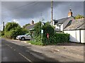
Area Overview for RG20 8JA
Photos of RG20 8JA


Area Information
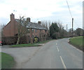
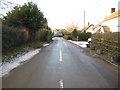
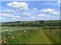
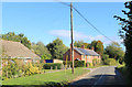
Living in RG20 8JA defines a quiet, compact residential lifestyle centred on a postcode cluster spanning just 36.5 hectares. This small area accommodates a population of 2042 residents, creating an environment where neighbours are often known by name. You will find the location extremely open due to a population density of only 26 people per square kilometre. Such low density means long sightlines and spacious surroundings rather than overcrowded streets. The site functions as a contained community within the broader Berkshire and Oxfordshire corridor. Daily life revolves around a deliberate balance of privacy and accessibility. Residents enjoy a sense of exclusivity without the isolation of truly rural settings. The layout supports a slow pace of life, away from the rush of major urban centres. This small footprint allows for a clear understanding of local limits and boundaries. The area attracts buyers seeking a retreat from city noise while maintaining reasonable access to wider facilities. You do not need to travel far to engage with your immediate surroundings. The combination of size and population density creates a distinct character. It is a place where the built environment does not dominate the landscape. Instead, the surrounding nature influences the rhythm of daily routines. Homeowners appreciate the lack of congestion and the availability of ample space outside their properties. This specific postcode represents a choice for those who value spaciousness and a tranquil atmosphere.
- Area Type
- Postcode
- Area Size
- 36.5 hectares
- Population
- 2042
- Population Density
- 26 people/km²
RG20 8JA represents an owner-occupied market defined by traditional housing stock. With a home ownership rate of 67%, the area functions as a目的地 for buyers seeking to purchase rather than rent. This high percentage indicates a stock of well-maintained houses where residents have a stake in the long-term upkeep of their estates. You will not find a significant rental sector, as most homes serve owner-occupiers. The accommodation type is exclusively houses, offering detached, semidetached, or terraced structures suitable for family living. This variety of house types supports different family sizes within the same postcode. The property market here targets residents who value ownership rights and stability. Buyers entering this market can expect to engage with current owners who likely care deeply about maintaining property standards. The 36.5-hectare size limits the volume of properties available, meaning supply is restricted compared to larger urban zones. Competition for homes may be higher due to the finite number of listings. Prices generally reflect the rural character and lack of urban density. Investors should note that the 26 people per square kilometre density affects land value and future development potential. Planning constraints often protect the existing architecture, preserving the aesthetic appeal of the cluster. This market is not for those seeking quick flips or new-build speculation. It is suited for people who want to settle permanently.
House Prices in RG20 8JA
Showing 7 properties
| Address | Type | Beds | Baths | Last Sale Price | Last Sale Date | |
|---|---|---|---|---|---|---|
| 1, Weston Farm Cottages, Lambourn Road, Weston, Newbury, RG20 8JA | house | - | - | £298,000 | Aug 2015 | |
| 2, Weston Farm Cottages, Lambourn Road, Weston, Newbury, RG20 8JA | Bungalow | - | - | £135,000 | May 2001 | |
| Chapel House, Lambourn Road, Weston, Newbury, RG20 8JA | Detached | 3 | 1 | £121,000 | Nov 1995 | |
| P I (physik Instrumente) Ltd, Weston Farm Barn, Lambourn Road, Weston, Newbury, RG20 8JA | office_workshop | - | - | - | - | |
| 3, Weston Farm Cottages, Lambourn Road, Weston, Newbury, RG20 8JA | house | - | - | - | - | |
| Weston Farm, Lambourn Road, Weston, Newbury, RG20 8JA | Detached | 3 | - | - | - | |
| 4, Weston Farm Cottages, Lambourn Road, Weston, Newbury, RG20 8JA | Semi-detached | 3 | 1 | - | - |
Energy Efficiency in RG20 8JA
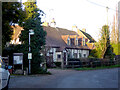
Residents of RG20 8JA enjoy practical access to retail and leisure facilities within a short drive. Five key amenities lie within practical reach, including Spar, Asda Hungerford, and Tesco Hungerford. These supermarkets provide ample choice for your weekly shopping needs. You can stock up on groceries or household items without travelling to distant towns. The availability of multiple retailers means you do not need to plan trips weeks in advance. Dining options are integrated into these larger stores, offering convenience for quick meals. For commuting, two railway stations enhance your mobility to work destinations. Kintbury Railway Station and Hungerford Railway Station act as gateways to wider travel networks. While local leisure activities like parks or cinemas are not listed in the immediate data, the presence of major supermarkets implies a functional neighbourhood. The area blends rural tranquility with urban convenience. You can start the day walking through green spaces and finish with a shop at Asda Hungerford. This pattern suits families who value both nature and modern retail. The 67% home ownership rate suggests a community invested in maintaining this lifestyle. Daily life here avoids the noise of city streets while keeping essential services close.
Amenities
Schools
Families living in RG20 8JA have access to specific educational institutions within the local catchment. New Barn Primary School operates as a special school in the vicinity, holding a good Ofsted rating. This institution provides specialised education for pupils with additional needs. For mainstream primary education, Inkpen Primary School is nearby with a satisfactory Ofsted rating. Parents seeking a higher standard of education have another option at Welford and Wickham C.E. Primary School. This school holds a good Ofsted rating and serves the local community. The mix of school types includes both church of England affiliations and mainstream state provision. The availability of three schools ensures that most children in the area attend institutions without needing to travel to distant towns. Commuters rely on these local provisions to ensure their children receive steady education nearby. The Ofsted ratings confirm that all listed schools meet government standards for safety and learning outcomes. A satisfactory rating at Inkpen Primary School indicates room for improvement but assures basic educational quality. The good rating at Welford and Wickham C.E. Primary School signals strong performance in teaching standards. Parents can rest assured that their children will not be sent away for education. This local provision supports the family-centric nature of the 67% owner-occupied market. Distance to each school is short, reducing travel time and stress on daily routines.
| Rank | School | Type | Entry gender | Ages |
|---|
Explore more schools in this area
Go to Schools tabDemographics
The community in RG20 8JA reflects a settled, mature demographic with a median age of 47 years. Adults between the ages of 30 and 64 form the most common age range, indicating a stable workforce and established families. This age profile suggests a neighbourhood where children are often raised and adults remain until retirement. Home ownership stands at 67%, meaning roughly two out of three residents own their property outright or with significant equity. This high rate contrasts sharply with rental-dominated districts, signalling deep community roots. Accommodation consists almost entirely of houses, offering separate living spaces rather than high-density flats. Ethnically, the area is predominantly White, aligning with the wider demographic trends of rural England. The demographic data points to a homogeneous community with shared cultural backgrounds. Housing types cater primarily to families and individuals seeking ownership rather than tenancy. The lack of social housing statistics in the dataset suggests a market where private investment dominates property sales. Quality of life appears high due to the stability provided by such a large owner-occupier base. Families benefit from long-term neighbours and a consistent community fabric. Property turnover is likely lower than in student hubs or commuter rental zones. This stability creates a predictable environment for those settling down.
Household Size
Accommodation Type
Tenure
Ethnic Group
Religion
Household Composition
Age
Household Deprivation
NS-SEC
Explore more demographic insights in this area
Go to Demographics tabPlanning
Planning Constraints
- Flood RiskPremium
- Ramsar Wetland SitesPremium
- Area of Outstanding Natural BeautyPremium
- Protected Nature ReservePremium
- Protected WoodlandPremium