Area Overview for RG20 7LU
Photos of RG20 7LU
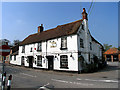

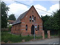

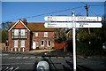
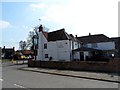
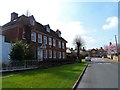
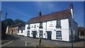
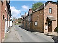
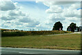
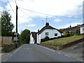
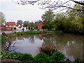
58 photos from this area
Area Information
Key information about the RG20 7LU including its size, population, and administrative classification.
- Area Type
- Postcode
- Area Size
- 4.1 hectares
- Population
- 1728
- Population Density
- 48 people/km²
House Prices in RG20 7LU
22
Properties
£492,217
Average Sold Price
£150,000
Lowest Price
£830,000
Highest Price
Showing 22 properties
| Address | Type | Beds | Baths | Last Sale Price | Last Sale Date | |
|---|---|---|---|---|---|---|
| The Firs, Old Stanmore Road, East Ilsley, Newbury, RG20 7LU | Semi-detached | 5 | 3 | £830,000 | Mar 2025 | |
| Leonora House, Old Stanmore Road, East Ilsley, Newbury, RG20 7LU | house | - | - | £795,000 | Sep 2021 | |
| 1, Orchard Lea, Old Stanmore Road, East Ilsley, Newbury, RG20 7LU | Detached | 3 | 2 | £350,000 | Jul 2020 | |
| The Old Pool House, Old Stanmore Road, East Ilsley, Newbury, RG20 7LU | Bungalow | - | - | £618,000 | Dec 2017 | |
| Little Mallards, Old Stanmore Road, East Ilsley, Newbury, RG20 7LU | Semi-detached | 4 | 3 | £735,000 | Aug 2017 | |
| Ridgeway View, Old Stanmore Road, East Ilsley, Newbury, RG20 7LU | house | - | - | £437,000 | Oct 2010 | |
| Greycott, Old Stanmore Road, East Ilsley, Newbury, RG20 7LU | Semi-detached | 4 | 2 | £330,000 | Dec 2006 | |
| 2, Orchard Lea, Old Stanmore Road, East Ilsley, Newbury, RG20 7LU | Semi-detached | - | - | £150,000 | Jul 2001 | |
| The Bungalow, Old Stanmore Road, East Ilsley, Newbury, RG20 7LU | Bungalow | - | - | £184,950 | Sep 1999 | |
| Pen Meadow, Old Stanmore Road, East Ilsley, Newbury, RG20 7LU | Bungalow | 4 | 3 | - | - |
Page 1 of 3
Energy Efficiency in RG20 7LU
Amenities
Schools
| Rank | School | Type | Entry gender | Ages |
|---|
Explore more schools in this area
Go to Schools tabDemographics
Household Size
Two person
most common
Accommodation Type
Houses
most common
Tenure
65
majority
Ethnic Group
White
most common
Religion
N/A
most common
Household Composition
N/A
most common
Age
47
median
Adults (30-64 years)
most common
Household Deprivation
N/A
with no deprivation
NS-SEC
46
in Lower managerial occupations
Explore more demographic insights in this area
Go to Demographics tabPlanning
Planning Constraints
- Flood RiskPremium
- Ramsar Wetland SitesPremium
- Area of Outstanding Natural BeautyPremium
- Protected Nature ReservePremium
- Protected WoodlandPremium