Area Overview for RG20 5NH
Photos of RG20 5NH
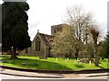
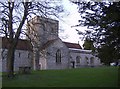
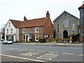
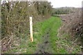
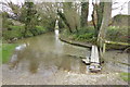
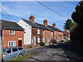
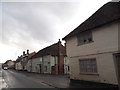
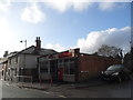
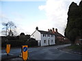
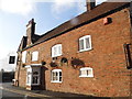
100 photos from this area
Area Information
Key information about the RG20 5NH including its size, population, and administrative classification.
- Area Type
- Postcode
- Area Size
- 1.1 hectares
- Population
- 1571
- Population Density
- 866 people/km²
House Prices in RG20 5NH
35
Properties
£288,563
Average Sold Price
£137,000
Lowest Price
£480,000
Highest Price
Showing 35 properties
| Address | Type | Beds | Baths | Last Sale Price | Last Sale Date | |
|---|---|---|---|---|---|---|
| 29 George Street, Kingsclere, RG20 5NH | Terraced | 2 | 1 | £285,000 | Dec 2024 | |
| 1A George Street, Kingsclere, RG20 5NH | Retail | 1 | 1 | £405,000 | Dec 2023 | |
| 10, The Litten, George Street, Kingsclere, RG20 5NH | house | 3 | 3 | £410,000 | Sep 2022 | |
| 27 George Street, Kingsclere, RG20 5NH | Terraced | 3 | 1 | £367,500 | Feb 2021 | |
| 12, The Litten, George Street, Kingsclere, RG20 5NH | Flat | 2 | 1 | £194,000 | Aug 2019 | |
| 21 George Street, Kingsclere, RG20 5NH | house | 3 | 2 | £480,000 | May 2019 | |
| 1, The Litten, George Street, Kingsclere, RG20 5NH | Flat | - | - | £155,000 | Jul 2018 | |
| 4, The Litten, George Street, Kingsclere, RG20 5NH | Detached | 4 | 2 | £300,000 | May 2018 | |
| 8, The Litten, George Street, Kingsclere, RG20 5NH | Detached | 3 | 1 | £420,000 | Mar 2016 | |
| 33 George Street, Kingsclere, RG20 5NH | Detached | - | - | £472,500 | Jun 2014 |
Page 1 of 4
Energy Efficiency in RG20 5NH
Amenities
Schools
| Rank | School | Type | Entry gender | Ages |
|---|
Explore more schools in this area
Go to Schools tabDemographics
Household Size
Two person
most common
Accommodation Type
Houses
most common
Tenure
84
majority
Ethnic Group
White
most common
Religion
N/A
most common
Household Composition
N/A
most common
Age
47
median
Adults (30-64 years)
most common
Household Deprivation
N/A
with no deprivation
NS-SEC
46
in Lower managerial occupations
Explore more demographic insights in this area
Go to Demographics tabPlanning
Planning Constraints
- Flood RiskPremium
- Ramsar Wetland SitesPremium
- Area of Outstanding Natural BeautyPremium
- Protected Nature ReservePremium
- Protected WoodlandPremium