Area Overview for RG20 4AN
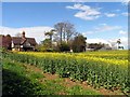
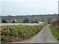
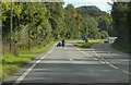
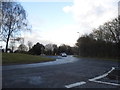
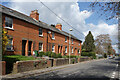
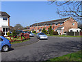
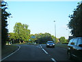
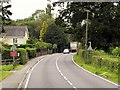
Photos of RG20 4AN
Area Information
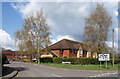
Living in RG20 4AN offers a definition of suburban stability characterised by a small, tightly knit residential cluster. This specific postcode covers a limited footprint of 13.2 hectares, creating an environment where neighbours know one another by name. The population stands at 1,786 people, resulting in a modest density of 66 people per square kilometre. Such low density ensures a quiet atmosphere without the noise and congestion found in denser urban centres. The area functions as a peaceful haven for those who prioritise space and tranquility over city excitement. Daily life here revolves around a slower pace, ideal for families or retirees seeking a retreat from the hustle. The sheer scale of the estate supports a manageable community dynamic where local issues are quickly resolved through direct communication. Residents enjoy the benefits of a contained neighbourhood where the distance between homes is small enough to foster interaction yet spacious enough to maintain privacy. This configuration makes RG20 4AN a practical choice for buyers who value a distinct separation from major road networks whilst remaining close to essential services. The manageable size of this cluster simplifies local governance and community engagement, ensuring that individual voices carry weight within the local context.
- Area Type
- Postcode
- Area Size
- 13.2 hectares
- Population
- 1786
- Population Density
- 66 people/km²
The housing landscape in RG20 4AN is overwhelmingly dominated by owner-occupied properties. With home ownership rates reaching 77%, this postcode operates distinctly different from the rental markets that characterise many larger cities. This high percentage of owner-occupiers usually means fewer short-term lettings and a steadier resale environment for prospective buyers. The predominant accommodation type consists of houses, which aligns perfectly with the area's low-density layout and 13.2 hectare size. Buyers looking at homes in RG20 4AN should expect a stock focused on detached or semi-detached dwellings rather than flats or high-rise apartments. This housing structure supports the local community's preference for private gardens and outdoor space, catering well to families with children or adults valuing their outdoor area. The fact that three-quarters of residents own their homes suggests a local economy where property assets change hands primarily through traditional sales rather than frequent vacancies. For those seeking to purchase, the market here represents a stable investment within a small, manageable residential cluster. The lack of significant rental pressure often keeps property values reflective of long-term holding rather than speculative flipping. Consequently, the local market offers a traditional buying experience suited for those intending to settle for the long term rather than quick turnovers.
House Prices in RG20 4AN
Showing 4 properties
| Address | Type | Beds | Baths | Last Sale Price | Last Sale Date | |
|---|---|---|---|---|---|---|
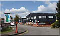
| Block E, Kingsclere Park, Kingsclere, RG20 4AN | Office | - | - | - | - | |
| Block F, Kingsclere Park, Kingsclere, RG20 4AN | Office | - | - | - | - | |
| 5, Time House, Kingsclere Park, Kingsclere, RG20 4AN | Office | - | - | - | - | |
| 4, Time House, Kingsclere Park, Kingsclere, RG20 4AN | Office | - | - | - | - |
Energy Efficiency in RG20 4AN
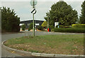
Residents of RG20 4AN enjoy convenient access to essential retail and transport hubs within practical reach. Five notable retailers operate nearby, including Budgens Kingsclere, Tesco Baughurst, and Waitrose Little. These specific venues provide residents with a daily selection of groceries, household essentials, and premium shopping options close to home. The inclusion of a Waitrose branch ensures access to higher-quality food and a sophisticated shopping experience directly aligned with the area's demographic profile. Transport links are equally well-serviced, with five railway stations located within easy commuting distance. Thatcham Railway Station, Newbury Racecourse Railway Station, and Midgham Railway Station stand out as the primary rail connections for leaving the area. This network of stations allows residents to travel to major employment centres with minimal travel time. The proximity of these specific retail outlets and railway stations means that daily essentials and weekly trips require little journey beyond the local suburb. This blend of convenience and accessibility makes RG20 4AN a practical base for those who value short commutes and quick errands. The local lifestyle balances the quiet of the residential cluster with the immediate availability of services that define modern suburban living.
Amenities
Schools
Families living in RG20 4AN have access to established educational institutions nearby. Ashford Hill Primary School serves as a key local option for young children attending primary education. This school is situated within practical reach of the residential cluster, offering a local setting for early academic development. The area also benefits from Cheam School, an independent institution that provides alternative educational pathways for families seeking private education. Having both state and independent options nearby gives residents flexibility in choosing the right educational environment for their children. This mix of school types means that public schooling is readily available alongside prestigious private alternatives, catering to diverse family needs and budgets. Parents in RG20 4AN do not need to commute across town to access quality education, as both primary and secondary-level independent schools are listed among the nearest facilities. The presence of these specific institutions, Ashford Hill Primary School and Cheam School, demonstrates a commitment to educational provision that complements the area's family-oriented demographic. School catchments often extend across the smaller RG20 4AN postcode, ensuring that children have local companions and communities within their own neighbourhood immediately after school hours.
| Rank | School | Type | Entry gender | Ages |
|---|
Explore more schools in this area
Go to Schools tabDemographics
The community profile in RG20 4AN reflects a mature population with a median age of 47 years. Adults aged between 30 and 64 years constitute the most common age range, indicating a demographic familiar with settlement and stability. This age bracket typically brings professional experience and financial security to the neighbourhood, shaping a resident base capable of maintaining properties independently. Home ownership defines the social fabric, with 77% of residents owning their homes outright or with a mortgage. Such a high ownership rate signals deep roots within the locality and suggests a low turnover of households compared to rental markets. The dominant accommodation type is houses, reinforcing the character of the area as a residential suburb rather than a high-rise district. The predominant ethnic group is White, which aligns with the broader demographic trends of many English villages and smaller suburban clusters. This homogeneity often contributes to a predictable social environment where shared cultural values facilitate community cohesion. Families and long-term residents form the core of this population, minimising the transient nature common in student or commuter hubs. The stability provided by high ownership rates and a mature age profile creates a reliable environment for neighbours seeking consistency in their daily lives.
Household Size
Accommodation Type
Tenure
Ethnic Group
Religion
Household Composition
Age
Household Deprivation
NS-SEC
Explore more demographic insights in this area
Go to Demographics tabPlanning
Planning Constraints
- Flood RiskPremium
- Ramsar Wetland SitesPremium
- Area of Outstanding Natural BeautyPremium
- Protected Nature ReservePremium
- Protected WoodlandPremium