Area Overview for RG2 9ZG
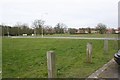
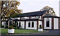
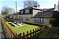
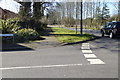
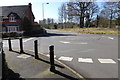
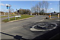
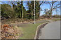
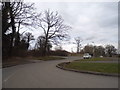
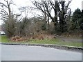
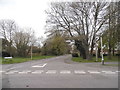
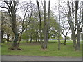
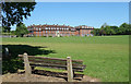
Photos of RG2 9ZG
Area Information
RG2 9ZG occupies a specific residential cluster within the postcode area, defined by a compact land size of 8,671 square metres. This small footprint supports a community of 1,934 residents, creating a neighbourly environment where the population density reaches 951 people per square kilometre. Living in this postcode means navigating a tightly knit setting where houses form the primary accommodation type. The area functions as a quiet residential hub rather than a commercial centre, focusing entirely on housing within its distinct boundaries. Prospective buyers seeking homes in RG2 9ZG find themselves in a settled location where daily life revolves around immediate local needs. The physical constraints of the land mean growth is naturally limited, preserving the character of the existing neighbourhood. This simplicity defines the area, offering a straightforward living experience without the complexity of larger mixed-use developments. You will experience a community where space is defined by proximity rather than scale.
- Area Type
- Postcode
- Area Size
- 8671 m²
- Population
- 1934
- Population Density
- 951 people/km²
RG2 9ZG presents a property market characterised by a strong emphasis on houses as the main accommodation type. The 50% home ownership rate indicates that half of the residents have purchased their properties, while the other half likely rent or are in the process of securing ownership. This balance suggests a market where buying is competitive but not prohibitive, with a significant portion of the population having already made the investment. Because the area covers only 8,671 square metres, the total number of available homes is inherently limited. You should treat this as a scarcity play when house hunting, as windows of opportunity open infrequently. The predominance of houses over other property types means you will not find large blocks of flats or converted apartments. This focus on single-family homes creates a consistent architectural aesthetic throughout the cluster. When considering homes in RG2 9ZG, expect a traditional market dynamic where established owners often list properties securely. The 50% ownership figure also hints at a stable community where families root themselves rather than move constantly.
House Prices in RG2 9ZG
Showing 15 properties
Energy Efficiency in RG2 9ZG
Residents of RG2 9ZG enjoy practical access to a range of amenities within a practical reach, though the immediate area is primarily residential. For daily shopping needs, you can visit the Co-op located at Arborfield, Finchampstead, or the Former location, providing a dependable choice of five nearby Co-op branches in the wider region. The shop infrastructure offers a standard selection of groceries and household essentials without the need for long travel. Transport links are also well established, with five railway stations accessible to locals including Wokingham Railway Station, Crowthorne Railway Station, and Winnersh Railway Station. These rail links facilitate easy commuting to major hubs like London. Additionally, Blackbushe Airport sits one station away, providing convenient regional travel options. While the postcode itself contains 8,671 square metres of housing, the surrounding network of stations and shops creates a dense web of convenience. You will find that daily necessities and transport planning require minimal effort given the density of nearby services.
Amenities
Schools
Bohunt School Wokingham serves as the key educational establishment for families living in RG2 9ZG. It operates as an academy and holds a good Ofsted rating, a status that reflects reliable standards in teaching and school life. This is the only named school in the immediate vicinity provided in the available data, meaning you primarily access education from this single facility for your children. The academy structure suggests modern governance and potentially increased autonomy in resource management compared to traditional maintained schools. For parents, the good rating provides reassurance regarding the quality of education your children will receive locally. The proximity of Bohunt School Wokingham means daily commutes for students should be manageable within the town's layout. When you look for schools near RG2 9ZG, this institution is your definitive choice based on the current information. Families should consider the specific intake policies of the academy, as a single local school can create pressure during admission applications. The good rating is a concrete metric you can rely on during your decision-making process.
| Rank | School | Type | Entry gender | Ages |
|---|
Explore more schools in this area
Go to Schools tabDemographics
The community in RG2 9ZG is dominated by adults aged between 30 and 64 years. The median age stands at 47, indicating a mature population with established households. House ownership levels sit exactly at 50%, suggesting an even split between owners and renters within this residential cluster. Accommodation consists primarily of houses, reinforcing the family-oriented nature of the settlement. The predominant ethnic group is White, reflecting the historical demographic make-up of the region. This demographic profile suggests an area attracted to stability and long-term settlement. While specific data on deprivation is not provided in the current records, the adult age range often correlates with financial security and willingness to invest in property maintenance. The 50% home ownership statistic implies a balanced market where buying into the area is a viable option for many. Understanding that nearly half the residents are outright owners helps you gauge the typical tenure length and community stickiness.
Household Size
Accommodation Type
Tenure
Ethnic Group
Religion
Household Composition
Age
Household Deprivation
NS-SEC
Explore more demographic insights in this area
Go to Demographics tabPlanning
Planning Constraints
- Flood RiskPremium
- Ramsar Wetland SitesPremium
- Area of Outstanding Natural BeautyPremium
- Protected Nature ReservePremium
- Protected WoodlandPremium