Area Overview for RG2 9YN
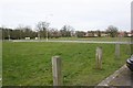
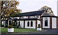
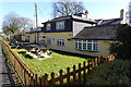
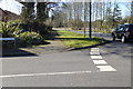
Photos of RG2 9YN
Area Information
Living in RG2 9YN offers a residential experience defined by its compact nature and clear demographic profile. This postcode covers a specific residential cluster spanning just 1.1 hectares. It accommodates a local population of 1,934 people, creating a tightly knit environment where residents know their neighbours. The area is situated in Berkshire, England, and hosts a population density of 951 people per square kilometre. This density suggests a neighbourhood where daily interactions are frequent but still maintain a private, housing-focused atmosphere. You will find that daily life here revolves around the built environment rather than expansive green spaces within the immediate boundary. The layout is designed primarily for housing, meaning local infrastructure supports domestic needs directly. Given the small footprint, amenities and transport nodes often border the immediate cluster, reducing the need for long commutes. Residents appreciate the proximity to Wokingham and Finchampstead, which are only a short drive away. This location serves as a quiet backdrop to the broader activity of the surrounding towns. The area attracts those seeking a stable, home-oriented life with limited exposure to through-traffic noise. It is a place where the boundary between private garden and public street is clearly defined. You can expect a consistent residential rhythm that avoids the unpredictability of mixed-use commercial zones. The 1.1 hectare size ensures that development pressure is locally contained, preserving the character of the homes found within. This makes RG2 9YN a practical choice for those prioritising a defined, small-scale community. The community in RG2 9YN reflects a mature household profile with a median age of 47. Most residents fall within the adult age range of 30 to 64 years, indicating a population that has likely settled into long-term living arrangements. Exactly 50% of households own their homes, a figure that suggests a balanced market between private ownership and renting. The remaining properties are predominantly houses, aligning with the fact that accommodation type in this postcode is listed as Houses. This housing stock supports families and older adults who prefer detached or semi-detached living over apartments. The predominant ethnic group is White, forming the baseline demographic of the local population. There are no other specific ethnic data points available to detail further diversity. You will find a community that values stability, evidenced by the high proportion of adults in their working or retirement years. The 47-year median age points to residents who have built careers and established families nearby. This age distribution often correlates with a desire for quality of life over rapid urban change. Because 50% of residents are homeowners, the area likely has a stronger sense of local investment. Tenants and owners coexist, but the equal split prevents an overwhelming dominance of either group. The demographic makeup excludes significant youth migration or elderly-only housing schemes. You are looking at a cross-section of the adult population who have chosen this area for its residential nature. The 951 people per square kilometre density mirrors this concentrated human interest. Living here means engaging with a group that has time for gardening, local clubs, and neighbourhood watch initiatives. This postcode area functions as a primarily residential zone where houses dominate the landscape. Data confirms that the predominant accommodation type is Houses, meaning you will find terraced, semi-detached, or detached properties rather than flats or sudden developments of blocks. With 50% of households owning their homes, the market reflects a significant commitment to long-term residency. The other half consists of rental properties, suggesting a steady stream of tenants or owner-occupiers purchasing to let. You would not expect a high-rise flat market here. The 1.1 hectare size limits the volume of new builds, reinforcing the established character of the stock. Buyers looking at RG2 9YN are entering a small cluster where property values are dictated by local scarcity. The fact that half the residents are owners indicates a stable neighbourhood where owners tend to maintain their properties. Rental properties serve professionals or families who move for work but remain for extended periods. The accommodation type of Houses implies that space is a priority for residents. You might encounter gardens, driveways, and garages as standard features of the properties. There are no indications of luxury complexes or student housing. The 50% ownership rate is a key metric for understanding the demographic stability. New entrants should anticipate buying a home that suits existing demand rather than a speculative niche. The market here is practical, driven by the need for housing in a constrained 1.1 hectare area. Families living in RG2 9YN have access to Bohunt School Wokingham, which is located nearby. This institution operates as an academy and holds a Ofsted rating of good. The school setting provides a solid educational foundation for children residing in the postcode. You cannot find other specific schools listed in the immediate data for this area, so Bohunt School Wokingham stands as the primary educational option referenced. The 'good' rating suggests the school meets national standards for teaching and leadership. As an academy, it enjoys operational independence from local authorities while remaining part of the state system. This structure often translates to flexible curriculum choices and modern resource management. Children in RG2 9YN will attend this school or similar institutions within a short bus journey. The proximity to a rated academy enhances the appeal of the area for students of all ages. Parents should note that the school type is specifically an academy. There are no private or secondary school details provided in the current dataset. The focus remains on this single, verified school location. Bohunt School Wokingham serves the wider community beyond just the 1.1 hectare boundary. Transport links to Wokingham facilitate easy access for catchment purposes. Living in RG2 9YN means giving a child the chance to attend a school with a positive inspection history. Digital connectivity in RG2 9YN is robust, supporting modern work and life requirements. The fixed broadband quality score is 80 out of 100, indicating good speed and reliability for working from home. The mobile coverage score is 82 out of 100, meaning signal strength for mobile devices is strong. These figures classify the area as having excellent internet infrastructure compared to national averages. You can trust that video calls, large file uploads, and smart home devices will function without interruption. This level of connectivity makes RG2 9YN a viable option for remote workers. Commuters rely on three main railway hubs within practical reach: Wokingham Railway Station, Crowthorne Railway Station, and Winnersh Railway Station. Rail links provide direct access to London and the wider network. Blackbushe Airport is one notable venue within reasonable distance, offering business aviation or private travel options. You have five rail stations and five retail-focused Co-op outlets very close by. The combination of rail access and high-speed broadband reduces dependency on physical roads for daily travel. Residents here enjoy a dual advantage of digital and physical mobility. Mobile phones work reliably outside the home for safety and communication. Broadband speeds support multiple users streaming simultaneously. This connectivity profile matches the needs of the 47-year-old median resident who may work from home or manage a small family business. Residents of RG2 9YN enjoy convenient access to five retail options, including Co-op Arborfield, Co-op Finchampstead, and Co-op Former. These outlets are situated within the nearby amenities list, ensuring daily shopping needs are met without travel. You do not need to commute into towns for groceries or household basics. Rail connectivity to Wokingham, Crowthorne, and Winnersh ensures you can reach larger districts quickly. Blackbushe Airport is one notable venue nearby, adding a touch of convenience for private travel or special cargo. The area supports a lifestyle centred on practicality and local sustainability. Five retail points mean competition and choice for residents. You can compare prices and stock levels at the different Co-op branches. Public transport via the rail network integrates seamlessly with local walking distances. The 1.1 hectare size means your daily walks end quickly at these facilities. There are no major leisure parks listed in the specific data, so entertainment relies on nearby towns. Dining options are likely found at the Co-op branches or adjacent pubs in the wider RG2 network. The character of the area is defined by proximity to essential services. It is a self-sufficient cluster where residents do not rely on distant town centres for survival. The five nearby rail stations reinforce the local commuter focus. Safety in RG2 9YN requires a nuanced view of environmental and criminal risks. The area passes all natural hazard assessments, including flood risk, Ramsar wetland sites, areas of outstanding natural beauty, protected nature reserves, and protected woodland. Your flood risk score is 0 out of 100, indicating low risk of rising water. These passes mean the location is free from major planning constraints or environmental dangers. However, the crime risk assessment shows a warning level with a score of 58 out of 100. This score denotes a medium crime risk where rates are around average. You should apply standard security precautions such as locking doors and securing valuables. Safety Score for crime is 58/100. This rating suggests that while the area is not high-risk, it is not crime-free either. Most residents experience a typical level of urban caution. The lack of protected nature areas removes a layer of rural tranquility but increases potential exposure to general suburban activity. The environmental side is clean of restrictions, so development is theoretically possible within planning rules. For the 1.1 hectare residential cluster, this balance is manageable. You should check local police reports for specific incidents near your chosen home. The 50% home ownership rate also helps neighbours look out for each other. Living here means accepting average crime levels in exchange for solid environmental safety. What is the community feel like in RG2 9YN? The community in RG2 9YN is stable and mature. With a median age of 47 and 951 people per square kilometre, neighbours tend to be adults seeking a quiet residential life. The 1.1 hectare size creates a tight-knit environment where familiarity exists but privacy is still respected. Who typically lives in this postcode area? Most residents are adults aged between 30 and 64 years. Half of the households own their homes, indicating a mix of established families and older professionals. Houses are the main accommodation type, reflecting a preference for homeownership over renting. Are there good schools near RG2 9YN? Yes, Bohunt School Wokingham is located nearby and is rated good by Ofsted. It operates as an academy. This provides a high-quality state education option for families living in the immediate vicinity without needing to travel far. How is transport and connectivity for residents? Connectivity is strong with a broadband score of 80 and mobile coverage of 82. Residents have easy access to Wokingham, Crowthorne, and Winnersh Railway Stations. Blackbushe Airport is also nearby. This setup supports remote work and efficient commuting across the region. Is RG2 9YN a safe area to live? The area has excellent environmental safety with zero risk of flooding or protected land constraints. However, crime risk is medium with a score of 58. You should use standard security precautions. Overall, it is a safe community for the 1,934 residents who live here.
- Area Type
- Postcode
- Area Size
- 1.1 hectares
- Population
- 1934
- Population Density
- 951 people/km²
This postcode area functions as a primarily residential zone where houses dominate the landscape. Data confirms that the predominant accommodation type is Houses, meaning you will find terraced, semi-detached, or detached properties rather than flats or sudden developments of blocks. With 50% of households owning their homes, the market reflects a significant commitment to long-term residency. The other half consists of rental properties, suggesting a steady stream of tenants or owner-occupiers purchasing to let. You would not expect a high-rise flat market here. The 1.1 hectare size limits the volume of new builds, reinforcing the established character of the stock. Buyers looking at RG2 9YN are entering a small cluster where property values are dictated by local scarcity. The fact that half the residents are owners indicates a stable neighbourhood where owners tend to maintain their properties. Rental properties serve professionals or families who move for work but remain for extended periods. The accommodation type of Houses implies that space is a priority for residents. You might encounter gardens, driveways, and garages as standard features of the properties. There are no indications of luxury complexes or student housing. The 50% ownership rate is a key metric for understanding the demographic stability. New entrants should anticipate buying a home that suits existing demand rather than a speculative niche. The market here is practical, driven by the need for housing in a constrained 1.1 hectare area. Families living in RG2 9YN have access to Bohunt School Wokingham, which is located nearby. This institution operates as an academy and holds a Ofsted rating of good. The school setting provides a solid educational foundation for children residing in the postcode. You cannot find other specific schools listed in the immediate data for this area, so Bohunt School Wokingham stands as the primary educational option referenced. The 'good' rating suggests the school meets national standards for teaching and leadership. As an academy, it enjoys operational independence from local authorities while remaining part of the state system. This structure often translates to flexible curriculum choices and modern resource management. Children in RG2 9YN will attend this school or similar institutions within a short bus journey. The proximity to a rated academy enhances the appeal of the area for students of all ages. Parents should note that the school type is specifically an academy. There are no private or secondary school details provided in the current dataset. The focus remains on this single, verified school location. Bohunt School Wokingham serves the wider community beyond just the 1.1 hectare boundary. Transport links to Wokingham facilitate easy access for catchment purposes. Living in RG2 9YN means giving a child the chance to attend a school with a positive inspection history. Digital connectivity in RG2 9YN is robust, supporting modern work and life requirements. The fixed broadband quality score is 80 out of 100, indicating good speed and reliability for working from home. The mobile coverage score is 82 out of 100, meaning signal strength for mobile devices is strong. These figures classify the area as having excellent internet infrastructure compared to national averages. You can trust that video calls, large file uploads, and smart home devices will function without interruption. This level of connectivity makes RG2 9YN a viable option for remote workers. Commuters rely on three main railway hubs within practical reach: Wokingham Railway Station, Crowthorne Railway Station, and Winnersh Railway Station. Rail links provide direct access to London and the wider network. Blackbushe Airport is one notable venue within reasonable distance, offering business aviation or private travel options. You have five rail stations and five retail-focused Co-op outlets very close by. The combination of rail access and high-speed broadband reduces dependency on physical roads for daily travel. Residents here enjoy a dual advantage of digital and physical mobility. Mobile phones work reliably outside the home for safety and communication. Broadband speeds support multiple users streaming simultaneously. This connectivity profile matches the needs of the 47-year-old median resident who may work from home or manage a small family business. Residents of RG2 9YN enjoy convenient access to five retail options, including Co-op Arborfield, Co-op Finchampstead, and Co-op Former. These outlets are situated within the nearby amenities list, ensuring daily shopping needs are met without travel. You do not need to commute into towns for groceries or household basics. Rail connectivity to Wokingham, Crowthorne, and Winnersh ensures you can reach larger districts quickly. Blackbushe Airport is one notable venue nearby, adding a touch of convenience for private travel or special cargo. The area supports a lifestyle centred on practicality and local sustainability. Five retail points mean competition and choice for residents. You can compare prices and stock levels at the different Co-op branches. Public transport via the rail network integrates seamlessly with local walking distances. The 1.1 hectare size means your daily walks end quickly at these facilities. There are no major leisure parks listed in the specific data, so entertainment relies on nearby towns. Dining options are likely found at the Co-op branches or adjacent pubs in the wider RG2 network. The character of the area is defined by proximity to essential services. It is a self-sufficient cluster where residents do not rely on distant town centres for survival. The five nearby rail stations reinforce the local commuter focus. Safety in RG2 9YN requires a nuanced view of environmental and criminal risks. The area passes all natural hazard assessments, including flood risk, Ramsar wetland sites, areas of outstanding natural beauty, protected nature reserves, and protected woodland. Your flood risk score is 0 out of 100, indicating low risk of rising water. These passes mean the location is free from major planning constraints or environmental dangers. However, the crime risk assessment shows a warning level with a score of 58 out of 100. This score denotes a medium crime risk where rates are around average. You should apply standard security precautions such as locking doors and securing valuables. Safety Score for crime is 58/100. This rating suggests that while the area is not high-risk, it is not crime-free either. Most residents experience a typical level of urban caution. The lack of protected nature areas removes a layer of rural tranquility but increases potential exposure to general suburban activity. The environmental side is clean of restrictions, so development is theoretically possible within planning rules. For the 1.1 hectare residential cluster, this balance is manageable. You should check local police reports for specific incidents near your chosen home. The 50% home ownership rate also helps neighbours look out for each other. Living here means accepting average crime levels in exchange for solid environmental safety. What is the community feel like in RG2 9YN? The community in RG2 9YN is stable and mature. With a median age of 47 and 951 people per square kilometre, neighbours tend to be adults seeking a quiet residential life. The 1.1 hectare size creates a tight-knit environment where familiarity exists but privacy is still respected. Who typically lives in this postcode area? Most residents are adults aged between 30 and 64 years. Half of the households own their homes, indicating a mix of established families and older professionals. Houses are the main accommodation type, reflecting a preference for homeownership over renting. Are there good schools near RG2 9YN? Yes, Bohunt School Wokingham is located nearby and is rated good by Ofsted. It operates as an academy. This provides a high-quality state education option for families living in the immediate vicinity without needing to travel far. How is transport and connectivity for residents? Connectivity is strong with a broadband score of 80 and mobile coverage of 82. Residents have easy access to Wokingham, Crowthorne, and Winnersh Railway Stations. Blackbushe Airport is also nearby. This setup supports remote work and efficient commuting across the region. Is RG2 9YN a safe area to live? The area has excellent environmental safety with zero risk of flooding or protected land constraints. However, crime risk is medium with a score of 58. You should use standard security precautions. Overall, it is a safe community for the 1,934 residents who live here.
House Prices in RG2 9YN
Showing 15 properties
Energy Efficiency in RG2 9YN
Residents of RG2 9YN enjoy convenient access to five retail options, including Co-op Arborfield, Co-op Finchampstead, and Co-op Former. These outlets are situated within the nearby amenities list, ensuring daily shopping needs are met without travel. You do not need to commute into towns for groceries or household basics. Rail connectivity to Wokingham, Crowthorne, and Winnersh ensures you can reach larger districts quickly. Blackbushe Airport is one notable venue nearby, adding a touch of convenience for private travel or special cargo. The area supports a lifestyle centred on practicality and local sustainability. Five retail points mean competition and choice for residents. You can compare prices and stock levels at the different Co-op branches. Public transport via the rail network integrates seamlessly with local walking distances. The 1.1 hectare size means your daily walks end quickly at these facilities. There are no major leisure parks listed in the specific data, so entertainment relies on nearby towns. Dining options are likely found at the Co-op branches or adjacent pubs in the wider RG2 network. The character of the area is defined by proximity to essential services. It is a self-sufficient cluster where residents do not rely on distant town centres for survival. The five nearby rail stations reinforce the local commuter focus. Safety in RG2 9YN requires a nuanced view of environmental and criminal risks. The area passes all natural hazard assessments, including flood risk, Ramsar wetland sites, areas of outstanding natural beauty, protected nature reserves, and protected woodland. Your flood risk score is 0 out of 100, indicating low risk of rising water. These passes mean the location is free from major planning constraints or environmental dangers. However, the crime risk assessment shows a warning level with a score of 58 out of 100. This score denotes a medium crime risk where rates are around average. You should apply standard security precautions such as locking doors and securing valuables. Safety Score for crime is 58/100. This rating suggests that while the area is not high-risk, it is not crime-free either. Most residents experience a typical level of urban caution. The lack of protected nature areas removes a layer of rural tranquility but increases potential exposure to general suburban activity. The environmental side is clean of restrictions, so development is theoretically possible within planning rules. For the 1.1 hectare residential cluster, this balance is manageable. You should check local police reports for specific incidents near your chosen home. The 50% home ownership rate also helps neighbours look out for each other. Living here means accepting average crime levels in exchange for solid environmental safety. What is the community feel like in RG2 9YN? The community in RG2 9YN is stable and mature. With a median age of 47 and 951 people per square kilometre, neighbours tend to be adults seeking a quiet residential life. The 1.1 hectare size creates a tight-knit environment where familiarity exists but privacy is still respected. Who typically lives in this postcode area? Most residents are adults aged between 30 and 64 years. Half of the households own their homes, indicating a mix of established families and older professionals. Houses are the main accommodation type, reflecting a preference for homeownership over renting. Are there good schools near RG2 9YN? Yes, Bohunt School Wokingham is located nearby and is rated good by Ofsted. It operates as an academy. This provides a high-quality state education option for families living in the immediate vicinity without needing to travel far. How is transport and connectivity for residents? Connectivity is strong with a broadband score of 80 and mobile coverage of 82. Residents have easy access to Wokingham, Crowthorne, and Winnersh Railway Stations. Blackbushe Airport is also nearby. This setup supports remote work and efficient commuting across the region. Is RG2 9YN a safe area to live? The area has excellent environmental safety with zero risk of flooding or protected land constraints. However, crime risk is medium with a score of 58. You should use standard security precautions. Overall, it is a safe community for the 1,934 residents who live here.
Amenities
Schools
Families living in RG2 9YN have access to Bohunt School Wokingham, which is located nearby. This institution operates as an academy and holds a Ofsted rating of good. The school setting provides a solid educational foundation for children residing in the postcode. You cannot find other specific schools listed in the immediate data for this area, so Bohunt School Wokingham stands as the primary educational option referenced. The 'good' rating suggests the school meets national standards for teaching and leadership. As an academy, it enjoys operational independence from local authorities while remaining part of the state system. This structure often translates to flexible curriculum choices and modern resource management. Children in RG2 9YN will attend this school or similar institutions within a short bus journey. The proximity to a rated academy enhances the appeal of the area for students of all ages. Parents should note that the school type is specifically an academy. There are no private or secondary school details provided in the current dataset. The focus remains on this single, verified school location. Bohunt School Wokingham serves the wider community beyond just the 1.1 hectare boundary. Transport links to Wokingham facilitate easy access for catchment purposes. Living in RG2 9YN means giving a child the chance to attend a school with a positive inspection history. Digital connectivity in RG2 9YN is robust, supporting modern work and life requirements. The fixed broadband quality score is 80 out of 100, indicating good speed and reliability for working from home. The mobile coverage score is 82 out of 100, meaning signal strength for mobile devices is strong. These figures classify the area as having excellent internet infrastructure compared to national averages. You can trust that video calls, large file uploads, and smart home devices will function without interruption. This level of connectivity makes RG2 9YN a viable option for remote workers. Commuters rely on three main railway hubs within practical reach: Wokingham Railway Station, Crowthorne Railway Station, and Winnersh Railway Station. Rail links provide direct access to London and the wider network. Blackbushe Airport is one notable venue within reasonable distance, offering business aviation or private travel options. You have five rail stations and five retail-focused Co-op outlets very close by. The combination of rail access and high-speed broadband reduces dependency on physical roads for daily travel. Residents here enjoy a dual advantage of digital and physical mobility. Mobile phones work reliably outside the home for safety and communication. Broadband speeds support multiple users streaming simultaneously. This connectivity profile matches the needs of the 47-year-old median resident who may work from home or manage a small family business. Residents of RG2 9YN enjoy convenient access to five retail options, including Co-op Arborfield, Co-op Finchampstead, and Co-op Former. These outlets are situated within the nearby amenities list, ensuring daily shopping needs are met without travel. You do not need to commute into towns for groceries or household basics. Rail connectivity to Wokingham, Crowthorne, and Winnersh ensures you can reach larger districts quickly. Blackbushe Airport is one notable venue nearby, adding a touch of convenience for private travel or special cargo. The area supports a lifestyle centred on practicality and local sustainability. Five retail points mean competition and choice for residents. You can compare prices and stock levels at the different Co-op branches. Public transport via the rail network integrates seamlessly with local walking distances. The 1.1 hectare size means your daily walks end quickly at these facilities. There are no major leisure parks listed in the specific data, so entertainment relies on nearby towns. Dining options are likely found at the Co-op branches or adjacent pubs in the wider RG2 network. The character of the area is defined by proximity to essential services. It is a self-sufficient cluster where residents do not rely on distant town centres for survival. The five nearby rail stations reinforce the local commuter focus. Safety in RG2 9YN requires a nuanced view of environmental and criminal risks. The area passes all natural hazard assessments, including flood risk, Ramsar wetland sites, areas of outstanding natural beauty, protected nature reserves, and protected woodland. Your flood risk score is 0 out of 100, indicating low risk of rising water. These passes mean the location is free from major planning constraints or environmental dangers. However, the crime risk assessment shows a warning level with a score of 58 out of 100. This score denotes a medium crime risk where rates are around average. You should apply standard security precautions such as locking doors and securing valuables. Safety Score for crime is 58/100. This rating suggests that while the area is not high-risk, it is not crime-free either. Most residents experience a typical level of urban caution. The lack of protected nature areas removes a layer of rural tranquility but increases potential exposure to general suburban activity. The environmental side is clean of restrictions, so development is theoretically possible within planning rules. For the 1.1 hectare residential cluster, this balance is manageable. You should check local police reports for specific incidents near your chosen home. The 50% home ownership rate also helps neighbours look out for each other. Living here means accepting average crime levels in exchange for solid environmental safety. What is the community feel like in RG2 9YN? The community in RG2 9YN is stable and mature. With a median age of 47 and 951 people per square kilometre, neighbours tend to be adults seeking a quiet residential life. The 1.1 hectare size creates a tight-knit environment where familiarity exists but privacy is still respected. Who typically lives in this postcode area? Most residents are adults aged between 30 and 64 years. Half of the households own their homes, indicating a mix of established families and older professionals. Houses are the main accommodation type, reflecting a preference for homeownership over renting. Are there good schools near RG2 9YN? Yes, Bohunt School Wokingham is located nearby and is rated good by Ofsted. It operates as an academy. This provides a high-quality state education option for families living in the immediate vicinity without needing to travel far. How is transport and connectivity for residents? Connectivity is strong with a broadband score of 80 and mobile coverage of 82. Residents have easy access to Wokingham, Crowthorne, and Winnersh Railway Stations. Blackbushe Airport is also nearby. This setup supports remote work and efficient commuting across the region. Is RG2 9YN a safe area to live? The area has excellent environmental safety with zero risk of flooding or protected land constraints. However, crime risk is medium with a score of 58. You should use standard security precautions. Overall, it is a safe community for the 1,934 residents who live here.
| Rank | School | Type | Entry gender | Ages |
|---|
Explore more schools in this area
Go to Schools tabDemographics
The community in RG2 9YN reflects a mature household profile with a median age of 47. Most residents fall within the adult age range of 30 to 64 years, indicating a population that has likely settled into long-term living arrangements. Exactly 50% of households own their homes, a figure that suggests a balanced market between private ownership and renting. The remaining properties are predominantly houses, aligning with the fact that accommodation type in this postcode is listed as Houses. This housing stock supports families and older adults who prefer detached or semi-detached living over apartments. The predominant ethnic group is White, forming the baseline demographic of the local population. There are no other specific ethnic data points available to detail further diversity. You will find a community that values stability, evidenced by the high proportion of adults in their working or retirement years. The 47-year median age points to residents who have built careers and established families nearby. This age distribution often correlates with a desire for quality of life over rapid urban change. Because 50% of residents are homeowners, the area likely has a stronger sense of local investment. Tenants and owners coexist, but the equal split prevents an overwhelming dominance of either group. The demographic makeup excludes significant youth migration or elderly-only housing schemes. You are looking at a cross-section of the adult population who have chosen this area for its residential nature. The 951 people per square kilometre density mirrors this concentrated human interest. Living here means engaging with a group that has time for gardening, local clubs, and neighbourhood watch initiatives. This postcode area functions as a primarily residential zone where houses dominate the landscape. Data confirms that the predominant accommodation type is Houses, meaning you will find terraced, semi-detached, or detached properties rather than flats or sudden developments of blocks. With 50% of households owning their homes, the market reflects a significant commitment to long-term residency. The other half consists of rental properties, suggesting a steady stream of tenants or owner-occupiers purchasing to let. You would not expect a high-rise flat market here. The 1.1 hectare size limits the volume of new builds, reinforcing the established character of the stock. Buyers looking at RG2 9YN are entering a small cluster where property values are dictated by local scarcity. The fact that half the residents are owners indicates a stable neighbourhood where owners tend to maintain their properties. Rental properties serve professionals or families who move for work but remain for extended periods. The accommodation type of Houses implies that space is a priority for residents. You might encounter gardens, driveways, and garages as standard features of the properties. There are no indications of luxury complexes or student housing. The 50% ownership rate is a key metric for understanding the demographic stability. New entrants should anticipate buying a home that suits existing demand rather than a speculative niche. The market here is practical, driven by the need for housing in a constrained 1.1 hectare area. Families living in RG2 9YN have access to Bohunt School Wokingham, which is located nearby. This institution operates as an academy and holds a Ofsted rating of good. The school setting provides a solid educational foundation for children residing in the postcode. You cannot find other specific schools listed in the immediate data for this area, so Bohunt School Wokingham stands as the primary educational option referenced. The 'good' rating suggests the school meets national standards for teaching and leadership. As an academy, it enjoys operational independence from local authorities while remaining part of the state system. This structure often translates to flexible curriculum choices and modern resource management. Children in RG2 9YN will attend this school or similar institutions within a short bus journey. The proximity to a rated academy enhances the appeal of the area for students of all ages. Parents should note that the school type is specifically an academy. There are no private or secondary school details provided in the current dataset. The focus remains on this single, verified school location. Bohunt School Wokingham serves the wider community beyond just the 1.1 hectare boundary. Transport links to Wokingham facilitate easy access for catchment purposes. Living in RG2 9YN means giving a child the chance to attend a school with a positive inspection history. Digital connectivity in RG2 9YN is robust, supporting modern work and life requirements. The fixed broadband quality score is 80 out of 100, indicating good speed and reliability for working from home. The mobile coverage score is 82 out of 100, meaning signal strength for mobile devices is strong. These figures classify the area as having excellent internet infrastructure compared to national averages. You can trust that video calls, large file uploads, and smart home devices will function without interruption. This level of connectivity makes RG2 9YN a viable option for remote workers. Commuters rely on three main railway hubs within practical reach: Wokingham Railway Station, Crowthorne Railway Station, and Winnersh Railway Station. Rail links provide direct access to London and the wider network. Blackbushe Airport is one notable venue within reasonable distance, offering business aviation or private travel options. You have five rail stations and five retail-focused Co-op outlets very close by. The combination of rail access and high-speed broadband reduces dependency on physical roads for daily travel. Residents here enjoy a dual advantage of digital and physical mobility. Mobile phones work reliably outside the home for safety and communication. Broadband speeds support multiple users streaming simultaneously. This connectivity profile matches the needs of the 47-year-old median resident who may work from home or manage a small family business. Residents of RG2 9YN enjoy convenient access to five retail options, including Co-op Arborfield, Co-op Finchampstead, and Co-op Former. These outlets are situated within the nearby amenities list, ensuring daily shopping needs are met without travel. You do not need to commute into towns for groceries or household basics. Rail connectivity to Wokingham, Crowthorne, and Winnersh ensures you can reach larger districts quickly. Blackbushe Airport is one notable venue nearby, adding a touch of convenience for private travel or special cargo. The area supports a lifestyle centred on practicality and local sustainability. Five retail points mean competition and choice for residents. You can compare prices and stock levels at the different Co-op branches. Public transport via the rail network integrates seamlessly with local walking distances. The 1.1 hectare size means your daily walks end quickly at these facilities. There are no major leisure parks listed in the specific data, so entertainment relies on nearby towns. Dining options are likely found at the Co-op branches or adjacent pubs in the wider RG2 network. The character of the area is defined by proximity to essential services. It is a self-sufficient cluster where residents do not rely on distant town centres for survival. The five nearby rail stations reinforce the local commuter focus. Safety in RG2 9YN requires a nuanced view of environmental and criminal risks. The area passes all natural hazard assessments, including flood risk, Ramsar wetland sites, areas of outstanding natural beauty, protected nature reserves, and protected woodland. Your flood risk score is 0 out of 100, indicating low risk of rising water. These passes mean the location is free from major planning constraints or environmental dangers. However, the crime risk assessment shows a warning level with a score of 58 out of 100. This score denotes a medium crime risk where rates are around average. You should apply standard security precautions such as locking doors and securing valuables. Safety Score for crime is 58/100. This rating suggests that while the area is not high-risk, it is not crime-free either. Most residents experience a typical level of urban caution. The lack of protected nature areas removes a layer of rural tranquility but increases potential exposure to general suburban activity. The environmental side is clean of restrictions, so development is theoretically possible within planning rules. For the 1.1 hectare residential cluster, this balance is manageable. You should check local police reports for specific incidents near your chosen home. The 50% home ownership rate also helps neighbours look out for each other. Living here means accepting average crime levels in exchange for solid environmental safety. What is the community feel like in RG2 9YN? The community in RG2 9YN is stable and mature. With a median age of 47 and 951 people per square kilometre, neighbours tend to be adults seeking a quiet residential life. The 1.1 hectare size creates a tight-knit environment where familiarity exists but privacy is still respected. Who typically lives in this postcode area? Most residents are adults aged between 30 and 64 years. Half of the households own their homes, indicating a mix of established families and older professionals. Houses are the main accommodation type, reflecting a preference for homeownership over renting. Are there good schools near RG2 9YN? Yes, Bohunt School Wokingham is located nearby and is rated good by Ofsted. It operates as an academy. This provides a high-quality state education option for families living in the immediate vicinity without needing to travel far. How is transport and connectivity for residents? Connectivity is strong with a broadband score of 80 and mobile coverage of 82. Residents have easy access to Wokingham, Crowthorne, and Winnersh Railway Stations. Blackbushe Airport is also nearby. This setup supports remote work and efficient commuting across the region. Is RG2 9YN a safe area to live? The area has excellent environmental safety with zero risk of flooding or protected land constraints. However, crime risk is medium with a score of 58. You should use standard security precautions. Overall, it is a safe community for the 1,934 residents who live here.
Household Size
Accommodation Type
Tenure
Ethnic Group
Religion
Household Composition
Age
Household Deprivation
NS-SEC
Explore more demographic insights in this area
Go to Demographics tabPlanning
Planning Constraints
- Flood RiskPremium
- Ramsar Wetland SitesPremium
- Area of Outstanding Natural BeautyPremium
- Protected Nature ReservePremium
- Protected WoodlandPremium