Area Overview for RG2 9WU
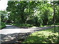
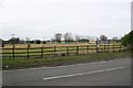
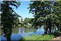
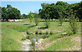
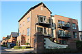
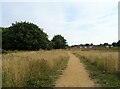
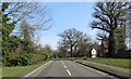
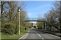
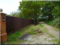
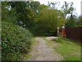
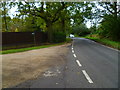
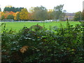
Photos of RG2 9WU
Area Information
The postcode area RG2 9WU represents a compact residential cluster covering 1,071 square metres. This small geography concentrates 1,734 residents within a space defined by high density rather than sprawling estates. Understanding this area requires recognising that 951 people per square kilometre creates an environment where neighbours are naturally closer, simplifying community interactions but reducing private space. Living in RG2 9WU means navigating a specific slice of the Wokingham district where life moves at a pace dictated by local infrastructure. The area functions as a dedicated home zone rather than a commercial hub, prioritising domestic needs over nightlife or industrial activity. Your daily routine will centre on accessing essential services like Co-op shops or赶往 nearby railway stations. The built environment is dominated by houses, reflecting a traditional suburban planning approach found across Berkshire. Although the area is small, its connection to wider transport networks through nearby Wokingham and Winnersh stations ensures it remains integrated with the regional economy. This postcode serves as a starting point for exploring homes in a region that balances rural tranquillity with commuter convenience. You are stepping into a defined community where the scale of development matches the footprint of the people living here.
- Area Type
- Postcode
- Area Size
- 1071 m²
- Population
- 1934
- Population Density
- 951 people/km²
The housing landscape in RG2 9WU is defined by its exclusive focus on detached and semi-detached structures. Fifty per cent of the total population owns their accommodation, establishing this as an owner-occupied zone rather than a rent-heavy district. This high ownership rate typically correlates with increased house prices and lower tenant turnover. The remaining housing stock supports the other half of the population through long-term leases or second-home ownership. Since houses are the predominant accommodation type, you will not find apartment blocks or terraced rows within this specific postcode. This architectural uniformity creates a consistent streetscape that appeals to buyers seeking traditional British suburban living. When looking at homes in RG2 9WU, your search filters naturally to properties with front gardens and driveways. The small size of the area, measuring just over a thousand square metres, means that inventory is limited. Property values here reflect the demand for secure tenure within a high-density cluster. Buyers should anticipate competition for available houses given the strong owner-occupation baseline. The market operates on local logic where availability drives prices upward. Prospective homeowners value the security of buying into a community where residents are likely to stay for decades.
House Prices in RG2 9WU
Showing 6 properties
| Address | Type | Beds | Baths | Last Sale Price | Last Sale Date | |
|---|---|---|---|---|---|---|
| Flat 3, Drake Court, 5 Shelduck Drive, Reading, RG2 9WU | Flat | - | - | - | - | |
| Flat 5, Drake Court, 5 Shelduck Drive, Reading, RG2 9WU | Flat | - | - | - | - | |
| Flat 2, Drake Court, 5 Shelduck Drive, Reading, RG2 9WU | Flat | - | - | - | - | |
| Flat 6, Drake Court, 5 Shelduck Drive, Reading, RG2 9WU | Flat | - | - | - | - | |
| Flat 1, Drake Court, 5 Shelduck Drive, Reading, RG2 9WU | Flat | - | - | - | - | |
| Flat 4, Drake Court, 5 Shelduck Drive, Reading, RG2 9WU | Flat | - | - | - | - |
Energy Efficiency in RG2 9WU
Your lifestyle in RG2 9WU revolves around practical access to essential retail and travel hubs. Five notable retailers operate within practical reach, including Co-op Arborfield, Co-op Finchampstead, and Lidl Wokingham. These specific locations offer a blend of fresh food and everyday necessities without requiring a long car journey. For travel, five railway stations lie nearby, most notably Wokingham Railway Station, Winnersh Railway Station, and Crowthorne Railway Station. This rail network provides direct links to Reading, London, and surrounding towns for commuters or visitors. Aviation access is available through Blackbushe Airport, offering private flight options for those with specific travel needs. The local amenities create a self-sufficient loop where you can shop, work, and travel without leaving the county. Daily errands become efficient because Co-op stores and railheads are within manageable distance. This concentration of services removes the need to travel further afield for basic goods. You live in a setting where convenience dictates the rhythm of your day. The presence of these specific named venues ensures that your quality of life depends on reliable, named services rather than vague shopping districts.
Amenities
Schools
Families considering schools near RG2 9WU have one primary option listed in immediate proximity. Bohunt School Wokingham operates as an academy with a good Ofsted rating. This single institution serves as the main educational reference point for the area. The presence of a good-rated academy provides a straightforward assessment of educational quality for parents. While the data lists only this one gateway school, it signals that the local authority has prioritised accredited education in this sector. The school type as an academy implies direct state funding while allowing operational autonomy from the local council. Children attending Bohunt School Wokingham benefit from a curriculum inspected and rated as good by Ofsted officials. There are no secondary schools, primary schools, or sixth forms listed in the immediate vicinity within the provided records. Parents must rely on this academy for local schooling or consider transport links to other institutions outside the immediate postcode. The mix is exclusively academy-led, removing the variable of maintained school variations. This consistency can offer predictability regarding performance metrics for families settling in RG2 9WU. You can rest assured that the academic standard meets the national criteria for a good rating.
| Rank | School | Type | Entry gender | Ages |
|---|
Explore more schools in this area
Go to Schools tabDemographics
The community within RG2 9WU reflects the lifecycle of stable families. The population median age stands at 47 years, confirming that Adults between 30 and 64 years dominate the demographic profile. This age distribution suggests a neighbourhood populated by established professionals rather than students or young renters. Fifty per cent of residents own their homes, indicating a market where long-term residents have secured property assets. The remaining half likely comprises rented households or those approaching retirement. Fewer than 64-year-olds form a smaller segment compared to the core adult group. Housing stock consists almost entirely of houses, distinguishing this area from urban blocks of flats or terraced housing. Ethnic identification is predominantly White, mirroring the broader historical settlement patterns of Berkshire. With a settlement density of 951 people per square kilometre, you live in a population that is thicker than the national average but not dense enough to create the intensity of major cities. The area offers a quiet setting where daily life does not revolve around transient populations. You are joining a cohort of residents who value stability within a house-based living arrangement.
Household Size
Accommodation Type
Tenure
Ethnic Group
Religion
Household Composition
Age
Household Deprivation
NS-SEC
Explore more demographic insights in this area
Go to Demographics tabPlanning
Planning Constraints
- Flood RiskPremium
- Ramsar Wetland SitesPremium
- Area of Outstanding Natural BeautyPremium
- Protected Nature ReservePremium
- Protected WoodlandPremium