Area Overview for RG2 9UU
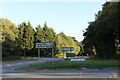
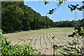
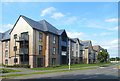
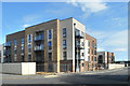
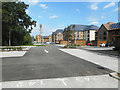
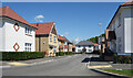
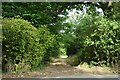
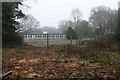
Photos of RG2 9UU
Area Information
Living in RG2 9UU offers a specific residential experience within a small cluster covering 1,370 square metres. The area serves a population of 3,322 people, creating a community that feels manageable yet established. This postcode is characterised by a distinct lack of planning constraints, with no flood risk, Ramsar wetland sites, Areas of Outstanding Natural Beauty, protected nature reserves, or protected woodland affecting the local environment. Such clearances allow for straightforward property ownership without significant environmental restrictions. Residents typically enjoy a straightforward daily life where safety and stability are central themes. The area functions as a quiet residential zone rather than a bustling commercial hub, focusing on the needs of the local population. Prospective buyers can expect an environment defined by its exclusivity from major planning complexities. The limited footprint of the land ensures that the neighbourhood retains its specific identity. You will find a setting where practical considerations like safety and connectivity take precedence over dramatic landscape features. The area stands out for its clear record on environmental assessments, which is a tangible benefit for anyone considering homes in RG2 9UU.
- Area Type
- Postcode
- Area Size
- 1370 m²
- Population
- 3322
- Population Density
- 404 people/km²
The property market in RG2 9UU is defined by a strong bias towards owner-occupation. With 77% of residents owning their homes, the area offers a stable environment for buyers rather than a volatile rental sector. Houses form the main accommodation type, meaning that apartments or flats are rare or absent from the local stock. This focus on houses indicates that the area caters to families or individuals seeking traditional residential living. If you look for homes in RG2 9UU, you will encounter properties designed for long-term settlement rather than short-term letting. The high ownership rate signals confidence in the local market and a preference for stability among current residents. There is little evidence of renting culture here, which often translates to lower turnover rates and more cohesive neighbourhoods. For buyers, this structure suggests that properties tend to stay with the same families for extended periods. The market does not rely on investor speculation but rather on local demand from people intending to stay. This dynamic creates a predictable environment for those looking to purchase a property in this specific postcode area.
House Prices in RG2 9UU
Showing 9 properties
Energy Efficiency in RG2 9UU
Daily life in RG2 9UU is supported by a range of amenities accessible within practical reach of your postcode. Five retail locations serve the local shopping needs, with notable Co-op branches located at Arborfield, Finchampstead, and Former sites. These Cooperatives provide essentials for grocery shopping and everyday goods directly to your neighbourhood. For travel and transport logistics, residents have access to five railway stations including Wokingham, Crowthorne, and Winnersh. This variety allows for flexible commuting options to various destinations across the region. Blackbushe Airport is also situated nearby, adding an extra layer of connectivity for those requiring air travel. While the area itself focuses on residential living, the proximity to these commercial and transport hubs means you do not need to travel far for essential services. Living in RG2 9UU gives you a balance of quiet residential space with the convenience of major retail chains and transport links. You can walk or take a short drive to your chosen Co-op for groceries or head to the nearest rail station for your daily commute.
Amenities
Schools
Families living in RG2 9UU benefit from access to two primary educational institutions within their immediate vicinity. Gorse Ride Junior School holds a good Ofsted rating, providing secondary education for younger children in the local system. Complementing this is Gorse Ride Infants' School, which also carries a good Ofsted rating and serves the early years of a child's education. Having both infant and junior phases represented locally ensures that children can often attend school near home without needing transport to a different catchment area. The consistent good rating across both schools indicates a standard of education that meets the requirements of parents in the area. You will not find any state-specified ratings of "outstanding" in the immediate list of schools for this postcode, but the good ratings provide reassurance on quality. For residents prioritising education, the availability of these named schools removes the need to commute for primary schooling. The presence of two separate schools for different age groups within the local network supports the needs of families with children at various stages of their development.
| Rank | School | Type | Entry gender | Ages |
|---|
Explore more schools in this area
Go to Schools tabDemographics
The community in RG2 9UU reflects a mature, stable demographic profile. The median age stands at 47 years, indicating a resident population dominated by adults aged between 30 and 64. This age distribution suggests a neighbourhood where families with young children and established households coexist comfortably. Home ownership is the norm, with 77% of residents owning their property outright or with a mortgage. This high level of ownership points to long-term residency and community investment rather than transient rental living. The primary form of accommodation consists of houses, catering specifically to those seeking standalone or semi-independent residential units. The predominant ethnic group is White, mirroring the broader demographics of this region of England. These figures paint a picture of a settled community where life has been established over time. The proportion of owner-occupiers means that the local demographics tend to be consistent rather than fluctuating rapidly with market trends. When considering living in RG2 9UU, you are entering an area where residents have taken root and built lasting ties to their homes. The stability is evident in the fact that nearly four out of five households are owned.
Household Size
Accommodation Type
Tenure
Ethnic Group
Religion
Household Composition
Age
Household Deprivation
NS-SEC
Explore more demographic insights in this area
Go to Demographics tabPlanning
Planning Constraints
- Flood RiskPremium
- Ramsar Wetland SitesPremium
- Area of Outstanding Natural BeautyPremium
- Protected Nature ReservePremium
- Protected WoodlandPremium