Area Overview for RG2 9NR
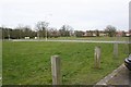
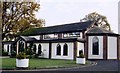
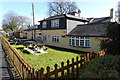
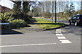
Photos of RG2 9NR
Area Information
Living in RG2 9NR offers a specific type of residential experience defined by its compact scale and established character. This postcode covers a precise area of 1.3 hectares, creating a tight-knit environment where residents often know one another. The population stands at 1,421 people, meaning you will rarely encounter the crowds found in larger town centres. Instead, daily life here revolves around a quiet, residential cluster where the pace tends to be slower. The density is notable, with 105,638 people per square kilometre, indicating houses are situated closely together. You are entering a setting that has evolved alongside the wider Windsor & Maidenhead lifestyle, distinct from the more urbanised Midlands. The area functions as a legitimate home for families who value a smaller footprint. While the land is limited, the concentration of residents creates a sense of community without the anonymity of vast estates. This small geographical boundary ensures that noise from neighbours spreads quickly and the public realm has specific, defined edges. For a homebuyer, RG2 9NR represents a settled location where the layout of the estate is fixed and the local atmosphere is well established. You are looking at a place where the built environment is mature and the population has been stable for a significant period.
- Area Type
- Postcode
- Area Size
- 1.3 hectares
- Population
- 1421
- Population Density
- 4191 people/km²
The housing stock in RG2 9NR is defined entirely by houses, as confirmed by the accommodation type data. This means you will not find large blocks of flats or recent apartment complexes within this specific postcode. The market is predominantly owner-occupied, with 61% of households holding deeds to their property. This statistic paints a clear picture of a settled residential area where residents have invested in long-term living rather than entering the rental market. Consequently, the properties available are likely to be owner-occupied homes that have remained in the same hands for extended periods. The high level of ownership implies a community often cared for by those with the highest stake in the condition of the streets. When you look at homes in RG2 9NR, you are looking for traditional family houses rather than modern social housing or private rentals. The small size of the area, covering just 1.3 hectares, limits the total number of properties available. This scarcity means competition for specific addresses can be fierce. The housing inventory is static, relying on the slower turnover typical of owner-occupied markets where sellers hold onto their assets for the long term.
House Prices in RG2 9NR
Showing 39 properties
| Address | Type | Beds | Baths | Last Sale Price | Last Sale Date | |
|---|---|---|---|---|---|---|
| 1 Faraday Close, Arborfield, RG2 9NR | Terraced | 3 | - | - | - | |
| 13 Faraday Close, Arborfield, RG2 9NR | Terraced | 3 | 1 | - | - | |
| 12 Faraday Close, Arborfield, RG2 9NR | Terraced | - | - | - | - | |
| 24 Faraday Close, Arborfield, RG2 9NR | Terraced | 3 | 1 | - | - | |
| 31 Faraday Close, Arborfield, RG2 9NR | Terraced | 3 | 1 | - | - | |
| 32 Faraday Close, Arborfield, RG2 9NR | Terraced | 3 | 1 | - | - | |
| 23 Faraday Close, Arborfield, RG2 9NR | Terraced | 3 | - | - | - | |
| 36 Faraday Close, Arborfield, RG2 9NR | Terraced | 3 | 1 | - | - | |
| 37 Faraday Close, Arborfield, RG2 9NR | Terraced | 4 | 1 | - | - | |
| 28 Faraday Close, Arborfield, RG2 9NR | Terraced | 3 | 1 | - | - |
Energy Efficiency in RG2 9NR
Your daily routine in RG2 9NR is serviced by a practical network of nearby amenities located within easy reach. Three Co-op stores anchor the retail landscape, specifically the locations at Arborfield, Finchampstead, and the Former site. These shops provide essential groceries and household items without requiring a long journey into a major city centre. You have five distinct rail stations to choose from for your commute, including Wokingham Railway Station, Winnersh Railway Station, and Winnersh Triangle Railway Station. These transport hubs connect you to the wider south-east rail network efficiently. Blackbushe Airport is the singular aviation facility listed as a nearby amenity, providing a unique local point of reference. While the immediate 1.3-hectare zone contains only residential housing, the reach of these five retail outlets and five railway stations extends your lifestyle radius considerably. Living here means stepping a short distance or driving a few minutes to access your weekly shopping or catch a train. The convenience of having multiple Co-op branches means you can choose the location nearest to your home from the three available options. This arrangement supports a self-sufficient routine where daily needs are met close to home, yet long-distance travel remains accessible through the rail network.
Amenities
Schools
| Rank | School | Type | Entry gender | Ages |
|---|
Explore more schools in this area
Go to Schools tabDemographics
The community in RG2 9NR reflects a mature demographic profile with a median age of 47 years. Most residents fall into the working-age bracket between 30 and 64 years, suggesting a household population that is actively engaged in employment or managing families. This age distribution points towards an area settled by people who have established roots rather than students or young professionals just starting their careers. Home ownership is high at 61%, indicating that the majority of those living here own their properties outright or have significant equity in their homes. This high rate of ownership suggests the local population values stability and permanence. The predominant ethnic group is White, which aligns with the broader demographic trends of the wider Berkshire region. Houses are the primary accommodation type, confirming that flats or other smaller units make up a small fraction of the housing stock. There is no data regarding deprivation scores, but the high homeownership rate generally correlates with financial security within the neighbourhood. You are dealing with a population that has lived in this specific postcode for many years, creating a steady demographic environment without the rapid churn seen in newer developments.
Household Size
Accommodation Type
Tenure
Ethnic Group
Religion
Household Composition
Age
Household Deprivation
NS-SEC
Explore more demographic insights in this area
Go to Demographics tabPlanning
Planning Constraints
- Flood RiskPremium
- Ramsar Wetland SitesPremium
- Area of Outstanding Natural BeautyPremium
- Protected Nature ReservePremium
- Protected WoodlandPremium