Area Overview for RG2 9HS
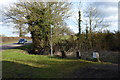
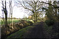
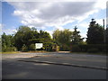
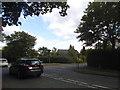
Photos of RG2 9HS
Area Information
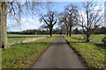
RG2 9HS represents a residential cluster defined by its intimate scale and established character. This specific postcode covers 2,036 square metres and supports a population of 1,592 people. The area maintains a population density of 147 people per square kilometre, creating a lived-in environment that feels personal rather than sprawling. Living in RG2 9HS means engaging with a community where houses provide the primary mode of accommodation. You will find a neighbourhood that prioritises a human scale over urban sprawl. The setting offers a quiet existence without the feeling of isolation often associated with very small settlements. This area stands apart from larger towns through its compact footprint and focused residential nature. Prospective buyers looking for a specific neighbourhood to call home will find RG2 9HS offers a contained environment with predictable daily patterns. The area's identity remains true to its function as a compact residential zone where proximity to neighbours is significant.
- Area Type
- Postcode
- Area Size
- 2036 m²
- Population
- 1592
- Population Density
- 147 people/km²
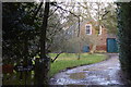
RG2 9HS presents a distinct property market characterised by traditional housing stock and strong ownership rates. The accommodation type is exclusively houses, indicating a landscape dominated by detached or semi-detached properties rather than apartments. With 74% of residents owning their homes, the area functions primarily as an owner-occupied market rather than a rental hub. This high ownership level suggests that the housing in RG2 9HS attracts buyers seeking stability and long-term residence. The total area size of 2,036 square metres limits the volume of housing available, meaning each property holds significant value within the community. Buyers looking at homes in RG2 9HS should expect a приобрести established stock rather than new developments. The density of 147 people per square kilometre ensures that properties do not exist in isolation but form part of a coherent whole. This market structure appeals to families and individuals who prefer the security of ownership in a small, manageable environment. The focus on houses means there is no availability of flats, catering specifically to those who value garden space and independent layouts.
House Prices in RG2 9HS
Showing 2 properties
| Address | Type | Beds | Baths | Last Sale Price | Last Sale Date | |
|---|---|---|---|---|---|---|
| Greensward Cottage, Reading Road, Arborfield, RG2 9HS | Semi-detached | 4 | - | £435,000 | Feb 2014 | |
| Long Cottage, Reading Road, Arborfield, RG2 9HS | house | - | - | £310,000 | Jul 2009 |
Energy Efficiency in RG2 9HS
Your daily life in RG2 9HS centres on practical convenience and access to essential services. Retail options within practical reach include Asda Shinfield, Co-op Former, and Lidl Beke. These supermarkets provide you with everything needed for weekly grocery shopping and household essentials. For transport links, nearby rail stations offer vital connections to the wider region. Earley Railway Station, Winnersh Triangle Railway Station, and Winnersh Railway Station are all accessible to residents. These stations facilitate commuting to broader employment hubs without requiring a long drive. The presence of a variety of retailer chains ensures that you do not need to travel far for basic necessities. Dining and leisure options are integrated into these nearby commercial hubs. You can manage your daily errands efficiently by staying within a short drive of key amenities. Living in RG2 9HS means balancing a quiet residential existence with ready access to major shopping and transport corridors.
Amenities
Schools
Families residing in RG2 9HS benefit from access to a diverse range of educational institutions nearby. Coombes Infant and Nursery School serves the younger years as a primary institution. Arborfield, Newland and Barkham Church of England Junior School offers primary education within the local community. Reddam House Berkshire operates as an independent school, providing an alternative for those seeking private education. Sindlesham School functions as a special educational provision, supporting specific learning needs. Additionally, The Coombes Church of England Primary School rounds out the available primary options. This mix allows you to choose between faith-based, independent, and state provision without leaving the immediate vicinity. The presence of multiple primary schools indicates a well-serviced area for early education. Special educational provision at Sindlesham School ensures that the local network accommodates varied learning requirements. When living in RG2 9HS, parents have the advantage of several well-known local names within a practical commuting distance for school runs.
| Rank | School | Type | Entry gender | Ages |
|---|
Explore more schools in this area
Go to Schools tabDemographics
The community within RG2 9HS reflects an established demographic profile suited to settled living. The median age stands at 47 years, aligning closely with the most common age range of adults aged 30 to 64. This indicates a population that has rooted itself in the location over time. Home ownership is a defining feature, with 74% of residents owning their properties outright. Children constitute a small minority of this population, which shapes the social fabric towards stability rather than rapid change. The predominant ethnic group is White, matching broader regional trends. Accommodation types remain consistent, with houses forming the dominant stock rather than flats or purpose-built blocks. Deprivation is not highlighted in the available data, allowing the focus to remain on the high rate of ownership. This pattern suggests a community where long-term residents have invested in their local environment. The suburb lacks temporary populations, resulting in a reliable social network and familiar surroundings for those considering moving to RG2 9HS.
Household Size
Accommodation Type
Tenure
Ethnic Group
Religion
Household Composition
Age
Household Deprivation
NS-SEC
Explore more demographic insights in this area
Go to Demographics tabPlanning
Planning Constraints
- Flood RiskPremium
- Ramsar Wetland SitesPremium
- Area of Outstanding Natural BeautyPremium
- Protected Nature ReservePremium
- Protected WoodlandPremium