Area Overview for RG2 9HD
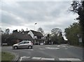
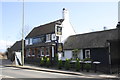
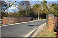
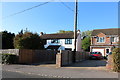
Photos of RG2 9HD
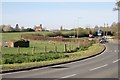
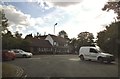
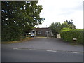
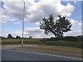


Area Information
Living in RG2 9HD offers a settled existence within a compact residential cluster covering just 3.6 hectares. This small postcode area accommodates a population of 1934, creating a close-knit environment where neighbours are likely to know each other. You will find that life here moves at a measured pace, distinct from the larger, more chaotic towns surrounding it. The density reaches 951 people per square kilometre, which balances being part of a community without feeling overwhelming. This specific location sits in England, providing a backdrop of established infrastructure while maintaining a tight layout typical of suburban developments. Homebuyers looking at RG2 9HD are choosing a place defined by its size and its specific residential character rather than grandeur or immediate access to major city centres. The area functions as a self-contained pocket of housing where daily life revolves around local routines and practical connectivity. You are stepping into a defined space where every street and garden contributes to the total footprint of the neighbourhood. The compact nature means that distances between homes are short, fostering a sense of familiarity for anyone settling down in this postcode.
- Area Type
- Postcode
- Area Size
- 3.6 hectares
- Population
- 1934
- Population Density
- 951 people/km²
The property market in RG2 9HD is defined by a clear preference for traditional living spaces. Houses make up the primary form of accommodation, meaning you will find semi-detached, detached, or terraced homes rather than apartment blocks. This housing structure naturally limits the supply of rental properties intended for single occupants or young professionals. With home ownership sitting exactly at 50%, the area represents a balanced split between buyers and renters within a small stock. Because the total footprint is only 3.6 hectares, the absolute number of available homes is finite, making specific properties closely sought after. You are looking at a market where inventory moves based on the needs of families or dual-income households seeking space. The absence of high-rise flats simplifies property searches to ground-level residences. This concentration of property types means that buyers looking for terraced living or substantial gardens will find the bulk of their options here, whereas those seeking urban-style apartments should look elsewhere. The market reflects a classic suburban economy where homeownership remains a central pillar of local life, supported by a steady turnover of families entering and exiting this specific postcode area.
House Prices in RG2 9HD
Showing 68 properties
| Address | Type | Beds | Baths | Last Sale Price | Last Sale Date | |
|---|---|---|---|---|---|---|
| 79 Martingale Grove, Arborfield Green, RG2 9HD | house | - | - | £650,000 | Mar 2024 | |
| 83 Martingale Grove, Arborfield Green, RG2 9HD | house | - | - | £460,000 | Mar 2024 | |
| 81 Martingale Grove, Arborfield Green, RG2 9HD | house | - | - | £462,500 | Mar 2024 | |
| 77 Martingale Grove, Arborfield Green, RG2 9HD | house | - | - | £680,000 | Feb 2024 | |
| 37 Martingale Grove, Arborfield Green, RG2 9HD | house | - | - | £365,000 | Feb 2024 | |
| 87 Martingale Grove, Arborfield Green, RG2 9HD | house | - | - | £380,000 | Feb 2024 | |
| 35 Martingale Grove, Arborfield Green, RG2 9HD | house | - | - | £375,000 | Feb 2024 | |
| 21 Martingale Grove, Arborfield Green, RG2 9HD | house | - | - | £575,000 | Sep 2023 | |
| 95 Martingale Grove, Arborfield Green, RG2 9HD | house | - | - | £241,290 | Aug 2023 | |
| 51 Martingale Grove, Arborfield Green, RG2 9HD | Detached | 3 | 2 | £485,000 | Jun 2023 |
Energy Efficiency in RG2 9HD
Your daily life in RG2 9HD is supported by a focused range of amenities located within practical walking or short driving distance. You have access to five notable retail venues, specifically the Co-op on Arborfield, the Co-op on Finchampstead, and the Lidl in Wokingham. These three specific locations provide the essential grocery shopping and household goods required for everyday living. Transport access is equally convenient, with five railway options including Wokingham and Winnersh stations, ensuring easy travel to wider areas. Blackbushe Airport sits nearby, offering another layer of regional connectivity. While the 3.6-hectare size of the postcode limits green space within the immediate boundaries, the nearby rail network connects you to larger parks, leisure centres, and entertainment districts found in Wokingham and Winnersh. Dining options likely extend further into the village centres mentioned in the amenity list. You do not find a high-density nightlife scene or a sprawling commercial district within this small cluster, but you do find the functional essentials for a quiet, manageable lifestyle. The lifestyle here is defined by convenience and connectivity rather than bustling urban energy, allowing you to run errands quickly before returning to a quieter domestic setting.
Amenities
Schools
Families considering RG2 9HD have one primary educational option listed in the immediate vicinity. Bohunt School Wokingham stands as the nearest academy, which currently holds a good Ofsted rating. This single listed entry suggests that for younger children, schooling might require travelling to neighbouring postcodes or utilizing primary schools not explicitly detailed in this specific dataset. The academy status indicates a school run by the Department for Education, often offering a different rigour and curriculum structure than community schools. A good rating from Ofsted confirms that the institution meets acceptable standards of education, safety, and leadership. For parents in this area, reliance on one main listed school means competition for places may be higher, and you must check catchment areas carefully. While this data highlights one specific secondary or special provision school, families often utilise a mix of primary and secondary institutions nearby. The presence of a good-rated academy provides a reassuring baseline for educational quality in the RG2 9HD corridor, ensuring that local schooling options maintain high standards despite the small number of institutions immediately bordering the postcode.
| Rank | School | Type | Entry gender | Ages |
|---|
Explore more schools in this area
Go to Schools tabDemographics
The community in RG2 9HD is characterised by a mature age profile, with a median age of 47 years. Most residents fall into the 30 to 64 year range, indicating an area populated largely by adults with established careers and families. Half of all households in this postcode own their homes, standing at a precise 50% ownership rate. The remaining balance suggests a mix of shared ownership or renting within a stock dominated by houses rather than flats. This accommodation type supports larger family units or those seeking single-family living arrangements. The predominant ethnic group is White, reflecting a demographic that aligns with the broader South East pattern but maintains its own distinct local identity. There are no indications of significant population gaps; the data presents a coherent picture of a stable, middle-aged demographic. For you as a potential neighbour, this means a community likely interested in steady growth, family activities, and long-term stability rather than transient student life. The demographic snapshot confirms a mature living environment where the majority of residents have already completed their major life transitions and are focused on maintaining and enjoying their homes.
Household Size
Accommodation Type
Tenure
Ethnic Group
Religion
Household Composition
Age
Household Deprivation
NS-SEC
Explore more demographic insights in this area
Go to Demographics tabPlanning
Planning Constraints
- Flood RiskPremium
- Ramsar Wetland SitesPremium
- Area of Outstanding Natural BeautyPremium
- Protected Nature ReservePremium
- Protected WoodlandPremium