Area Overview for RG2 9GL
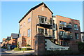
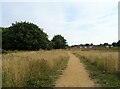
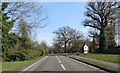
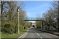
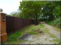
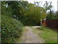
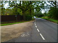
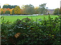
Photos of RG2 9GL
Area Information
RG2 9GL represents a compact residential cluster covering 2.0 hectares, home to a population of 1,934 individuals. Living in this postcode means engaging with a tightly knit environment where density reaches 951 people per square kilometre. The location sits within England as a specific residential zone, offering proximity to key transport nodes like Wokingham Railway Station and Blackbushe Airport. Residents of RG2 9GL benefit from a setting that balances suburban quiet with practical access to Hampshire's wider network. Homes in this area are predominantly situated within a housing stock characterised by a mix of semi-detached and terraced properties typical of the Wokingham district. The community size allows for a manageable pace of life while maintaining links to larger commercial centres via Co-op Arborfield and Finchampstead. Daily life here revolves around a mix of local independence and regional connectivity. You can navigate this small footprint efficiently, knowing that essential services and transport links are never far away.
- Area Type
- Postcode
- Area Size
- 2.0 hectares
- Population
- 1934
- Population Density
- 951 people/km²
Homes in RG2 9GL are characterised by a stock primarily consisting of houses with a 50% home ownership rate. This balance between owner-occupied and rented accommodation suggests a market where stability meets some investment presence. The accommodation type is strictly houses, offering extended living spaces compared to the flats commonly found in urban developments. For buyers seeking to purchase in this specific postcode, the market reflects a mature estate rather than a rapidly changing development site. The concentration of 1,934 residents within 2.0 hectares indicates limited new-build availability, reinforcing the need to look at existing stock. This housing pattern aligns with the median age of 47, as older properties often suit the demographic profile of two-income families or empty nesters. Selling or buying here involves navigating a traditional property cycle dominated by local transactions rather than bulk rentals from outside agencies. Expect a market driven by those seeking the space and permanence that houses provide within the Berkshire locale.
House Prices in RG2 9GL
Showing 11 properties
| Address | Type | Beds | Baths | Last Sale Price | Last Sale Date | |
|---|---|---|---|---|---|---|
| 6 Hornbeam Place, Arborfield, RG2 9GL | Detached | 2 | 2 | £410,000 | Aug 2025 | |
| 3 Hornbeam Place, Arborfield, RG2 9GL | Retail | 4 | 2 | £715,000 | May 2022 | |
| 9 Hornbeam Place, Arborfield, RG2 9GL | house | - | - | £495,000 | Feb 2022 | |
| 7 Hornbeam Place, Arborfield, RG2 9GL | house | - | - | £599,000 | Jul 2017 | |
| 1 Hornbeam Place, Arborfield, RG2 9GL | house | - | - | £595,000 | May 2017 | |
| 11 Hornbeam Place, Arborfield, RG2 9GL | Detached | 4 | 2 | £620,000 | Apr 2017 | |
| 10 Hornbeam Place, Arborfield, RG2 9GL | house | - | - | £635,000 | Apr 2017 | |
| 8 Hornbeam Place, Arborfield, RG2 9GL | house | - | - | £615,000 | Apr 2017 | |
| 2 Hornbeam Place, Arborfield, RG2 9GL | house | - | - | £590,000 | Apr 2017 | |
| 5 Hornbeam Place, Arborfield, RG2 9GL | house | - | - | - | - |
Energy Efficiency in RG2 9GL
Residents of RG2 9GL enjoy a lifestyle supported by a practical range of amenities within easy reach. Retail options include three Co-op stores located at Arborfield and Finchampstead, alongside a Lidl supermarket in Wokingham. These venues cover essential grocery shopping, household goods, and daily necessities without requiring long journeys. For those arriving by train, five nearby railway stations provide frequent connections to Wokingham, Winnersh, and Crowthorne. This rail density means you can access major towns quickly if you wish to explore further. Blackbushe Airport remains a notable nearby feature, offering selection for aviation enthusiasts or business travellers. The area lacks dedicated leisure complexes or large parks, focusing instead on functional convenience and local shop access. Driving to Co-op Arborfield or the Lidl outlet takes only minutes from your doorstep. This practical approach to amenities ensures that daily errands are efficient, allowing you to return home to the quiet of the residential cluster.
Amenities
Schools
Families living near RG2 9GL benefit from access to Bohunt School Wokingham, a prominent academy located close by. The school holds an Ofsted rating of good, a status that signals reliable educational standards and effective teaching practices. With Bohunt School Wokingham as the primary option nearby, parents have access to a secondary education provider that many in the region trust. The absence of primary schools listed in the immediate vicinity means younger children may rely on local nurseries or adjacent primary institutions not detailed in current records. Still, the presence of a good-rated academy provides a strong anchor for family decision-making. You do not need to look far for high-quality education when considering RG2 9GL. The single academy listed serves the area's demand for secondary schooling, ensuring that homes in this postcode are linked to a proven educational environment. This setup supports families who prioritise established institutions over experimental new schools.
| Rank | School | Type | Entry gender | Ages |
|---|
Explore more schools in this area
Go to Schools tabDemographics
The community in RG2 9GL reflects a settled, mature population with a median age of 47 years. Most residents fall into the 30 to 64 age range, indicating a household profile defined by families and established professionals. Half of all households in this postcode hold their homes free of mortgage, representing a 50% home ownership rate. This statistic highlights an area where stability and long-term residency are common themes rather than transient living situations. The predominant ethnic group in RG2 9GL is White, shaping a community demographic consistent with much of the surrounding Wokingham borough. Accommodation types are exclusively houses, distinguishing this cluster from developments featuring flats or apartments. With 1,934 people living in such a concentrated area, the social fabric remains close-knit. The higher-than-average age profile suggests residents value access to local amenities over nightlife or student-focused services. Everyone here likely benefits from the convenience of living in a section dominated by owner-occupied households where generations may stay put for decades.
Household Size
Accommodation Type
Tenure
Ethnic Group
Religion
Household Composition
Age
Household Deprivation
NS-SEC
Explore more demographic insights in this area
Go to Demographics tabPlanning
Planning Constraints
- Flood RiskPremium
- Ramsar Wetland SitesPremium
- Area of Outstanding Natural BeautyPremium
- Protected Nature ReservePremium
- Protected WoodlandPremium