Area Overview for RG2 9BH
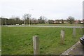
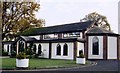
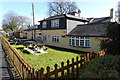
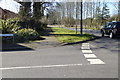
Photos of RG2 9BH
Area Information
RG2 9BH is a compact residential postcode in England, covering 9,322 square metres and home to 1,934 residents. Its population density of 951 people per square kilometre suggests a tightly knit community, where daily life revolves around proximity to local amenities and transport links. The area’s character is shaped by its modest size and the mix of households, with a median age of 47 and a strong presence of adults aged 30–64. While it lacks large-scale infrastructure, its strategic location near Wokingham Railway Station and Blackbushe Airport offers connectivity to nearby towns and cities. The area’s appeal lies in its balance of quiet living and practical access to services, from Co-op stores to schools. For buyers seeking a small, established neighbourhood with a focus on convenience, RG2 9BH provides a snapshot of suburban England, where community ties and essential facilities coexist without the sprawl of larger urban areas.
- Area Type
- Postcode
- Area Size
- 9322 m²
- Population
- 1934
- Population Density
- 951 people/km²
The property market in RG2 9BH is defined by a 50% home ownership rate, indicating that half of the area’s housing stock is owner-occupied, with the remainder likely rented out. The accommodation type is predominantly houses, which suggests a focus on family homes rather than apartments or flats. This small postcode area, covering just 9,322 square metres, means the housing stock is limited, making it a niche market for buyers seeking specific properties. The proximity to Wokingham Railway Station and nearby retail hubs like Co-op Arborfield and Co-op Finchampstead adds to the area’s appeal, offering practicality for commuters and families. However, the small size of RG2 9BH means buyers should consider surrounding areas for broader options, while the existing properties reflect a balance between residential comfort and accessibility to key services.
House Prices in RG2 9BH
Showing 26 properties
Energy Efficiency in RG2 9BH
Living in RG2 9BH grants access to a range of amenities within practical reach. The area is served by five retail outlets, including Co-op Arborfield, Co-op Finchampstead, and Co-op Former, providing essential shopping and services. Three railway stations—Wokingham, Winnersh, and Crowthorne—offer frequent train services, making it easy to reach nearby towns like Reading or Windsor. Blackbushe Airport, while not a major international hub, provides regional flight options. The presence of these amenities fosters a self-contained lifestyle, where daily errands and travel are manageable without long commutes. The compact nature of the area means residents can walk or cycle to local shops and transport hubs, enhancing convenience. While the data does not mention parks or leisure facilities, the proximity to Wokingham suggests access to green spaces and recreational areas in the surrounding region.
Amenities
Schools
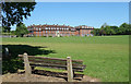
The nearest school to RG2 9BH is Bouhunt School Wokingham, an academy with a Good Ofsted rating. This institution serves the local community and is likely a primary or secondary school, though the data does not specify. The presence of a single school in the immediate vicinity suggests that families in RG2 9BH may rely on this institution for their children’s education. As an academy, Bouhunt School operates independently of local authority control, which can offer advantages such as autonomy in curriculum and resource allocation. However, the lack of additional schools in the data means that families may need to consider commuting to nearby areas for alternative educational options. The Good rating indicates a satisfactory standard of education, but parents should investigate further to align with their specific needs.
| Rank | School | Type | Entry gender | Ages |
|---|
Explore more schools in this area
Go to Schools tabDemographics
The community in RG2 9BH is predominantly composed of adults aged 30–64, reflecting a median age of 47. This age group makes up the majority of residents, indicating a stable population with established careers and family structures. Home ownership stands at 50%, suggesting a mix of owner-occupied properties and rental homes. The accommodation type is primarily houses, which aligns with the area’s residential character. The predominant ethnic group is White, though no data is provided on other demographic groups. The population density of 951 people per square kilometre implies a moderately sized community, where social interactions are likely to be frequent. While the data does not specify deprivation levels, the combination of age profile and home ownership suggests a generally stable quality of life, with a focus on long-term residency rather than transient populations.
Household Size
Accommodation Type
Tenure
Ethnic Group
Religion
Household Composition
Age
Household Deprivation
NS-SEC
Explore more demographic insights in this area
Go to Demographics tabPlanning
Planning Constraints
- Flood RiskPremium
- Ramsar Wetland SitesPremium
- Area of Outstanding Natural BeautyPremium
- Protected Nature ReservePremium
- Protected WoodlandPremium