Area Overview for RG2 8TR
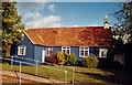
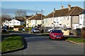
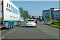
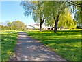
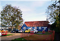
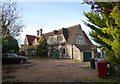
Photos of RG2 8TR


Area Information
RG2 8TR is a small, tightly packed residential postcode in England, covering just 3,093 square metres and home to 1,986 residents. Its high population density — 642,126 people per square kilometre — reflects a compact, closely knit community. This area is defined by its residential character, with a focus on houses rather than flats, catering to a demographic skewed towards adults aged 30–64. Daily life here is shaped by proximity to essential services, including retail outlets and rail networks. The area’s small size means it is easy to navigate on foot or by bike, with local shops and transport hubs within practical reach. While it lacks sprawling green spaces or large public amenities, its density supports a sense of community and convenience. For those prioritising proximity to urban infrastructure over expansive natural surroundings, RG2 8TR offers a compact, functional living environment. The presence of multiple rail stations, including Reading West and Earley, ensures easy access to nearby towns and cities, making it a viable option for commuters.
- Area Type
- Postcode
- Area Size
- 3093 m²
- Population
- 1986
- Population Density
- 2089 people/km²
RG2 8TR is a predominantly owner-occupied area, with 62% of residents owning their homes. The housing stock is largely composed of houses, which are more common than flats or apartments in this postcode. This suggests a market skewed towards established families and long-term residents, with limited availability of rental properties. The small size of the area — just 3,093 square metres — means property choices are constrained, and buyers may need to consider nearby postcode areas for more options. The high home ownership rate indicates a stable market, though it may also mean limited turnover, making it challenging for first-time buyers or renters to find opportunities. For those seeking a house in this area, the compact nature of RG2 8TR means proximity to amenities is a key advantage, though the limited size of the postcode may require careful consideration of commuting needs and access to larger urban facilities.
House Prices in RG2 8TR
Showing 9 properties
| Address | Type | Beds | Baths | Last Sale Price | Last Sale Date | |
|---|---|---|---|---|---|---|
| 14 Spencer Road, Reading, RG2 8TR | Semi-detached | 3 | 1 | £345,000 | Mar 2024 | |
| 2 Spencer Road, Reading, RG2 8TR | Semi-detached | 3 | 1 | £396,000 | May 2022 | |
| 10 Spencer Road, Reading, RG2 8TR | Terraced | 3 | 2 | £320,000 | Mar 2018 | |
| 16 Spencer Road, Reading, RG2 8TR | house | - | - | £170,000 | Jul 2006 | |
| 6 Spencer Road, Reading, RG2 8TR | Terraced | - | - | £114,000 | Nov 2001 | |
| 12 Spencer Road, Reading, RG2 8TR | Semi-detached | - | - | £80,000 | Feb 1999 | |
| 18 Spencer Road, Reading, RG2 8TR | house | - | - | - | - | |
| 4 Spencer Road, Reading, RG2 8TR | Semi-detached | - | - | - | - | |
| 8 Spencer Road, Reading, RG2 8TR | Terraced | - | - | - | - |
Energy Efficiency in RG2 8TR
Living in RG2 8TR means daily life is shaped by its proximity to essential services and transport links. The area has five retail outlets within reach, including Lidl Whitley, Aldi Unit 6 Gateway Retail Park, and Co-op Whitley, providing convenient access to groceries and everyday necessities. These shops are complemented by a network of rail stations, including Reading West and Earley, which connect residents to broader regional networks. While the area lacks large parks or leisure facilities, its compact size ensures that amenities are easily accessible on foot or by bike. The presence of multiple retail options and transport hubs suggests a practical, no-frills lifestyle, ideal for those prioritising convenience over expansive recreational spaces. For residents who enjoy walking or cycling, the short distances between shops and stations make RG2 8TR a functional, if modest, place to live.
Amenities
Schools
| Rank | School | Type | Entry gender | Ages |
|---|
Explore more schools in this area
Go to Schools tabDemographics
The population of RG2 8TR is predominantly adults aged 30–64, with a median age of 47. This suggests a mature, established community, likely with strong family ties and long-term residency. Home ownership is high at 62%, indicating a stable housing market where many residents are likely to have lived in their homes for years. The area is largely composed of houses, which aligns with the demographic profile of older, settled households. The predominant ethnic group is White, reflecting a homogenous community. While no specific data on deprivation or diversity is provided, the high home ownership rate and age profile suggest a relatively low dependency on social services. However, the lack of detailed socioeconomic data means broader conclusions about quality of life remain unverified. The compact nature of the area, combined with its residential focus, implies a quiet, low-traffic environment, though it may lack the cultural or social diversity found in larger urban centres.
Household Size
Accommodation Type
Tenure
Ethnic Group
Religion
Household Composition
Age
Household Deprivation
NS-SEC
Explore more demographic insights in this area
Go to Demographics tabPlanning
Planning Constraints
- Flood RiskPremium
- Ramsar Wetland SitesPremium
- Area of Outstanding Natural BeautyPremium
- Protected Nature ReservePremium
- Protected WoodlandPremium