Area Overview for RG2 8DS
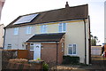
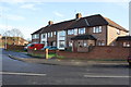
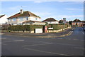
Photos of RG2 8DS

Area Information
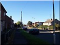
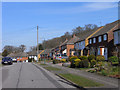
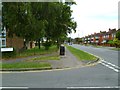
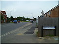
RG2 8DS is a small, tightly knit residential postcode in England, home to 1,585 residents. The area is defined by its compact size and focus on single-family housing, with a population skewed toward adults aged 30–64. Daily life here is characterised by proximity to essential services, including multiple retail outlets and rail links. The postcode’s location offers a balance of convenience and tranquillity, with easy access to nearby towns via well-connected railway stations. While the community is relatively small, it benefits from excellent broadband connectivity, scoring 100 out of 100 for fixed broadband quality. Mobile coverage is strong, though slightly lower at 85. This makes RG2 8DS suitable for those prioritising reliable internet for work or leisure. The area’s low flood risk and absence of environmental constraints like protected woodlands or AONB designations suggest a stable, low-maintenance living environment. However, its limited size means opportunities for expansion or development are constrained, making it a niche choice for buyers seeking a specific, established residential setting.
- Area Type
- Postcode
- Area Size
- Not available
- Population
- 1585
- Population Density
- 4419 people/km²
The property market in RG2 8DS is dominated by houses, with a home ownership rate of 37%. This indicates that the area is not primarily a rental market but rather one where a minority of properties are owner-occupied. Given the small population and compact postcode, the housing stock is limited, which may restrict availability for buyers seeking multiple options. The focus on single-family homes suggests properties are likely to be larger, with potential for family living. However, the low home ownership rate could reflect a reliance on private rentals or shared ownership schemes. Buyers should consider the area’s size and the potential for limited inventory, particularly for those prioritising ownership. The lack of high-density housing or flats means RG2 8DS may not appeal to those seeking urban or multi-generational living arrangements.
House Prices in RG2 8DS
No properties found in this postcode.
Energy Efficiency in RG2 8DS
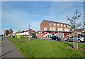
Residents of RG2 8DS have access to a range of retail amenities within practical reach, including Co-op Whitley, Lidl Whitley, and Tesco Reading. These stores provide everyday shopping options, from groceries to household essentials. The area’s rail stations offer additional convenience, with multiple lines connecting to Reading and beyond, facilitating travel for work, leisure, or socialising. While no parks or leisure facilities are explicitly listed in the data, the proximity to larger towns suggests nearby green spaces and recreational opportunities. The combination of retail outlets and rail connectivity supports a lifestyle that balances local convenience with regional connectivity, making it suitable for those prioritising accessibility over expansive leisure amenities.
Amenities
Schools
The nearest school to RG2 8DS is Blagdon Nursery School, which provides early years education. No primary or secondary schools are listed in the data, meaning families may need to look beyond the immediate area for comprehensive schooling. The presence of a nursery suggests the area caters to young children, but parents seeking a full range of educational options will need to consider nearby towns. The absence of higher-level schools in the postcode itself may impact convenience for families with older children. This highlights the importance of proximity to larger settlements for access to a broader school network.
| Rank | School | Type | Entry gender | Ages |
|---|
Explore more schools in this area
Go to Schools tabDemographics
The population of RG2 8DS has a median age of 47, with the majority of residents falling within the 30–64 age range. This suggests a community skewed toward middle-aged adults, likely including families and professionals. Home ownership in the area is relatively low at 37%, indicating that a significant proportion of residents are renters. The primary accommodation type is houses, which aligns with the area’s focus on single-family homes. The predominant ethnic group is White, though no specific data on diversity or deprivation is provided. The age profile and housing stock suggest a mature, stable population with established roots. For buyers, this demographic profile may imply a quieter, less transient environment compared to areas with higher rental rates or younger populations. The absence of detailed diversity metrics means further analysis would be needed to assess the full range of community characteristics.
Household Size
Accommodation Type
Tenure
Ethnic Group
Religion
Household Composition
Age
Household Deprivation
NS-SEC
Explore more demographic insights in this area
Go to Demographics tabPlanning
Planning Constraints
- Flood RiskPremium
- Ramsar Wetland SitesPremium
- Area of Outstanding Natural BeautyPremium
- Protected Nature ReservePremium
- Protected WoodlandPremium