Area Overview for RG2 7TA
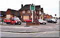
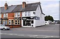
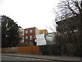
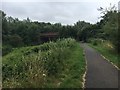
Photos of RG2 7TA
Area Information
RG2 7TA is a compact residential postcode in England, covering just 1,884 square metres and home to 1,790 residents. Despite its small size, the area has a high population density of 950,122 people per square kilometre, reflecting its role as a tightly knit community. The median age of 47 suggests a mature demographic, with most residents falling within the 30–64 age range. Daily life here is shaped by proximity to essential services, including multiple schools and retail hubs. The area’s strategic location near Reading’s rail network ensures easy access to the city’s amenities, while digital connectivity scores of 100 for broadband and 85 for mobile coverage support both work and leisure. Living in RG2 7TA means navigating a balance between residential tranquillity and urban convenience, with a focus on family-oriented living given the prevalence of primary schools. However, the high crime risk score of 25/100 underscores the need for vigilance. For buyers, this small area offers a snapshot of suburban life with limited space for expansion, making it a niche market for those prioritising proximity to services over property size.
- Area Type
- Postcode
- Area Size
- 1884 m²
- Population
- 1790
- Population Density
- 2882 people/km²
The property market in RG2 7TA is characterised by a 36% home ownership rate, suggesting that the majority of homes are rented. This contrasts with areas where owner-occupation is more common, indicating a potential focus on rental properties. The accommodation type is predominantly houses, which may appeal to families or those seeking larger living spaces. However, the small area size of 1,884 square metres limits the availability of new builds, making the existing stock highly sought after. For buyers, this means a competitive market with limited options, particularly for those prioritising property size. The high population density also implies that properties are likely to be close to each other, with little scope for expansion. While the data does not specify average prices, the rental market may offer more flexibility for those unable to purchase.
House Prices in RG2 7TA
Showing 1 properties
| Address | Type | Beds | Baths | Last Sale Price | Last Sale Date | |
|---|---|---|---|---|---|---|
| 28 Canterbury Road, Reading, RG2 7TA | Semi-detached | - | - | - | - |
Energy Efficiency in RG2 7TA
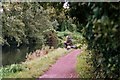
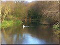
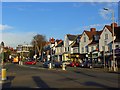
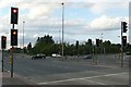
The lifestyle in RG2 7TA is shaped by its proximity to retail and transport hubs. Nearby amenities include Morrisons Whitley, Aldi Whitley, and Makro Reading, offering a range of shopping options for daily essentials. These retail outlets cater to both household needs and casual browsing, contributing to the area’s convenience. The rail network, with stations such as Reading West and Earley, provides seamless access to the city’s cultural and commercial centres, reducing the need for car ownership. While the area lacks dedicated parks or leisure facilities, the nearby schools and retail centres create a self-contained environment. The density of services means residents can access shopping, transport, and education without long commutes, though the absence of green spaces may be a drawback for those prioritising outdoor recreation.
Amenities
Schools
Residents of RG2 7TA have access to a range of educational institutions, including George Palmer Primary School and The Palmer Primary Academy, both of which cater to younger children. The Palmer Primary Academy holds an Ofsted rating of ‘good’, indicating a reliable standard of education. Independent schools such as OneSchool Global Reading Senior Campus and Redlands Education Centre provide alternative options for families seeking private education. The mix of primary and independent schools suggests a diverse educational landscape, allowing parents to choose between state and private schooling. For families with younger children, the proximity of these schools reduces commuting time, enhancing convenience. However, the lack of secondary schools in the immediate area may require families to look beyond RG2 7TA for comprehensive education.
| Rank | School | Type | Entry gender | Ages |
|---|
Explore more schools in this area
Go to Schools tabDemographics
The population of RG2 7TA is predominantly adults aged 30–64, with a median age of 47. This suggests a community of established professionals and families, likely drawn to the area’s access to schools and transport. Home ownership is low at 36%, indicating a rental market that may cater to younger professionals or those seeking flexibility. The accommodation type is primarily houses, which aligns with the demographic profile of families requiring more space. The predominant ethnic group is White, with no data provided on other groups. The high population density—nearly a million people per square kilometre—suggests limited land for new development, potentially increasing competition for properties. While the data does not specify deprivation levels, the combination of low home ownership and high density may point to a mix of economic backgrounds, with some residents relying on rental income or part-time work.
Household Size
Accommodation Type
Tenure
Ethnic Group
Religion
Household Composition
Age
Household Deprivation
NS-SEC
Explore more demographic insights in this area
Go to Demographics tabPlanning
Planning Constraints
- Flood RiskPremium
- Ramsar Wetland SitesPremium
- Area of Outstanding Natural BeautyPremium
- Protected Nature ReservePremium
- Protected WoodlandPremium