Area Overview for RG2 7SS
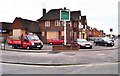
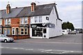
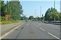
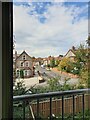
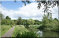
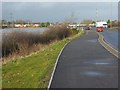
Photos of RG2 7SS
Area Information
RG2 7SS is a compact residential postcode in England, covering 8,830 square metres and home to 2,138 residents. This small cluster of homes is densely populated, with 242,136 people per square kilometre, reflecting a tight-knit community. The area’s character is defined by its mix of family-oriented living and practical amenities. With a median age of 47, the population skews toward adults aged 30–64, suggesting a mature demographic with established households. Daily life here is shaped by proximity to essential services, including multiple retail outlets and rail stations. The area’s limited size means residents often share local facilities, creating a sense of familiarity. While it lacks sprawling parks or major landmarks, its strength lies in accessibility—Reading’s transport links and nearby schools make it appealing for families. However, the high population density and small footprint mean space is at a premium, requiring buyers to consider proximity to shared resources. For those seeking a manageable, well-connected environment, RG2 7SS offers a blend of convenience and community.
- Area Type
- Postcode
- Area Size
- 8830 m²
- Population
- 2138
- Population Density
- 4228 people/km²
The property market in RG2 7SS is defined by a low home ownership rate of 37%, indicating that most properties are rented rather than owned. The area is dominated by houses, which are typically larger than flats, but the small postcode size suggests limited housing stock. This makes the market competitive, with buyers needing to consider proximity to shared amenities rather than expansive private land. The high population density means properties are closely spaced, which can affect both privacy and property values. For buyers, the area’s compact nature means that proximity to transport and schools is a key consideration. While the lack of high home ownership might suggest a rental-focused market, the presence of family-oriented housing hints at a demand for stable, long-term residences. However, the limited size of the area means that new developments are unlikely, and buyers should approach the market with realistic expectations about availability and space.
House Prices in RG2 7SS
Showing 20 properties
| Address | Type | Beds | Baths | Last Sale Price | Last Sale Date | |
|---|---|---|---|---|---|---|
| 2 Brent Gardens, Reading, RG2 7SS | Semi-detached | 2 | 1 | £325,000 | May 2025 | |
| 16 Brent Gardens, Reading, RG2 7SS | Semi-detached | 2 | 1 | £275,500 | Apr 2020 | |
| 5 Brent Gardens, Reading, RG2 7SS | Semi-detached | 3 | - | £296,700 | Mar 2018 | |
| 13 Brent Gardens, Reading, RG2 7SS | Semi-detached | 2 | - | £280,000 | Nov 2016 | |
| 11 Brent Gardens, Reading, RG2 7SS | Semi-detached | 2 | 1 | £169,950 | Apr 2007 | |
| 3 Brent Gardens, Reading, RG2 7SS | Semi-detached | - | - | £84,950 | Feb 2000 | |
| 12 Brent Gardens, Reading, RG2 7SS | Semi-detached | 3 | 2 | - | - | |
| 18 Brent Gardens, Reading, RG2 7SS | house | - | - | - | - | |
| 1 Brent Gardens, Reading, RG2 7SS | Semi-detached | - | - | - | - | |
| 4 Brent Gardens, Reading, RG2 7SS | Semi-detached | - | - | - | - |
Energy Efficiency in RG2 7SS
The lifestyle in RG2 7SS is shaped by its proximity to practical amenities. Within walking or short driving distance are five retail outlets, including Aldi Whitley, Morrisons Whitley, and Makro Reading, offering a range of grocery and household goods. These stores cater to daily needs, reducing the necessity for long trips to larger shopping centres. The area’s rail connections to Reading and nearby stations provide access to broader leisure and cultural options in surrounding towns. While there is no mention of parks or recreational spaces in the data, the presence of multiple retail and transport hubs suggests a focus on convenience over expansive green spaces. The compact nature of the area means that amenities are closely clustered, creating a self-contained environment for residents. For those prioritising accessibility and practicality, RG2 7SS offers a lifestyle that balances local convenience with regional connectivity.
Amenities
Schools
Residents of RG2 7SS have access to three primary schools within practical reach: Whitley Park Infant and Nursery School, Whitley Park Junior School, and Whitley Park Primary and Nursery School. The latter holds a ‘good’ Ofsted rating, indicating a solid standard of education. The presence of infant, junior, and primary schools with nursery provision suggests a comprehensive system for early to primary education, catering to children from infancy through to age 11. This cluster of schools is particularly beneficial for families with multiple children at different stages of schooling. The proximity of these institutions to homes in RG2 7SS reduces commuting times, making it an attractive option for parents. However, the absence of secondary schools in the immediate area means students may need to travel to nearby towns for further education. The quality of primary education here is a notable strength for the community.
| Rank | School | Type | Entry gender | Ages |
|---|
Explore more schools in this area
Go to Schools tabDemographics
The community in RG2 7SS is predominantly composed of adults aged 30–64, with a median age of 47. This suggests a population of established professionals and families, rather than younger or retired residents. Home ownership is relatively low, at 37%, indicating that a majority of households are likely renters. The area is characterised by houses rather than flats or apartments, reflecting a traditional housing stock. The predominant ethnic group is White, with no specific data on other demographics. The high population density—242,136 people per square kilometre—means living spaces are closely packed, which can influence the pace of life and community interactions. While this density offers proximity to amenities, it also means limited private outdoor space. The age profile suggests a stable, perhaps middle-income population, but the lack of data on deprivation or income levels leaves some quality-of-life factors unexplored.
Household Size
Accommodation Type
Tenure
Ethnic Group
Religion
Household Composition
Age
Household Deprivation
NS-SEC
Explore more demographic insights in this area
Go to Demographics tabPlanning
Planning Constraints
- Flood RiskPremium
- Ramsar Wetland SitesPremium
- Area of Outstanding Natural BeautyPremium
- Protected Nature ReservePremium
- Protected WoodlandPremium