Area Overview for RG2 7RE
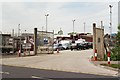
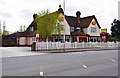
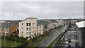
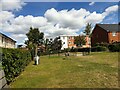
Photos of RG2 7RE
Area Information
RG2 7RE is a compact residential postcode in England, covering 9,542 square metres and home to 2,138 people. Its high population density of 224,059 people per square kilometre reflects a tightly knit community, though the area’s small size means it is a focused cluster rather than a sprawling suburb. The demographic profile suggests a mature population, with a median age of 47 and the majority of residents aged 30–64. This age range indicates a mix of established families and professionals, many of whom may be drawn to the area’s proximity to local schools and transport links. The area is predominantly White, with a home ownership rate of 37%, suggesting a rental-heavy market. Daily life here is shaped by nearby amenities, including retail outlets and rail stations, while the absence of major natural constraints like AONB or protected woodlands means development is not restricted. However, the area’s high crime risk, rated critical, is a notable factor for prospective buyers.
- Area Type
- Postcode
- Area Size
- 9542 m²
- Population
- 2138
- Population Density
- 4228 people/km²
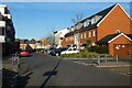
The property market in RG2 7RE is characterised by a low home ownership rate of 37%, indicating that the area is primarily a rental market rather than one dominated by owner-occupied homes. The accommodation type is predominantly houses, which is notable given the high population density—suggesting that properties are likely to be older, larger homes rather than apartments or flats. This dynamic may appeal to renters seeking more space, though the limited area size means housing stock is constrained. For buyers, the small footprint of RG2 7RE means properties are likely to be in high demand, particularly for those seeking family homes near schools and transport. However, the rental-heavy market could indicate limited long-term investment potential, with prices potentially influenced by local demand rather than broader trends.
House Prices in RG2 7RE
Showing 27 properties
| Address | Type | Beds | Baths | Last Sale Price | Last Sale Date | |
|---|---|---|---|---|---|---|
| 28 Kingsbridge Road, Reading, RG2 7RE | Terraced | 2 | 1 | £255,000 | Jan 2019 | |
| 30 Kingsbridge Road, Reading, RG2 7RE | Semi-detached | 2 | - | £260,000 | Sep 2017 | |
| 26 Kingsbridge Road, Reading, RG2 7RE | Terraced | 3 | - | £325,000 | Aug 2017 | |
| 32 Kingsbridge Road, Reading, RG2 7RE | house | - | - | £227,000 | Jul 2014 | |
| 1 Kingsbridge Road, Reading, RG2 7RE | Semi-detached | 3 | - | £230,000 | May 2014 | |
| 7 Kingsbridge Road, Reading, RG2 7RE | house | 3 | - | £205,000 | May 2013 | |
| 6 Kingsbridge Road, Reading, RG2 7RE | house | 3 | - | £195,000 | Nov 2010 | |
| 4 Kingsbridge Road, Reading, RG2 7RE | house | - | - | £186,000 | Jul 2009 | |
| 3 Kingsbridge Road, Reading, RG2 7RE | house | - | - | £124,000 | Sep 2002 | |
| 34 Kingsbridge Road, Reading, RG2 7RE | house | - | - | £120,000 | May 2002 |
Energy Efficiency in RG2 7RE
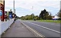
Residents of RG2 7RE benefit from a range of nearby amenities, including five retail outlets such as Aldi Whitley, Morrisons Whitley, and Makro Reading. These shops provide convenience for daily shopping, with a mix of local and larger chain stores. The rail network, with stations like Reading and Earley, offers easy access to broader urban centres, enhancing both commuting and leisure opportunities. While the area lacks detailed information on parks or leisure facilities, the proximity to retail and transport suggests a lifestyle focused on practicality and accessibility. The small size of RG2 7RE means amenities are likely to be within walking or short driving distance, though the absence of specific data on green spaces or recreational areas may limit insights into outdoor living options.
Amenities
Schools
Residents of RG2 7RE have access to three primary schools: Whitley Park Junior School, Whitley Park Infant and Nursery School, and Whitley Park Primary and Nursery School. All three cater to younger children, with the latter holding a ‘good’ Ofsted rating. This concentration of primary schools suggests the area is well-suited for families with young children, though no secondary schools are listed in the data. The presence of multiple primary schools in close proximity may reduce travel times for parents and provide options for different educational needs. However, the absence of secondary schooling nearby could be a consideration for families planning for long-term educational requirements. The ‘good’ rating at one school is a positive indicator, but parents should verify current performance and capacity.
| Rank | School | Type | Entry gender | Ages |
|---|
Explore more schools in this area
Go to Schools tabDemographics
The community in RG2 7RE is defined by its age profile, with a median age of 47 and the most common age range being 30–64 years. This suggests a population skewed towards middle-aged and older adults, with fewer young families or retirees compared to other areas. Home ownership is relatively low at 37%, indicating that a majority of residents are likely to be renters, possibly including younger professionals or those in transient employment. The accommodation type is predominantly houses, which is unusual for a high-density area, hinting at a mix of older, larger properties. The predominant ethnic group is White, with no data provided on other ethnicities. The high population density, combined with a mature demographic, may reflect a community where many residents have lived for years, though the rental market suggests a degree of turnover.
Household Size
Accommodation Type
Tenure
Ethnic Group
Religion
Household Composition
Age
Household Deprivation
NS-SEC
Explore more demographic insights in this area
Go to Demographics tabPlanning
Planning Constraints
- Flood RiskPremium
- Ramsar Wetland SitesPremium
- Area of Outstanding Natural BeautyPremium
- Protected Nature ReservePremium
- Protected WoodlandPremium