Area Overview for RG2 6UL
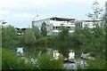
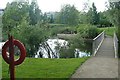
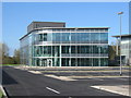
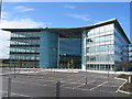
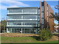
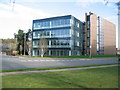
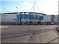
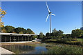
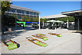
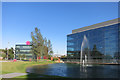
Photos of RG2 6UL

Area Information
RG2 6UL is a small, tightly packed residential area in England, covering just 2.8 hectares. With a population of 1846 people, it is a compact community where 252 people live per square kilometre. The area is predominantly home to adults aged 30–64, reflecting a mature, stable demographic. Most residents own their homes, with 77% of properties in private ownership. The area is characterised by its housing stock, which is largely composed of traditional houses rather than flats or apartments. Living here means proximity to essential services, with multiple retail outlets and rail stations within reach. However, the small size of RG2 6UL means that the housing market is limited, and buyers must consider the immediate surroundings for broader options. The area’s density and age profile suggest a community focused on long-term residency, with a quiet, established feel.
- Area Type
- Postcode
- Area Size
- 2.8 hectares
- Population
- 1846
- Population Density
- 252 people/km²
The property market in RG2 6UL is characterised by a high rate of home ownership, with 77% of residents in private ownership. The accommodation type is predominantly houses, indicating that the area is not suited to renters or those seeking flats. This suggests a market focused on family homes and long-term residency, rather than short-term lettings. The small area size of 2.8 hectares means that the housing stock is limited, and buyers may need to look beyond RG2 6UL itself for more options. The concentration of houses also implies that the area is likely to have mature properties, potentially with larger gardens or traditional architectural features. For buyers, this means a market where properties are likely to be in stable demand, though competition may be fierce due to the area’s limited size.
House Prices in RG2 6UL
No properties found in this postcode.
Energy Efficiency in RG2 6UL
RG2 6UL offers access to a range of amenities within practical reach. Retail options include major outlets such as Costco Reading, Aldi Unit 6 Gateway Retail Park, and Tesco Reading, providing convenience for shopping and daily needs. The area’s proximity to multiple rail stations—Reading West, Reading, and Earley—ensures easy access to public transport, supporting both local and regional travel. While the area itself is small, the surrounding infrastructure means residents can enjoy a mix of retail, dining, and transport options without needing to travel far. The presence of these amenities contributes to a lifestyle that balances convenience with the quieter, more compact nature of the postcode.
Amenities
Schools
The nearest school to RG2 6UL is the Grazeley Parochial Church of England Aided Primary School, which serves the local community. This primary school has an Ofsted rating of satisfactory, indicating it meets acceptable standards but may have areas for improvement. The absence of secondary schools in the immediate vicinity means families may need to consider nearby areas for secondary education. The presence of a primary school suggests that RG2 6UL is a family-friendly area, though parents should investigate further for comprehensive schooling options. The single school listed reflects the area’s small size and limited infrastructure, requiring residents to look beyond the postcode for broader educational facilities.
| Rank | School | Type | Entry gender | Ages |
|---|
Explore more schools in this area
Go to Schools tabDemographics
The population of RG2 6UL has a median age of 47, with the majority of residents falling within the 30–64 age range. This indicates a community of middle-aged adults, many of whom may be in their prime working years or nearing retirement. Home ownership is high, with 77% of residents living in properties they own, suggesting a stable, long-term presence in the area. The accommodation type is predominantly houses, which aligns with the age profile of older, family-oriented residents. The predominant ethnic group is White, and no data is provided on other demographic groups. The population density of 252 people per square kilometre reflects a moderately populated area, balancing privacy with proximity to amenities. This density, combined with the age range, suggests a community that values stability and established living environments.
Household Size
Accommodation Type
Tenure
Ethnic Group
Religion
Household Composition
Age
Household Deprivation
NS-SEC
Explore more demographic insights in this area
Go to Demographics tabPlanning
Planning Constraints
- Flood RiskPremium
- Ramsar Wetland SitesPremium
- Area of Outstanding Natural BeautyPremium
- Protected Nature ReservePremium
- Protected WoodlandPremium