Area Overview for RG2 6BN
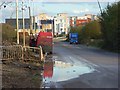
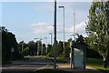
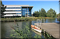
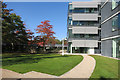
Photos of RG2 6BN

Area Information
RG2 6BN is a small, tightly packed residential postcode in England, covering just 1900 square metres and home to 1700 people. With a population density of 708 people per square kilometre, this area is characterised by its compact layout and close-knit community feel. The median age of 47 suggests a mature demographic, with the majority of residents aged between 30 and 64. This is a predominantly owner-occupied area, with 48% of homes owned by residents, though the housing stock is almost entirely composed of houses rather than flats. The area’s proximity to major retail hubs like Tesco Reading and Costco Reading, combined with easy access to rail stations such as Reading West and Earley, ensures daily life is both convenient and connected. While the community is small, its strategic location near transport links and amenities makes it appealing for those seeking a balance between suburban comfort and urban accessibility.
- Area Type
- Postcode
- Area Size
- 1900 m²
- Population
- 1700
- Population Density
- 708 people/km²
The property market in RG2 6BN is defined by its high proportion of owner-occupied homes, with 48% of residents owning their properties. The area is almost exclusively composed of houses, which contrasts with the higher prevalence of flats in larger urban centres. This suggests a market that caters to families or individuals seeking more space and privacy, though the small size of the postcode means the housing stock is limited. For buyers, this presents a challenge: the area is compact, and the immediate surroundings may offer more options. The owner-occupation rate implies a stable market, but with limited availability, competition for properties could be fierce. Those considering the area should also factor in the need to look beyond RG2 6BN for additional housing choices, particularly if seeking larger or more varied property types.
House Prices in RG2 6BN
Showing 23 properties
| Address | Type | Beds | Baths | Last Sale Price | Last Sale Date | |
|---|---|---|---|---|---|---|
| Flat 9, 9 Sunapee Road, Reading, RG2 6BN | Flat | 2 | 2 | - | - | |
| Flat 5, 9 Sunapee Road, Reading, RG2 6BN | Flat | 2 | 2 | - | - | |
| Flat 16, 9 Sunapee Road, Reading, RG2 6BN | Flat | 2 | 2 | - | - | |
| Flat 12, 9 Sunapee Road, Reading, RG2 6BN | Flat | 3 | 2 | - | - | |
| Flat 17, 9 Sunapee Road, Reading, RG2 6BN | Flat | 1 | 1 | - | - | |
| Flat 1, 9 Sunapee Road, Reading, RG2 6BN | Flat | 1 | 1 | - | - | |
| Flat 7, 9 Sunapee Road, Reading, RG2 6BN | Flat | 1 | 1 | - | - | |
| Flat 6, 9 Sunapee Road, Reading, RG2 6BN | Flat | 2 | 2 | - | - | |
| Flat 14, 9 Sunapee Road, Reading, RG2 6BN | Flat | 1 | 1 | - | - | |
| Flat 2, 9 Sunapee Road, Reading, RG2 6BN | Flat | - | - | - | - |
Energy Efficiency in RG2 6BN
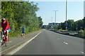
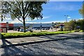
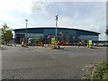
The lifestyle in RG2 6BN is shaped by its proximity to retail and transport hubs. Nearby, residents have access to major supermarkets such as Tesco Reading, Costco Reading, and Morrisons Whitley, ensuring a wide range of shopping and dining options. The presence of five rail stations, including Reading West and Earley, adds to the area’s connectivity, enabling quick travel to other parts of the region. While the data does not mention parks or leisure facilities, the retail and transport infrastructure suggests a practical, service-oriented lifestyle. The compact nature of the area means amenities are within easy reach, though those seeking more expansive recreational spaces may need to venture further afield.
Amenities
Schools
The nearest school to RG2 6BN is Green Park Village Primary Academy, a primary school with an Ofsted rating of ‘good’. This provides families with a local option for early education, though the absence of secondary schools in the immediate area means students may need to travel further for secondary education. The presence of a primary school with a positive rating is a key consideration for families prioritising convenience and educational quality. While the data does not list additional schools, the proximity to major transport links suggests that commuting to nearby secondary schools is feasible. The single school in the area reflects a focus on primary education, which may suit those with younger children but require planning for future schooling needs.
| Rank | School | Type | Entry gender | Ages |
|---|
Explore more schools in this area
Go to Schools tabDemographics
The population of RG2 6BN is largely composed of adults aged 30 to 64, with a median age of 47. This suggests a stable, middle-aged community with established households. Home ownership sits at 48%, indicating that nearly half of residents own their homes, while the remaining 52% are likely to be renters. The area is dominated by houses rather than flats, reflecting a more traditional housing stock. The predominant ethnic group is White, though the data does not specify the proportion of other ethnicities. With a population of 1700, the area is small enough to foster a sense of familiarity, yet it is not isolated, given its proximity to larger retail and transport networks. The absence of specific deprivation data means that the area’s socioeconomic profile remains largely unquantified, but the presence of multiple rail stations and high broadband scores suggests a level of infrastructure that supports both daily living and economic activity.
Household Size
Accommodation Type
Tenure
Ethnic Group
Religion
Household Composition
Age
Household Deprivation
NS-SEC
Explore more demographic insights in this area
Go to Demographics tabPlanning
Planning Constraints
- Flood RiskPremium
- Ramsar Wetland SitesPremium
- Area of Outstanding Natural BeautyPremium
- Protected Nature ReservePremium
- Protected WoodlandPremium