Area Overview for RG2 0LP
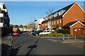
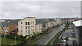
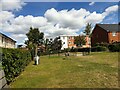
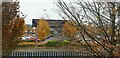
Photos of RG2 0LP

Area Information
RG2 0LP is a compact residential postcode in England, spanning 7,950 square metres and home to 2,138 residents. Its high population density — 268,933 people per square kilometre — reflects a tightly knit community. This area is defined by its proximity to key transport hubs, including Reading West and Earley railway stations, which link residents to major cities like London and Oxford. Daily life here is shaped by the presence of primary schools, such as Whitley Park Primary and Nursery School, which holds an Ofsted rating of 'good'. The area’s small size means amenities are closely clustered, with supermarkets like Aldi and Morrisons within easy reach. While the population is predominantly White and skewed toward adults aged 30–64, the community’s character is influenced by its mix of homeowners and renters. For buyers, RG2 0LP offers a blend of practicality and accessibility, though its density and limited space may appeal more to those prioritising convenience over expansive living.
- Area Type
- Postcode
- Area Size
- 7950 m²
- Population
- 2138
- Population Density
- 4228 people/km²
RG2 0LP is a small area with a housing stock primarily composed of houses, reflecting a suburban or semi-rural character. Only 37% of homes are owner-occupied, which suggests a higher reliance on rental properties compared to owner-occupied areas. This dynamic may indicate a mix of long-term residents and transient occupants, potentially affecting property values and market stability. The limited size of the postcode means the housing supply is constrained, which could make the area competitive for buyers. For those considering investment, the predominance of houses might appeal to families seeking larger living spaces, though the low home ownership rate could signal a market more suited to renters. Buyers should also consider the area’s proximity to rail links and schools, which may enhance its desirability despite its small footprint.
House Prices in RG2 0LP
No properties found in this postcode.
Energy Efficiency in RG2 0LP
RG2 0LP offers a practical lifestyle with essential amenities within reach. The area includes five retail outlets, such as Aldi Whitley and Morrisons Whitley, providing everyday shopping convenience. These supermarkets cater to a range of needs, from groceries to household items, reducing the need for long trips. The proximity to rail stations enhances mobility, allowing residents to access broader regional opportunities. However, the data does not mention parks or leisure facilities, so outdoor recreation may require travel beyond the postcode. The presence of multiple schools and shops creates a self-contained environment, though the area’s small size means it lacks the diversity of larger towns. For those valuing ease of access to services and transport, RG2 0LP provides a functional, if compact, living experience.
Amenities
Schools
The area is served by three primary schools: Whitley Park Junior School, Whitley Park Infant and Nursery School, and Whitley Park Primary and Nursery School, which holds an Ofsted rating of 'good'. This concentration of primary education options is a key draw for families, ensuring children have access to multiple school places within a short distance. The presence of a nursery and infant school alongside a junior school suggests a comprehensive early-years and primary education system. However, the data does not mention secondary schools, so parents may need to look beyond RG2 0LP for secondary education. The 'good' rating at Whitley Park Primary indicates a reliable standard of teaching, though prospective residents should verify current performance and capacity to ensure their child’s needs are met.
| Rank | School | Type | Entry gender | Ages |
|---|
Explore more schools in this area
Go to Schools tabDemographics
The median age in RG2 0LP is 47, with the majority of residents falling between 30 and 64 years old. This suggests a mature, stable population, likely with established careers and families. Home ownership is relatively low at 37%, indicating that a significant portion of the housing stock is rented. The area is dominated by houses rather than flats, reflecting a preference for single-family dwellings. The predominant ethnic group is White, though the data does not specify further diversity metrics. With no information on deprivation levels, it is unclear how economic pressures might affect quality of life. However, the age profile suggests a community focused on long-term residency rather than transient populations. The high proportion of adults implies a need for services catering to mature demographics, such as healthcare and retirement planning.
Household Size
Accommodation Type
Tenure
Ethnic Group
Religion
Household Composition
Age
Household Deprivation
NS-SEC
Explore more demographic insights in this area
Go to Demographics tabPlanning
Planning Constraints
- Flood RiskPremium
- Ramsar Wetland SitesPremium
- Area of Outstanding Natural BeautyPremium
- Protected Nature ReservePremium
- Protected WoodlandPremium