Area Overview for RG2 0HU
Photos of RG2 0HU

Area Information
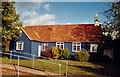
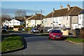
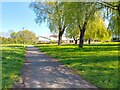
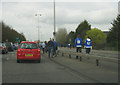
RG2 0HU is a small residential postcode area in England, home to around 1986 people. It is a tightly knit cluster of homes, predominantly occupied by adults aged 30-64, with a median age of 47. The area is defined by its quiet, stable character, with a low crime risk and no environmental constraints such as protected woodlands or wetlands. Daily life here is shaped by proximity to rail networks and local retail. Residents benefit from easy access to Reading West and Earley railway stations, which connect to major urban hubs. The area’s broadband score of 100 ensures seamless digital connectivity, while mobile coverage of 85 is sufficient for most needs. Though small, RG2 0HU offers a balance of convenience and tranquillity, appealing to those seeking a settled lifestyle without sacrificing access to essential services. Its compact size means the community feels cohesive, with shared amenities and a focus on practical living.
- Area Type
- Postcode
- Area Size
- Not available
- Population
- 1986
- Population Density
- 2089 people/km²
RG2 0HU is primarily an owner-occupied area, with 62% of homes owned by their residents. The housing stock is dominated by houses rather than flats, which is typical of smaller, rural or semi-rural postcode areas. This suggests a market skewed towards family homes and long-term occupancy rather than short-term rental properties. The compact size of the area means the property options are limited, with most homes concentrated within a small geographical footprint. Buyers should consider nearby postcode areas for broader choices, though RG2 0HU itself offers a stable, low-risk investment. The high home ownership rate and absence of planning constraints indicate a market where properties are likely to retain value, particularly for those seeking a quiet, established neighbourhood with minimal external pressures.
House Prices in RG2 0HU
No properties found in this postcode.
Energy Efficiency in RG2 0HU
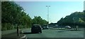
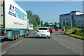
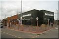
The lifestyle in RG2 0HU is shaped by its proximity to essential retail and transport hubs. Within reach are shops such as Lidl Whitley, Aldi Unit 6 Gateway Retail Park, and Co-op Whitley, offering everyday groceries and convenience. The area’s rail network, with stations at Reading West, Reading, and Earley, provides easy access to urban amenities, cultural attractions, and employment opportunities. While there is no data on parks or leisure facilities, the absence of environmental restrictions suggests open spaces may be available nearby. The combination of retail options and rail connectivity means daily life is efficient, with minimal need to travel far for essentials. The area’s character is defined by practicality, catering to those who value accessibility without sacrificing the quietude of a smaller community.
Amenities
Schools
| Rank | School | Type | Entry gender | Ages |
|---|
Explore more schools in this area
Go to Schools tabDemographics
The population of RG2 0HU is predominantly adults aged 30-64, with a median age of 47. This suggests a mature, established community with a strong presence of middle-aged and older residents. Home ownership is high at 62%, indicating a stable housing market where most residents are long-term occupants rather than renters. The area is characterised by houses rather than flats, reflecting a preference for single-family homes. The predominant ethnic group is White, though no specific diversity metrics are provided. The absence of data on deprivation or socioeconomic breakdown means the quality of life here can only be inferred from the available figures: a low crime risk and no environmental restrictions. This combination suggests a safe, unobtrusive environment where residents are likely to have long-term ties to the area.
Household Size
Accommodation Type
Tenure
Ethnic Group
Religion
Household Composition
Age
Household Deprivation
NS-SEC
Explore more demographic insights in this area
Go to Demographics tabPlanning
Planning Constraints
- Flood RiskPremium
- Ramsar Wetland SitesPremium
- Area of Outstanding Natural BeautyPremium
- Protected Nature ReservePremium
- Protected WoodlandPremium